Download
Preview
Add to list
More
14.0 km
~4 hrs 22 min
948 m
Loop
“Trek the wild Connemara, scaling peaks and delving into history on the Benlettery-Binn Bhraoin Loop.”
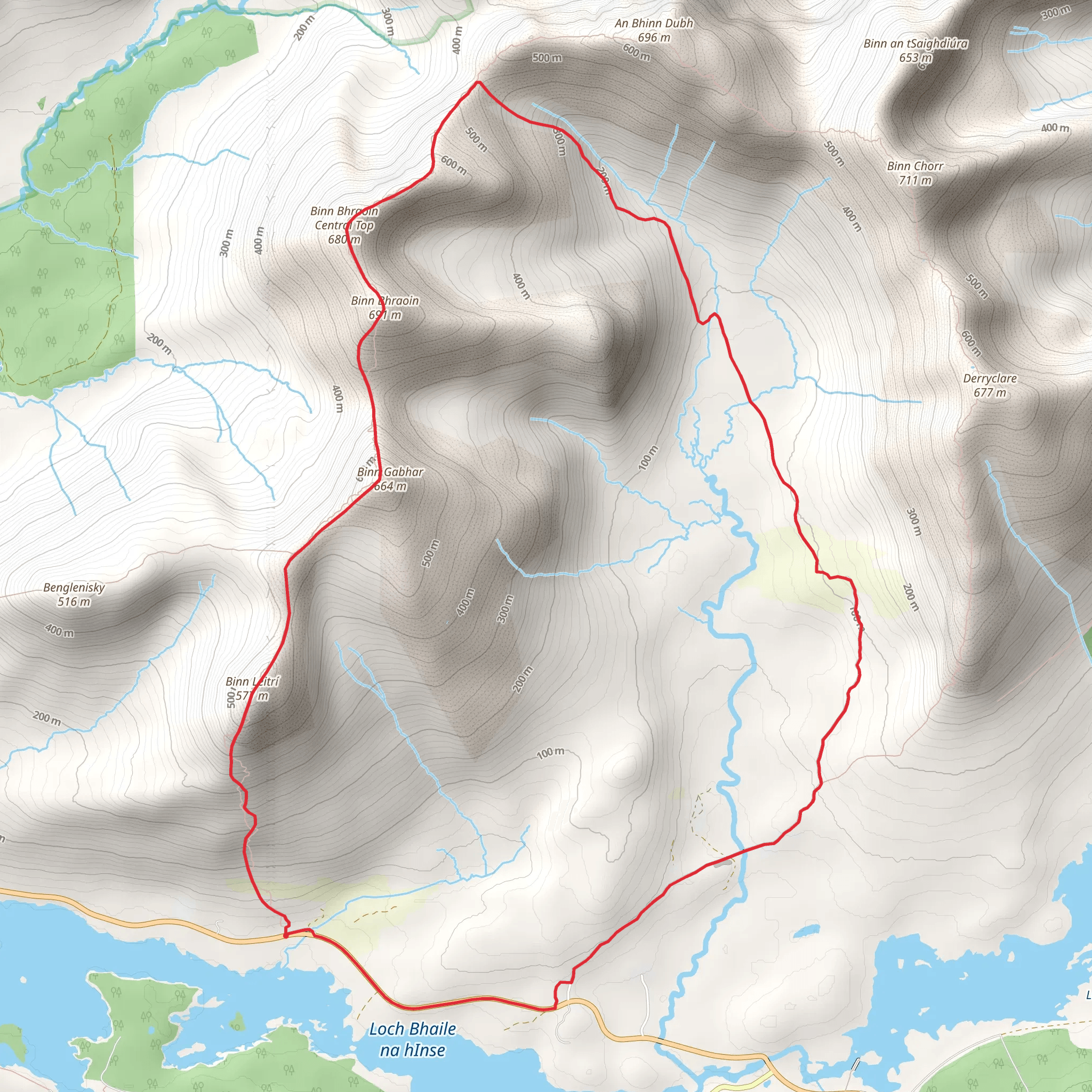
Embarking on the Benlettery to Binn Bhraoin Mountain Loop, hikers will traverse approximately 14 kilometers (about 8.7 miles) with an elevation gain of around 900 meters (nearly 2953 feet), offering a moderately challenging experience through the rugged beauty of Connemara in County Galway, Ireland. This looped trail promises a journey through a landscape steeped in natural splendor and historical significance.
Getting to the Trailhead
The trailhead is conveniently located near the town of Recess in County Galway. For those arriving by car, the starting point is accessible via the N59 road, which is a main artery through Connemara, connecting to Galway city. There is a parking area where hikers can leave their vehicles before starting the hike. Public transport options are limited in this rural area, but during the tourist season, there may be local shuttle services from Galway city to Connemara that get you close to the trailhead. From there, a taxi or a pre-arranged lift could be used to reach the starting point.
Navigating the Trail
As you set out on the trail, using HiiKER for navigation will ensure you stay on the right path, as the terrain can be challenging with rocky and uneven ground. The initial ascent up Benlettery, the first peak in the loop, offers a steady climb. The trail here is well-trodden and marked by cairns, leading you to the summit which stands at 577 meters (1893 feet). From this vantage point, you'll be rewarded with panoramic views of the Twelve Bens mountain range and the expansive Ballynahinch Lake.
Continuing on, the trail descends into a col before ascending again towards Binn Bhraoin, which is higher at 729 meters (2392 feet). The path between these peaks can be boggy and requires careful navigation, especially in poor weather conditions. The ascent to Binn Bhraoin is steeper and more challenging, but the summit offers breathtaking vistas of the surrounding landscape, including the Atlantic Ocean and the Inagh Valley.
Landmarks and Wildlife
Throughout the hike, you'll encounter a variety of landmarks and wildlife. The Twelve Bens themselves are a dominant feature, with their quartzite peaks shaping the skyline. The area is rich in flora and fauna, with the possibility of spotting red deer, pine martens, and a diverse range of birdlife, including birds of prey like the peregrine falcon.
Historical Significance
The region is not only a natural wonder but also a place of historical importance. Connemara has a rich cultural heritage, with evidence of ancient settlements and farming practices. The landscape is dotted with remnants of old cottages and dry-stone walls that tell the story of past generations who lived and worked in these mountains.
Safety and Preparation
Given the trail's remote location and changeable weather conditions, hikers should be well-prepared with appropriate gear, including waterproof clothing, sturdy hiking boots, and enough food and water. It's also wise to inform someone of your hiking plans and expected return time.
Conclusion
The Benlettery to Binn Bhraoin Mountain Loop is a journey through the heart of Connemara's wild and rugged terrain, offering hikers a chance to immerse themselves in the natural beauty and historical tapestry of this unique part of Ireland. With careful planning and respect for the environment, this hike can be a truly memorable experience.
Comments and Reviews
User comments, reviews and discussions about the Benlettery to Binn Bhraoin Mountain Loop, Ireland.
4.53
average rating out of 5
17 rating(s)

