Download
Preview
Add to list
More
16.9 km
~2 days
1268 m
Multi-Day
“Beneath shifting skies, this wild Connemara loop weaves adventure, sweeping vistas, and echoes of ancient lives.”
Starting from the trailhead near Letterfrack, a small village in County Galway, the Benbaun and An Bhinn Bhán Loop is a challenging 17 km (about 10.5 miles) circuit with a total elevation gain of approximately 1,300 metres (4,265 feet). The route is set within the rugged beauty of Connemara National Park, renowned for its wild landscapes, bogs, and quartzite peaks.
Getting There
Letterfrack is the nearest significant settlement and serves as the gateway to Connemara National Park. For those arriving by public transport, buses from Galway city run regularly to Letterfrack, with the journey taking about 2.5 hours. If driving, follow the N59 from Galway towards Clifden, turning off at Letterfrack. Parking is available at the Connemara National Park Visitor Centre, which is a short walk from the trailhead.
Route Overview and Terrain
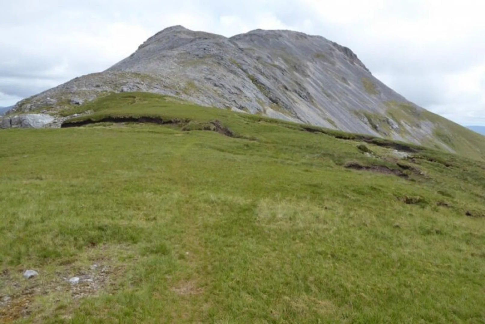
The loop begins on well-marked paths near the visitor centre, quickly leaving behind the lowland meadows and entering the open uplands. The initial section is relatively gentle, but the gradient soon increases as the trail ascends toward the Maumina col. Expect boggy ground and loose stones underfoot, especially after rain, so waterproof boots are essential.
Summiting Benbaun
At around 6 km (3.7 miles) into the hike, the route reaches the summit of Benbaun, the highest peak in County Galway at 729 metres (2,392 feet). The ascent is steep and exposed, with panoramic views over the Twelve Bens range, the Atlantic coastline, and the patchwork of lakes and bogs below. On clear days, the Aran Islands and even Croagh Patrick to the north are visible.
Traversing the Ridge to An Bhinn Bhán
From Benbaun, the trail follows a dramatic ridge, undulating over rocky outcrops and grassy saddles. The next major summit, An Bhinn Bhán (also known as Binn Bhán), stands at 729 metres (2,392 feet) and offers equally impressive vistas. This section is exposed to the elements, with strong winds and sudden weather changes common, so layered clothing and a map downloaded from HiiKER are recommended.
Flora, Fauna, and Landmarks
Connemara National Park is a haven for wildlife. Keep an eye out for red deer, mountain hares, and peregrine falcons soaring overhead. The bogs are dotted with wildflowers in summer, including orchids and bog cotton. The quartzite rocks of the Twelve Bens are a distinctive feature, glinting white in the sunlight.
The region is steeped in history, with evidence of ancient farming and turf cutting visible in the landscape. The remains of old stone walls and potato ridges (lazy beds) are reminders of the area’s past, particularly the hardships faced during the Great Famine.
Descent and Return
The descent from An Bhinn Bhán is steep and can be slippery, especially in wet conditions. The trail loops back toward Letterfrack, passing through heathland and patches of native woodland before rejoining the lower paths near the visitor centre. The final stretch is a gentle walk, allowing time to reflect on the dramatic scenery and rich heritage of Connemara.
Navigation can be challenging in poor visibility, so carrying a GPS device or using the HiiKER app is strongly advised. Weather in the region is unpredictable, and hikers should be prepared for rain, wind, and rapidly changing conditions at any time of year.
Comments and Reviews
User comments, reviews and discussions about the Benbaun and An Bhinn Bhán Loop, Ireland.
4.6
average rating out of 5
20 rating(s)