Download
Preview
Add to list
More
128.6 km
~8 days
3521 m
Multi-Day
“Embark on the challenging Wicklow Way for a breathtaking journey through Ireland's vibrant landscapes and history.”
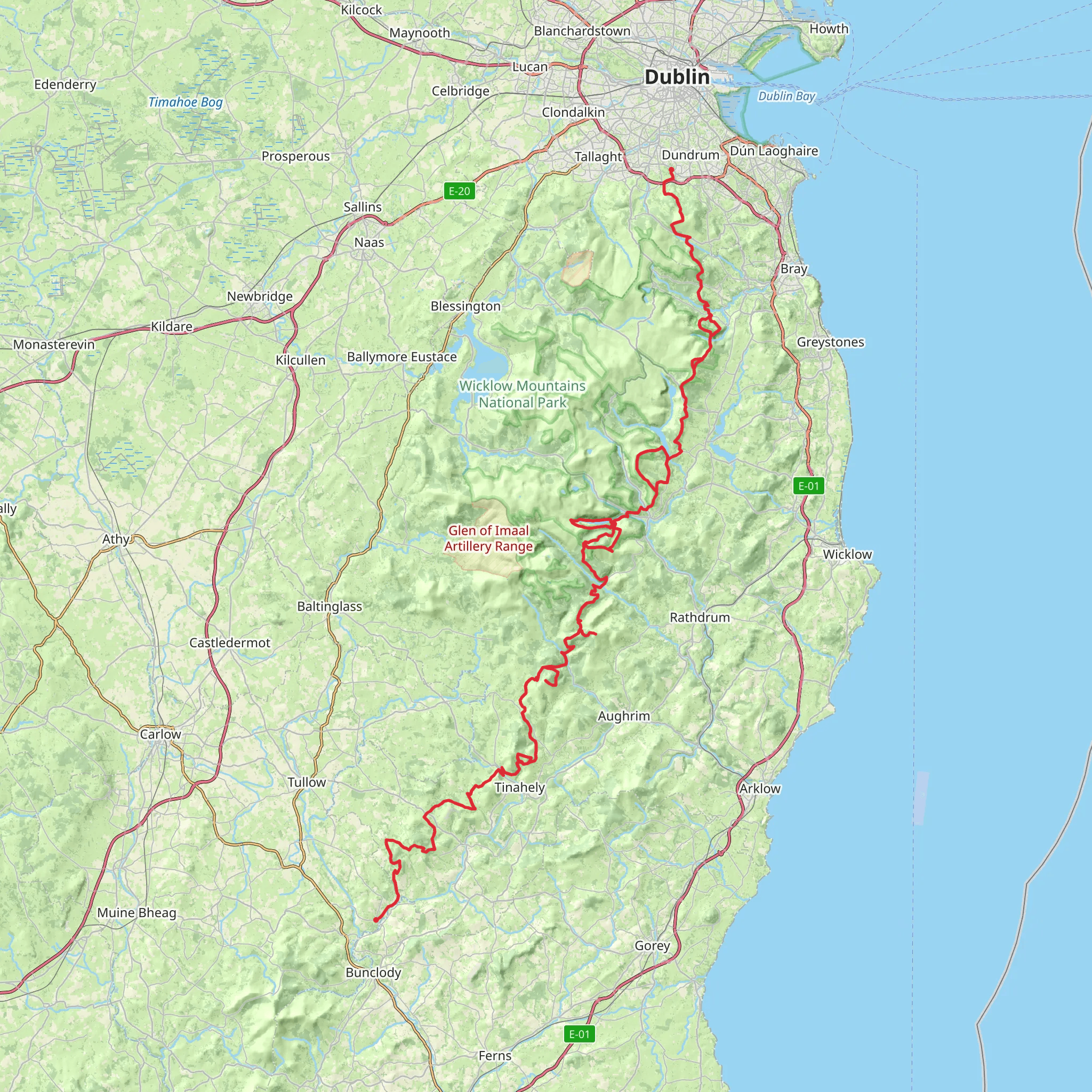
Embarking on the Wicklow Way offers an unforgettable journey through the heart of Ireland's natural beauty and rich history. Spanning approximately 129 kilometers (about 80 miles) with an elevation gain of around 3,500 meters (11,500 feet), this point-to-point trail begins near County Dublin and winds its way through the stunning landscapes of Ticknock, Tibradden Wood, and the Wicklow Mountains National Park. Rated as difficult, this trail demands preparation and respect for the terrain.
Getting There
The trailhead is conveniently accessible from Dublin, making it an ideal starting point for both locals and international visitors. If you're traveling by public transport, you can take a bus or train from Dublin to Marlay Park, which is a popular starting point for the Wicklow Way. For those driving, Marlay Park offers parking facilities, though it's advisable to check availability, especially during peak hiking seasons.
Trail Highlights and Landmarks
As you set off from Marlay Park, you'll soon find yourself immersed in the lush greenery of Ticknock and Tibradden Wood. These areas are known for their dense forests and serene atmosphere, providing a peaceful start to your journey. Keep an eye out for the Fairy Castle, a notable cairn located on the summit of Two Rock Mountain, offering panoramic views of Dublin and the surrounding countryside.
Continuing south, the trail leads you into the heart of the Wicklow Mountains National Park. This expansive park is a haven for wildlife enthusiasts, with opportunities to spot red deer, peregrine falcons, and a variety of other bird species. The park's diverse ecosystems range from heather-covered moorlands to ancient woodlands, each offering its own unique charm.
Historical Significance
The Wicklow Way is steeped in history, with several points of interest along the route. As you traverse the trail, you'll encounter remnants of Ireland's past, including ancient monastic sites and historical landmarks. One such site is the Glendalough Valley, home to a 6th-century monastic settlement founded by St. Kevin. This area is not only a spiritual and historical highlight but also a place of breathtaking natural beauty, with its two glacial lakes nestled amidst the mountains.
Navigation and Safety
Given the trail's length and difficulty, proper navigation tools are essential. HiiKER is a recommended resource for detailed maps and real-time trail information. Weather conditions in the Wicklow Mountains can change rapidly, so it's crucial to be prepared with appropriate gear, including waterproof clothing and sturdy hiking boots. Always check the weather forecast before setting out and be mindful of your physical limits.
Final Stretches
As you approach the southern end of the trail, the landscape gradually transitions from rugged mountains to rolling hills and farmland. The trail concludes near the village of Clonegal in County Carlow, where you can reflect on the diverse landscapes and rich history you've experienced along the way. Whether you're a seasoned hiker or embarking on your first long-distance trek, the Wicklow Way promises an adventure filled with natural wonders and cultural treasures.
What to expect?
Activity types
Comments and Reviews
User comments, reviews and discussions about the Wicklow Way, Ireland.
4.72
average rating out of 5
156 rating(s)

