Download
3D Preview
Add to list
More
5.9 km
~1 hrs 31 min
214 m
Point-to-Point
“Winding from mossy woods to wild mountain views, Tibradden Mountain Trail dazzles with Dublin’s natural magic.”
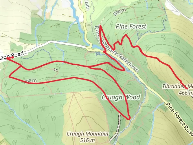
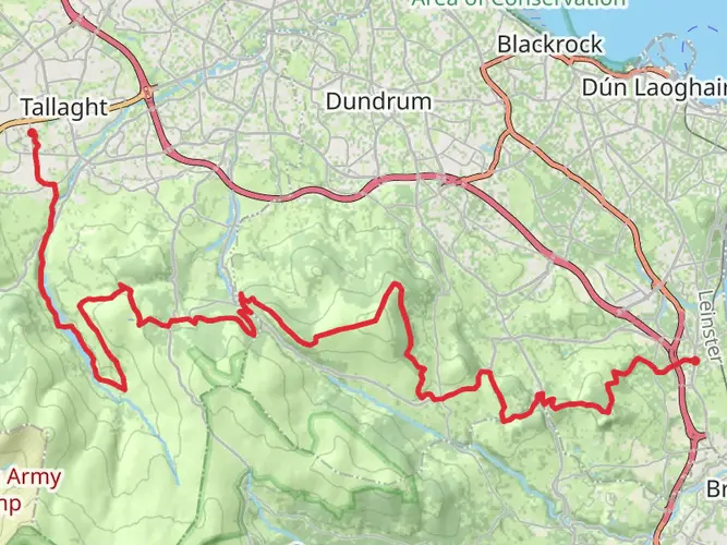
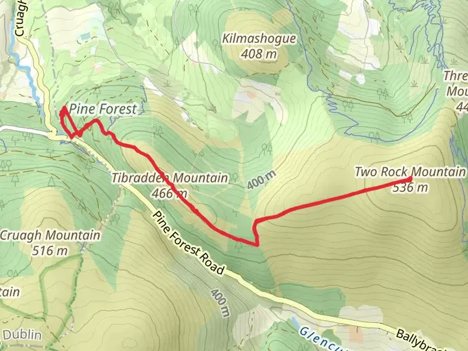
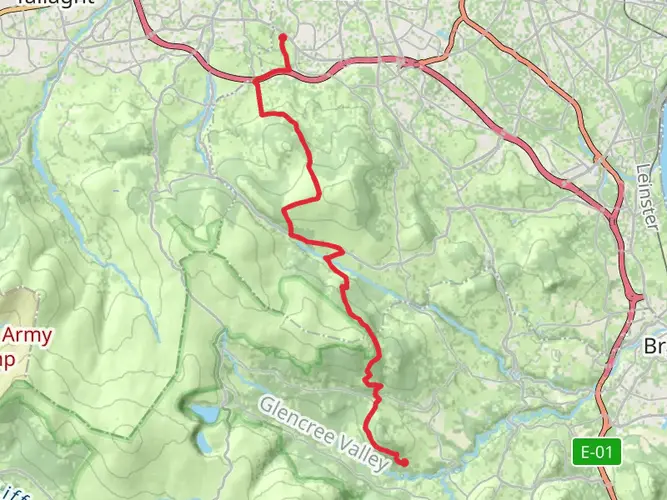
Starting just south of Dublin city, the Tibradden Mountain Trail begins near the Zipit Forest Adventures entrance in Tibradden Wood, a well-known spot for outdoor activities. Easily accessible by car, the trailhead is located off the R116 road, with parking available at the Tibradden Wood car park. For those using public transport, Dublin Bus routes 44B and 161 serve the nearby area, with the closest stop at Kilmashogue Lane, about a 10-minute walk from the trailhead.
Trail Overview and Terrain
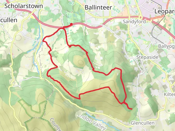
Covering approximately 6 km (3.7 miles) point-to-point, the trail ascends around 200 metres (656 feet) as it winds through the ancient woodland of Tibradden Wood and up onto the open slopes of Tibradden Mountain. The path is well-marked and maintained, but expect a mix of forest tracks, rocky outcrops, and some boggy patches, especially after rain. The moderate difficulty rating is due to the steady climb and uneven ground, so sturdy hiking boots are recommended.
Woodland and Wildlife
The first section leads through dense Scots pine, oak, and birch, with the forest floor carpeted in moss and ferns. Keep an eye out for native wildlife such as red squirrels, jays, and the occasional deer. In spring and early summer, the woods are alive with birdsong and wildflowers, while autumn brings a spectacular display of golden foliage.
Open Mountain and Panoramic Views
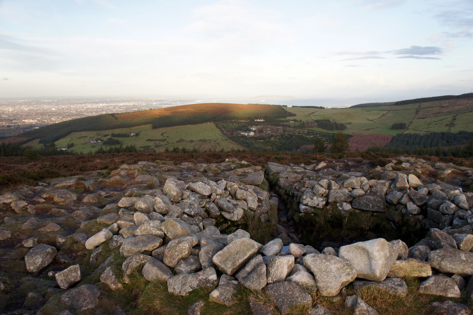
Emerging from the trees around the halfway point, the trail opens onto heathland dotted with heather and gorse. The climb becomes more exposed, offering sweeping views over Dublin city, the Irish Sea, and the Wicklow Mountains. On clear days, the panorama stretches as far as Howth Head and the Sugarloaf. The summit area, at roughly 2.5 km (1.5 miles) from the start, is marked by a prehistoric burial cairn—an ancient passage tomb dating back over 4,000 years, highlighting the region’s archaeological significance.
Navigation and Safety
The route is generally easy to follow, but weather can change quickly on the mountain. Carry a waterproof jacket and check your progress using HiiKER, which provides up-to-date trail maps and navigation tools for this area. Mobile signal is usually reliable, but always let someone know your plans before setting out.
Finishing the Trail
The descent follows a gentle gradient back into woodland, eventually reaching the southern end of Tibradden Wood near the Cruagh Road. From here, you can arrange a pickup or retrace your steps to the starting point if you need to return to your vehicle. Public transport options are limited at the southern end, so plan your exit in advance.
This trail offers a rewarding mix of natural beauty, historical intrigue, and accessible adventure just a short distance from Dublin, making it a popular choice for both locals and visitors.

What to expect?
Activity types
Comments and Reviews
User comments, reviews and discussions about the Tibradden Mountain Trail, Ireland.
4.81
average rating out of 5
63 rating(s)