Download
Preview
Add to list
More
5.3 km
~1 hrs 22 min
188 m
Out and Back
“Winding from mossy woods to windswept hills, this trail dazzles with city views and wild encounters.”
Starting from the car park at Cruagh Wood, just off Cruagh Road near Rathfarnham, County Dublin, this out-and-back route covers approximately 5 km (about 3.1 miles) with an elevation gain of around 200 metres (about 656 feet). The trailhead is easily accessible by car, with parking available at Cruagh Wood car park. For those using public transport, Dublin Bus routes from the city centre to Rathfarnham or Rockbrook will get you within a short taxi or walk to the trailhead.
Getting Into the Woods
The path begins with a gentle ascent through the dense, mossy woodland of Cruagh Wood, part of the Wicklow Mountains National Park. The forest is a mix of Sitka spruce, Scots pine, and native broadleaf trees, providing shelter for red squirrels, jays, and a variety of woodland birds. The first kilometre (0.6 miles) is on a well-maintained forest track, making for an easy start as you gradually climb.
Climbing to the Open Hills
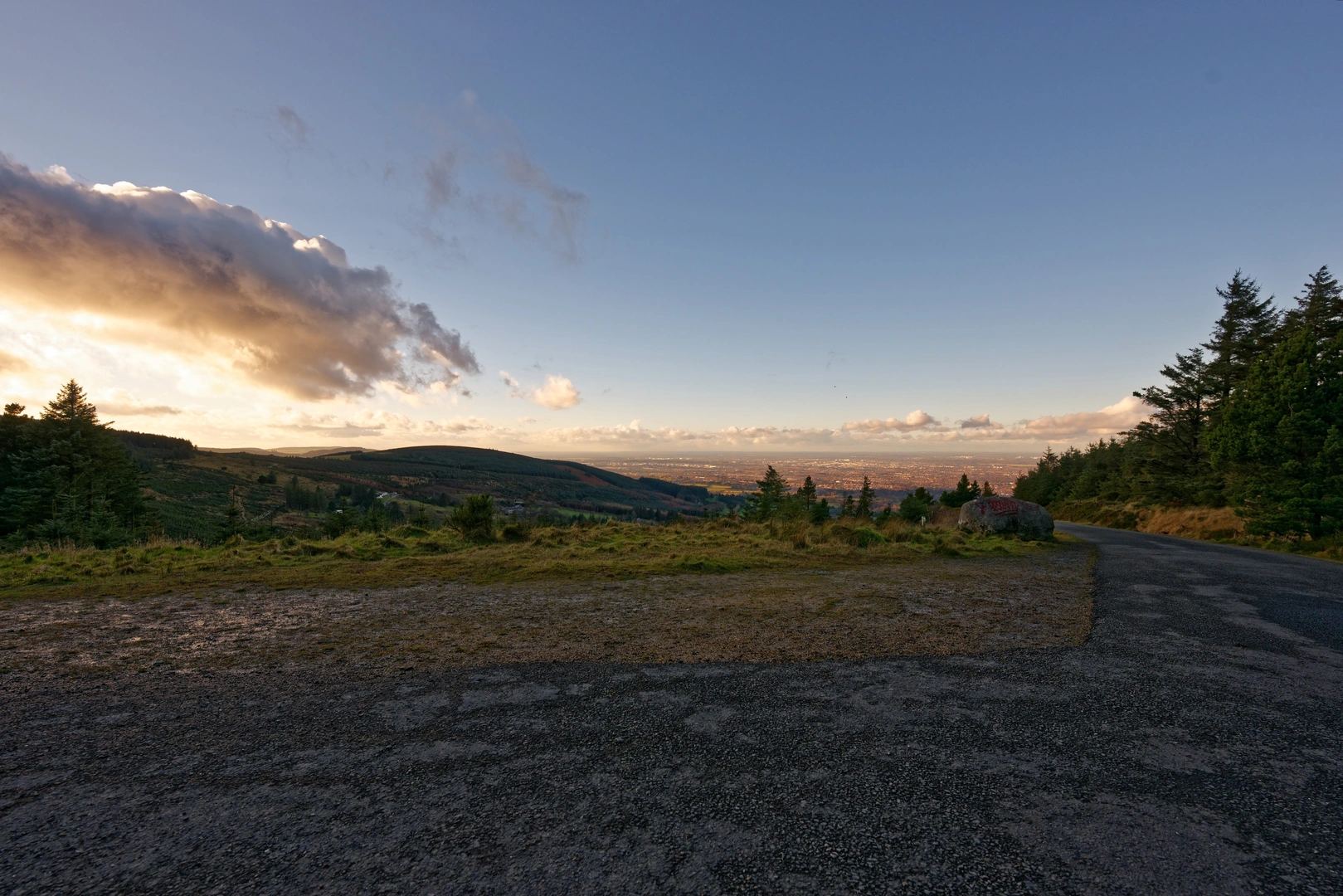
After about 1.5 km (just under a mile), the trail leaves the thicker woodland and opens up to heathland and bog, typical of the Wicklow uplands. Here, the path becomes steeper and rockier, with the next 100 metres (328 feet) of elevation gained over a relatively short distance. The views begin to open up, offering sweeping vistas back towards Dublin city and, on clear days, out to the Irish Sea. Watch for sika deer grazing in the early morning or evening, and keep an eye out for kestrels and buzzards overhead.
Landmarks and Points of Interest
At roughly 2.5 km (1.5 miles), you’ll reach the high point of the route, marked by a trig pillar. This spot offers panoramic views across the Wicklow Mountains, including glimpses of Tibradden Mountain and the Glenasmole Valley. The area is steeped in history, with the nearby Hell Fire Club (Montpelier Hill) visible to the north—a site with 18th-century ruins and legends of secret societies. The landscape here has been shaped by centuries of sheep farming and turf cutting, and you may notice old boundary walls and peat banks.
Navigation and Safety
The trail is well-marked, but weather in the Wicklow Mountains can change rapidly, with mist and rain common even in summer. Waterproof clothing and sturdy boots are recommended, as the upper sections can be muddy and slippery. For navigation, HiiKER provides detailed maps and GPS tracks for this route, which are especially useful if visibility drops.
Return Journey
The return follows the same path back through the woodland, offering a different perspective on the landscape as you descend. The total hike takes most walkers 1.5 to 2.5 hours, depending on pace and stops for photos or wildlife spotting. The proximity to Dublin makes this a popular trail, especially on weekends, so early starts are recommended for a quieter experience.

Activity types
Comments and Reviews
User comments, reviews and discussions about the Cruagh - Mountain Access Route, Ireland.
4.81
average rating out of 5
21 rating(s)