Download
3D Flyover
Add to list
More
83.8 km
~3 days
874 m
Multi-Day
“Trek the Sli An Earagail trail for a cultural and scenic journey through Ireland's rugged Donegal heartland.”
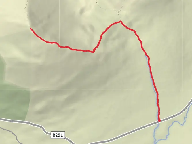
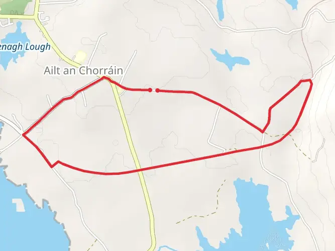
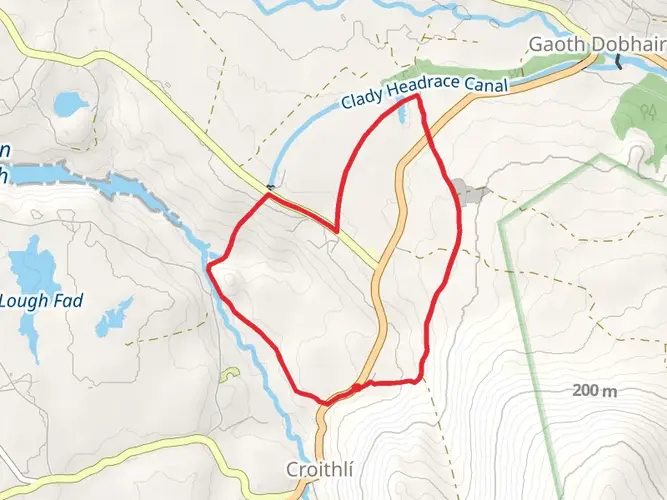
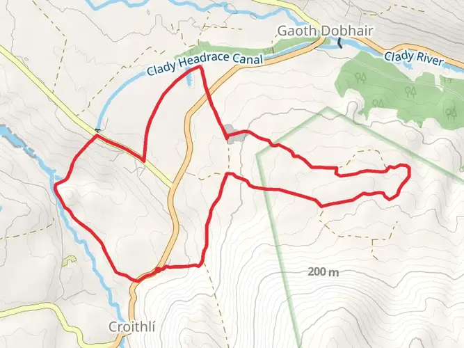
Embarking on the Sli An Earagail - Sli Dhun Na Ngall, hikers will traverse approximately 84 kilometers (about 52 miles) of varied terrain with an elevation gain of around 800 meters (roughly 2625 feet). This loop trail, nestled in the rugged landscapes of County Donegal, Ireland, offers a medium difficulty rating, making it accessible to hikers with a reasonable level of fitness and experience.
Getting to the Trailhead The trailhead is conveniently located near the town of Ardara, a charming hub for visitors starting their journey. For those arriving by public transport, buses serve the nearby towns and villages, from where you can catch a local taxi to the starting point. If driving, Ardara is well-connected by roads and offers parking facilities where you can leave your car before setting off on the hike.
Navigating the Trail As you commence your hike, the use of a navigation tool like HiiKER will be invaluable in keeping you on the right path. The trail is well-marked in most sections, but having a digital map can help ensure you don't miss any of the spectacular sights along the way.
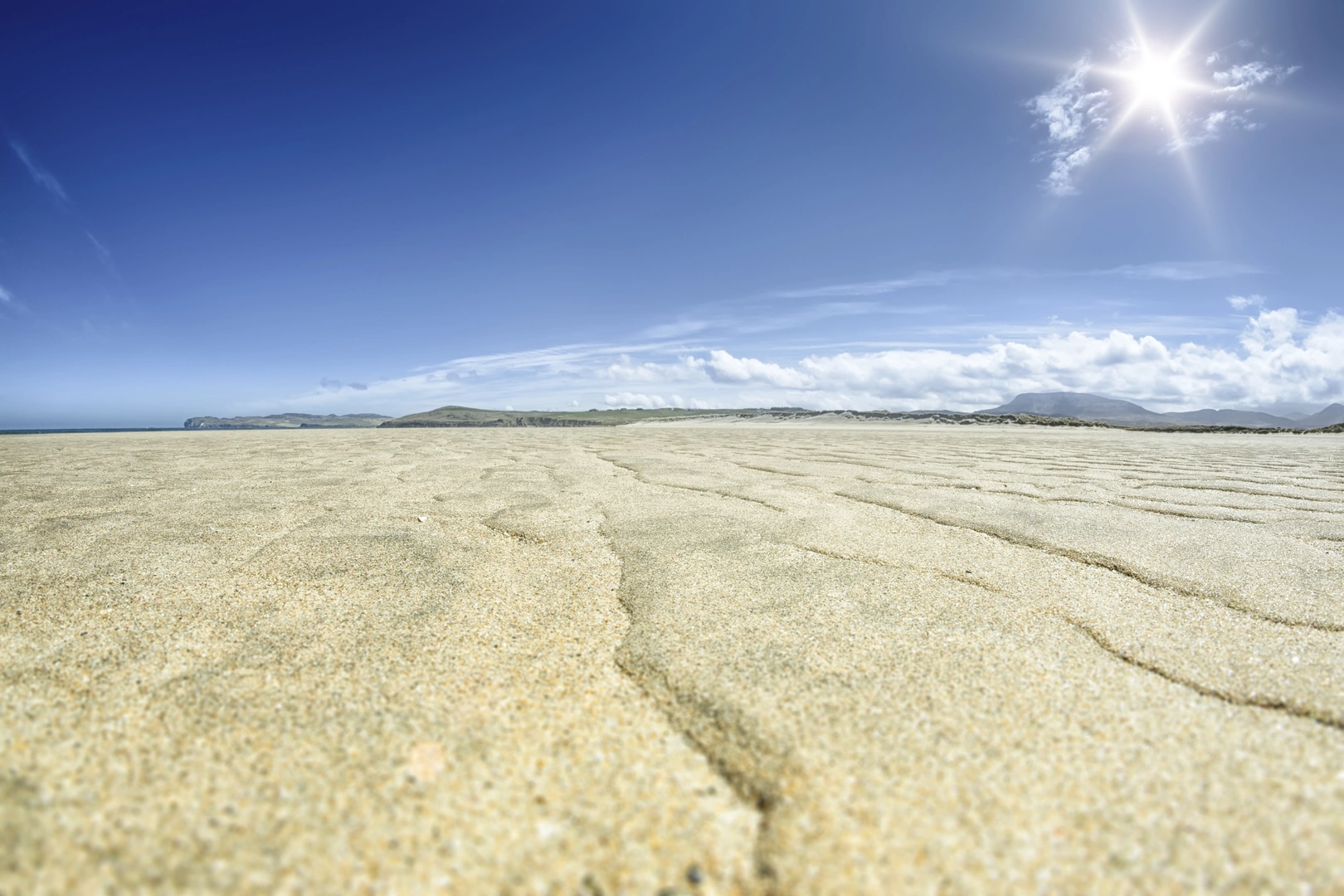
Landmarks and Natural Beauty The Sli An Earagail - Sli Dhun Na Ngall is a journey through the heart of Gaeltacht, the Irish-speaking region, where the culture and traditions of Ireland are vibrantly alive. The trail offers breathtaking views of the Atlantic Ocean, the Bluestack Mountains, and the sweeping glens and bogs that are characteristic of Donegal's landscape.
Historical Significance The region is steeped in history, with ancient sites dotted along the route. You'll encounter remnants of the past such as old churches, standing stones, and castles that tell the story of a land shaped by centuries of habitation.
Wildlife and Flora The trail is a haven for wildlife enthusiasts. The diverse habitats you'll pass through are home to a variety of birds, including the rare corncrake. The flora is equally impressive, with wildflowers and plants that are unique to the Irish climate and geography.
Preparing for the Hike Before setting out, ensure you have adequate supplies, as the trail can be remote in parts. Water, food, and weather-appropriate clothing are essential. The Irish weather can be unpredictable, so be prepared for rain and wind, even on seemingly clear days.
Accommodation and Amenities Along the route, there are opportunities to rest and refuel in small towns and villages. Accommodations range from cozy bed and breakfasts to more rustic camping options. It's advisable to book in advance, especially during peak hiking season.
Safety and Etiquette Always respect the natural environment and the local communities you'll be passing through. Stick to the trail, carry out all litter, and be mindful of wildlife. In case of emergencies, have a plan in place, as mobile phone coverage can be patchy in remote areas.
By taking the time to prepare and plan, hikers can look forward to an enriching experience on the Sli An Earagail - Sli Dhun Na Ngall, where the wild Irish landscape and the warmth of its people create memories that last a lifetime.

What to expect?
Activity types
Frequently asked questions
How long is the Sli An Earagail - Sli Dhun Na Ngall hike?
The Sli An Earagail - Sli Dhun Na Ngall route is 83.85 km long, or about 52 miles. It is a multi-day route in County Donegal, so most walkers break it into several stages rather than attempting the full distance in one outing.
How much climbing is on the Sli An Earagail - Sli Dhun Na Ngall trail?
The total elevation gain on the Sli An Earagail - Sli Dhun Na Ngall is 874 meters. That spread of climbing over nearly 84 km keeps the route relatively manageable compared with steeper mountain walks, which helps explain why it is often treated as an easier long-distance option.
Is the Sli An Earagail - Sli Dhun Na Ngall a loop walk or point-to-point route?
The Sli An Earagail - Sli Dhun Na Ngall is a loop-style multi-day walk in west Donegal. Sport Ireland lists the trail as a loop with both the start and finish at Dunlewy, making it practical for walkers who want to return to the same base or parking area after completing the circuit.
Where does the Sli An Earagail - Sli Dhun Na Ngall start and finish?
The Sli An Earagail - Sli Dhun Na Ngall starts and finishes at Dunlewy in County Donegal. Sport Ireland gives the trailhead at Dunlewy with coordinates 55.02554, -8.12041, and notes Bunbeg as the nearest town to the start for services and onward travel.
What kind of terrain is on the Sli An Earagail - Sli Dhun Na Ngall hike?
The Sli An Earagail - Sli Dhun Na Ngall crosses a mix of coastal paths, forestry tracks, bog roads, and quiet public roads. The route passes landscapes around Errigal, the Atlantic coast, Lough Nacung, and Lough Dunlewy, so conditions can vary from rougher shoreline sections to easier road and track walking.
Is the Sli An Earagail - Sli Dhun Na Ngall part of Ireland’s National Waymarked Trails?
Yes. The Sli An Earagail - Sli Dhun Na Ngall is listed by Sport Ireland as one of Ireland’s National Waymarked Trails. It is waymarked with yellow arrows on a black background and managed by Donegal County Council and Údarás na Gaeltachta.
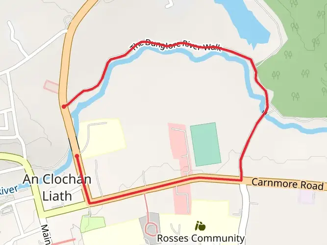
Is there a map available for the Sli An Earagail - Sli Dhun Na Ngall route?
Yes. An official overview map and stage maps are published for the Sli An Earagail - Sli Dhun Na Ngall, covering sections such as Muine Mor, Gaoth Dobhair, Bunbeg, Bun na Leaca, Gort an Choirce, An Fal Carrach, and Loch Chinneidigh. HiiKER can also be used to follow the full route as a single long-distance hike.
Comments and Reviews
User comments, reviews and discussions about the Sli An Earagail - Sli Dhun Na Ngall, Ireland.
4.41
average rating out of 5
27 rating(s)