Download
Preview
Add to list
More
3.2 km
~1 hrs 22 min
439 m
Out and Back
“Traverse Muckish Mountain's historical Miner's Path for panoramic vistas and a touch of wild Irish heritage.”
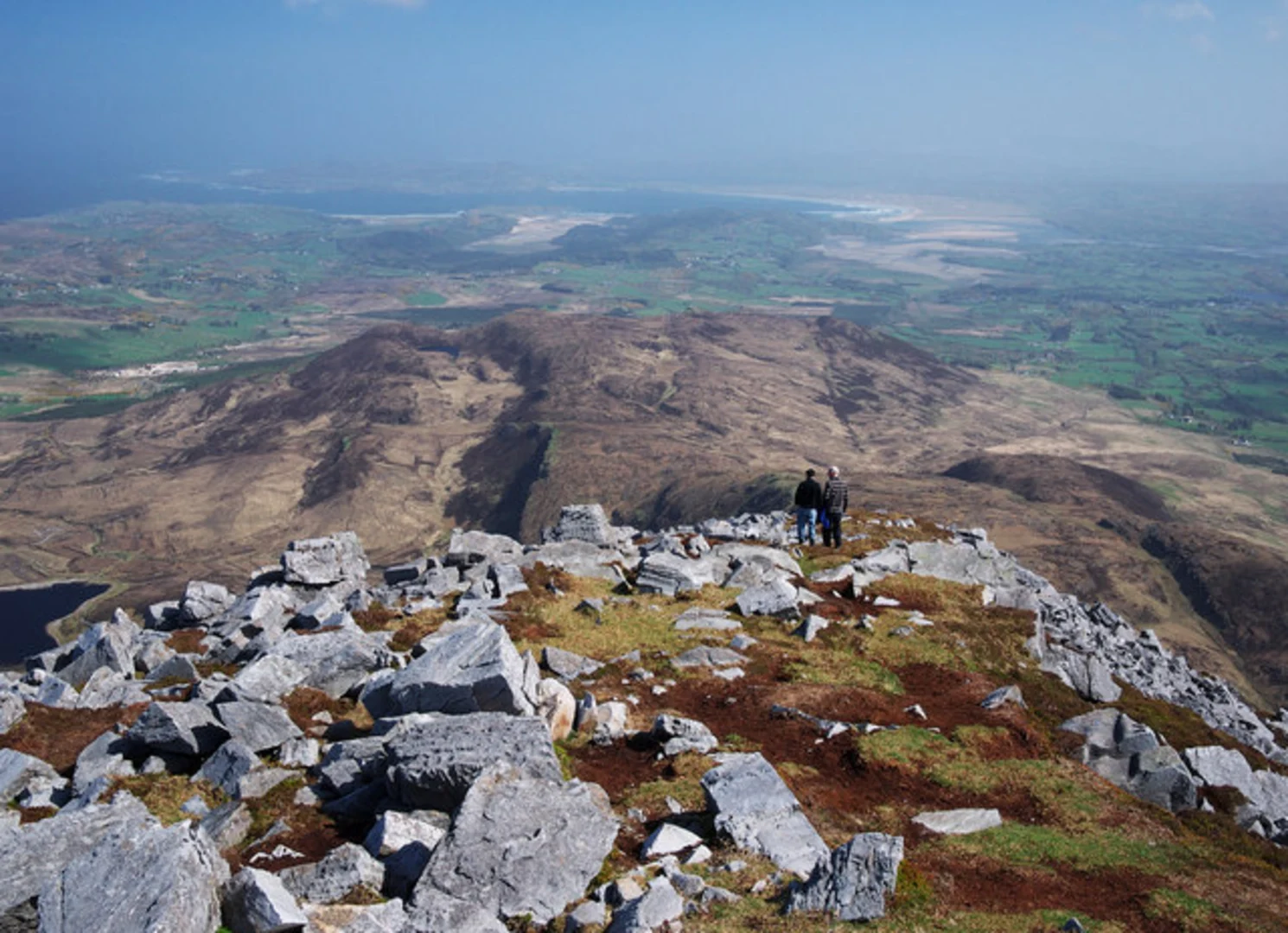
The Muckish via the Miner's Path is a moderately challenging hike that takes you to the summit of one of Donegal's most iconic mountains, Muckish. The trail is approximately 3 km (about 1.9 miles) long with an elevation gain of around 400 meters (roughly 1,300 feet), offering a rewarding experience with stunning views and a touch of history.Getting to the TrailheadTo reach the trailhead, you can drive to the base of Muckish Mountain, which is located near the village of Falcarragh in County Donegal, Ireland. If you're using public transport, the nearest significant town with bus services is Letterkenny. From there, you can take a local taxi to the starting point of the hike, as direct public transport to the mountain is limited.The AscentThe Miner's Path begins at the base of the mountain, where a small parking area can be found. The path is well-defined and was historically used by miners when the area was an active quarry. As you ascend, the terrain is a mixture of grassy slopes and rocky steps. The initial part of the hike is relatively gentle, but it becomes steeper as you approach the summit.Historical SignificanceMuckish Mountain is part of the Derryveagh Mountains range and has a rich history. The name 'Muckish' comes from the Irish 'Mucais' or 'An Mhucais', meaning 'pig's back', which is a reference to the mountain's distinctive shape. The Miner's Path itself is a reminder of the mountain's industrial past, as it was once used to transport high-quality sand for glass making from the quarries on the mountain.Flora and FaunaAs you make your way up, keep an eye out for the diverse flora and fauna that inhabit the area. The lower slopes are home to heather and bogland plants, while higher up, you may spot mountain hares and various bird species, including peregrine falcons. The mountain is also a habitat for the rare and protected Natterjack toad.Reaching the SummitThe final push to the summit can be challenging, with loose scree and larger boulders. However, the effort is well worth it as you are greeted with panoramic views of the surrounding landscape. On a clear day, you can see across to Tory Island and the other peaks of the Derryveagh range.NavigationWhile the path is distinct, weather conditions can change rapidly, and visibility can become poor. It's recommended to use a reliable navigation tool like HiiKER to keep track of your progress and ensure you remain on the correct route.DescentThe descent follows the same path back down the mountain. Take care as you navigate the loose scree and steep sections. The descent is often quicker but requires caution to avoid slips and falls.PreparationBefore setting out, ensure you have appropriate hiking boots, clothing for changeable weather, and sufficient water and food. It's also wise to inform someone of your plans and expected return time.This hike is a fantastic way to experience the rugged beauty of County Donegal and offers a glimpse into the area's history. With careful preparation and respect for the mountain environment, the Muckish via the Miner's Path can be a memorable adventure.

Comments and Reviews
User comments, reviews and discussions about the Muckish via the Miner's path, Ireland.
4.78
average rating out of 5
23 rating(s)