Download
3D Flyover
Add to list
More
454.0 km
~18 days
8065 m
Multi-Day
“Embark on the IAT's Irish odyssey, where history whispers and nature's majesty unfolds underfoot.”
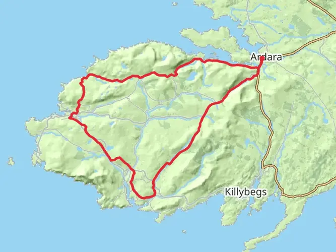
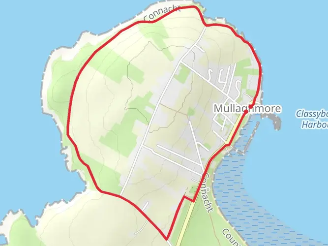
The International Appalachian Trail (IAT) in Ireland stretches approximately 454 kilometers (282 miles), with an elevation gain of around 8,000 meters (26,247 feet). This point-to-point trail begins near County Donegal, a region steeped in history and rich with cultural heritage. As you embark on this medium-difficulty hike, you'll traverse a landscape that has been shaped by centuries of human activity and the dramatic forces of nature.
Getting to the Trailhead
To reach the starting point of the IAT near County Donegal, you can drive or take public transportation. If you're coming by car, the trailhead is accessible via the N15 road, which runs through County Donegal. For those relying on public transport, buses serve the area, and the nearest significant landmark to the trailhead is the town of Donegal. From there, local transportation options can get you closer to your starting point.
Navigating the Trail
As you navigate the trail, HiiKER is an invaluable tool for keeping on track. It provides detailed maps and waypoints that are essential for a trail of this length and complexity. Make sure to download the necessary maps and updates before setting out, as some sections of the trail may have limited mobile reception.
Landmarks and Scenery
The IAT in Ireland offers a diverse range of landscapes, from rugged coastlines and rolling hills to dense woodlands and open moorlands. As you hike, you'll encounter numerous landmarks that are not only visually striking but also historically significant. The trail passes through areas that have been inhabited since prehistoric times, with ancient standing stones and remnants of early Christian settlements dotting the landscape.
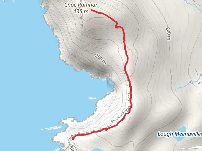
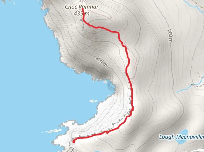
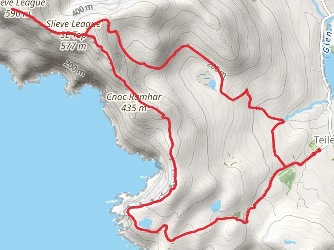
One of the most iconic landmarks you'll encounter is Slieve League, home to some of Europe's highest sea cliffs. The views from atop these cliffs are breathtaking, with the Atlantic Ocean stretching out before you. Approximately 200 kilometers (124 miles) into the hike, you'll reach the Sperrin Mountains, offering a challenging ascent and the opportunity to witness some of the most unspoiled wilderness in Ireland.
Flora and Fauna
The trail is a haven for wildlife enthusiasts, with a variety of habitats that support a rich biodiversity. Keep an eye out for native bird species such as the European goldfinch and the peregrine falcon. The plant life is equally varied, with heather, gorse, and bog cotton providing a colorful tapestry that changes with the seasons.
Historical Significance
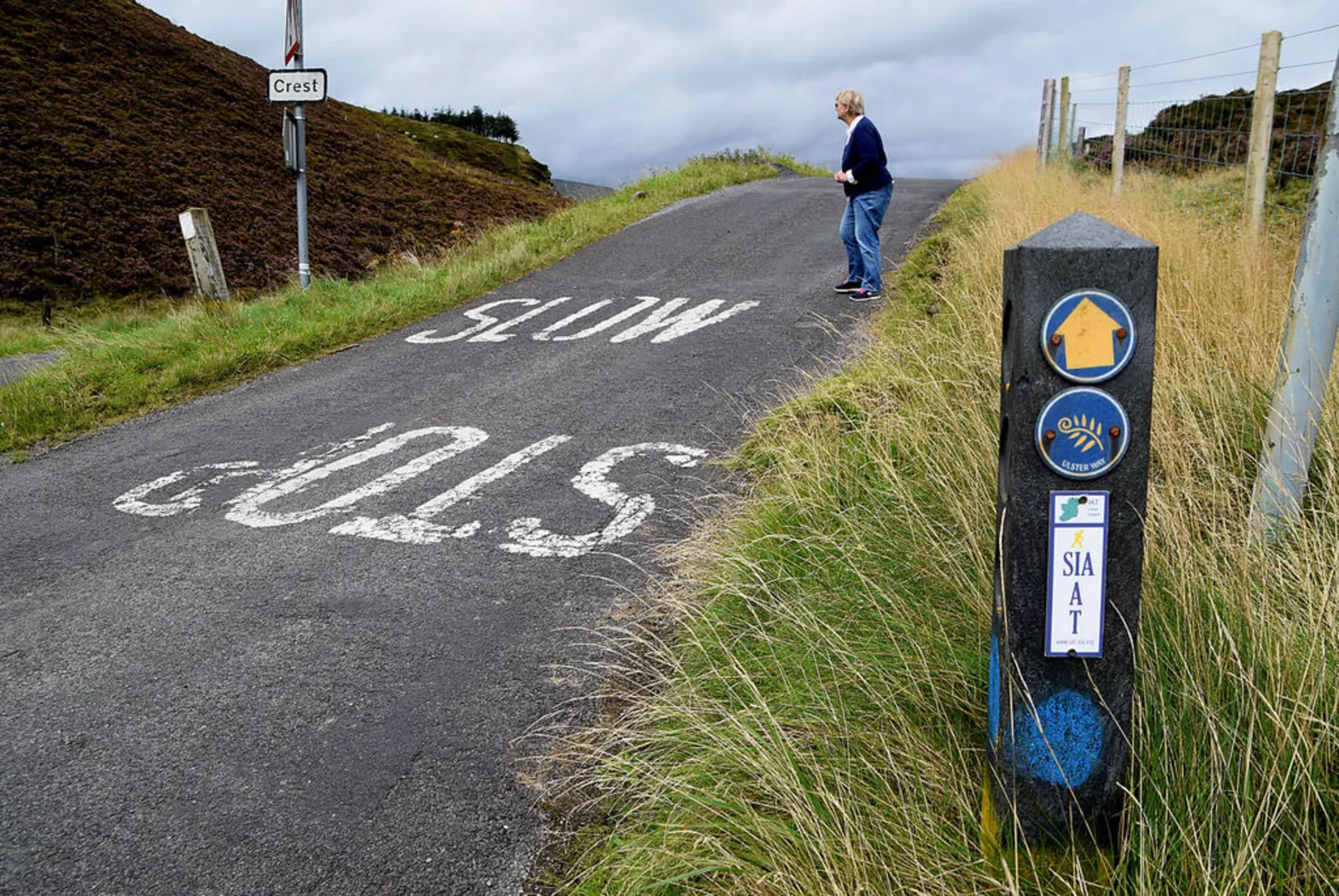
The region through which the IAT passes is laden with history. From the Neolithic period to the Gaelic lords and the impact of the Plantation of Ulster, each step along the trail is a walk through time. The trail also crosses paths with the Ulster Way and the ancient pilgrimage path of St. Patrick's Way, allowing hikers to experience a part of Ireland's spiritual and religious heritage.
Preparation and Planning
Given the trail's length and varied terrain, preparation is key. Ensure you have appropriate gear for all weather conditions, as the Irish climate can be unpredictable. Waterproof clothing, sturdy hiking boots, and a reliable tent (if camping) are essential. Plan your resupply points in advance, as some sections of the trail are remote and have limited facilities.
Remember to leave no trace and respect the natural environment, preserving it for future generations of hikers to enjoy. With careful planning and respect for the trail, your hike along the International Appalachian Trail in Ireland will be an unforgettable experience.

What to expect?
Activity types
Comments and Reviews
User comments, reviews and discussions about the International Appalachian Trail, Ireland.
4.63
average rating out of 5
16 rating(s)