Download
3D Flyover
Add to list
More
209.4 km
~9 days
4821 m
Multi-Day
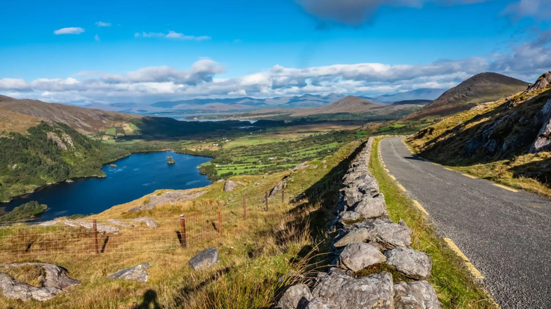
“Embark on the Beara Way, a mesmerizing trek through Ireland's coastal splendor and ancient history.”
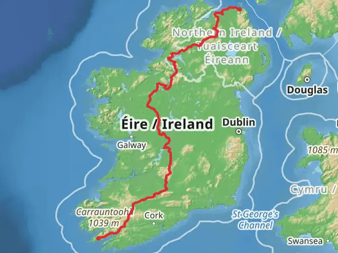
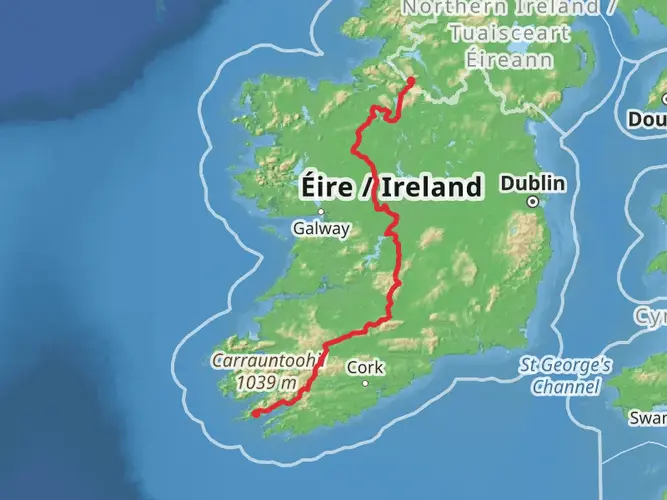
Spanning approximately 209 kilometers (130 miles) with an elevation gain of around 4800 meters (15,750 feet), the Beara Way is a captivating loop trail that takes you through the rugged beauty of the Beara Peninsula in County Cork and into parts of County Kerry, Ireland. This medium-difficulty hike offers a blend of coastal views, mountainous terrain, and rich cultural heritage.
Getting to the Trailhead
The Beara Way traditionally starts and ends in the quaint town of Glengarriff, County Cork, which is accessible by car or public transport. If you're driving, you can reach Glengarriff by taking the N71 road. For those relying on public transport, buses run from Cork city to Glengarriff, making the trailhead accessible without a car.
Navigating the Trail
The loop can be walked in either direction, but many choose to hike it clockwise. HiiKER is an excellent tool for navigation, providing detailed maps and waypoints to ensure you stay on the right path. The trail is well-marked with the familiar yellow walking man and arrows, but having a digital tool like HiiKER can be invaluable, especially in areas where signage might be less obvious.
Landmarks and Scenery
As you embark on the Beara Way, you'll be greeted by a variety of landscapes, from the rugged coastline with its crashing waves to the serene beauty of the Caha and Slieve Miskish mountain ranges. The trail takes you through picturesque villages like Castletownbere, Allihies, and Eyeries, each with its own unique charm.
One of the significant landmarks you'll encounter is the Dursey Island, which you can reach by Ireland's only cable car. The island offers stunning views and a peaceful retreat from the mainland. Approximately 22 kilometers (13.7 miles) into the hike, you'll find the historical Dereen Gardens, known for their subtropical flora.
Wildlife and Nature
The Beara Peninsula is a haven for wildlife enthusiasts. Keep an eye out for a variety of seabirds along the coast, and you might even spot seals basking on the rocks. Inland, the diverse habitats are home to badgers, otters, and the elusive Irish hare.
Cultural and Historical Significance
The Beara Way is steeped in history, with numerous ancient sites along the route. You'll pass standing stones, wedge tombs, and stone circles, some dating back over 3,000 years. The trail also traverses through areas rich in folklore and storytelling, adding a mystical element to your hike.
Preparation and Planning
Given the trail's length and varied terrain, it's essential to be well-prepared. Ensure you have suitable hiking boots, rain gear, and layers to adapt to Ireland's changeable weather. Plan your accommodation in advance, as the trail passes through several towns where B&Bs and hostels offer a warm welcome.
Conclusion
The Beara Way is a journey through time, nature, and the soul of Ireland's wild landscape. With careful planning and a spirit of adventure, hikers will find this trail to be a profoundly rewarding experience.

What to expect?
Activity types
Frequently asked questions
How long does it take to walk the Beara Way?
The Beara Way is a long, difficult multi-day loop of 209.35 km with 4,821 meters of climbing, so most hikers break it into roughly 8 to 10 walking days. Daily timing depends on stage length, weather, and how much time is spent in villages such as Glengarriff, Castletownbere, Allihies, and Eyeries.
Where is the starting point for the Beara Way in County Cork?
The Beara Way is generally started in Glengarriff, County Cork, and the route also finishes there because it is a loop. Official trail information lists Glengarriff as both the start and finish point, making it a practical base for arranging lodging, supplies, and transport at either end of the walk.
How hard is the Beara Way hike?
The Beara Way is best treated as a difficult long-distance hike rather than a beginner trail. Over 209.35 km it gains 4,821 meters in elevation, and the route crosses a mix of quiet roads, woodland paths, rougher upland sections, and remote ground on the Beara Peninsula in Cork and Kerry.
Can the Beara Way be walked as a loop?
Yes. The Beara Way is a loop trail, so it can be walked as a circuit rather than a point-to-point route. That means hikers can begin in Glengarriff, travel around the Beara Peninsula through places such as Castletownbere, Allihies, and Eyeries, and return to the same town at the end.
Is the Beara Way well waymarked?
The Beara Way is a waymarked national trail, using the standard yellow walking-man style signage used on Irish walking routes. Even so, this is a long and difficult route with remote stretches, so navigation still matters, especially on rougher sections and at road or track junctions around the peninsula.
Can you do the Beara Way without a car?
Yes, the Beara Way can be started without a car because Glengarriff is served by Bus Éireann route 236 from Cork. Since the trail is a loop that starts and ends in Glengarriff, public transport works especially well for hikers who want to arrive in Cork, travel to the trailhead, and finish in the same place.
Are dogs allowed on the Beara Way?
No. Official trail information for the Beara Way lists dogs as not allowed. That restriction matters on a long route like this because the trail crosses farmland and remote rural sections on the Beara Peninsula, so it is not a suitable choice for hikers planning to bring a dog.
Comments and Reviews
User comments, reviews and discussions about the Beara Way, Ireland.
4.75
average rating out of 5
87 rating(s)