Download
3D Flyover
Add to list
More
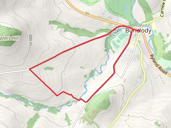
105.0 km
~4 days
1626 m
Multi-Day
“Embark on the South Leinster Way for a panoramic journey through Ireland's historic and natural splendor.”
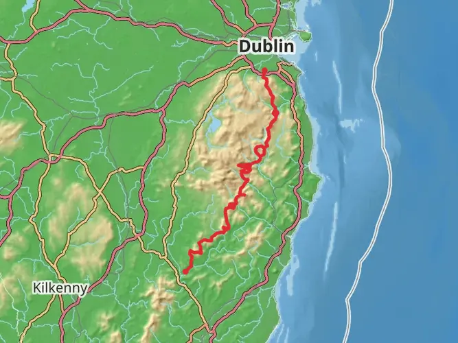
The South Leinster Way is a captivating long-distance walking route that stretches approximately 105 kilometers (about 65 miles) across the scenic landscapes of South Leinster, from the village of Kildavin near County Carlow to the coastal town of Carrick-on-Suir. With an elevation gain of around 1600 meters (approximately 5250 feet), this trail offers a medium difficulty rating, making it accessible to hikers with a reasonable level of fitness.
Getting to the Trailhead
To begin your journey on the South Leinster Way, you can reach the trailhead in Kildavin via public transport or by car. If you're traveling by bus, services run from major cities to nearby towns, where you can then take a taxi to Kildavin. For those driving, Kildavin is situated near the N80 road, and parking is available in the village.
Navigating the Trail
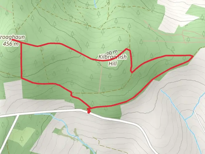
As you embark on the trail, you'll find that the route is well-marked with the standard yellow walking man and arrows used for national waymarked trails in Ireland. For additional navigation support, the HiiKER app provides detailed maps and GPS coordinates to ensure you stay on the right path.
Landmarks and Scenery
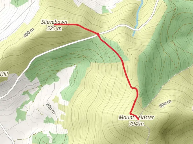
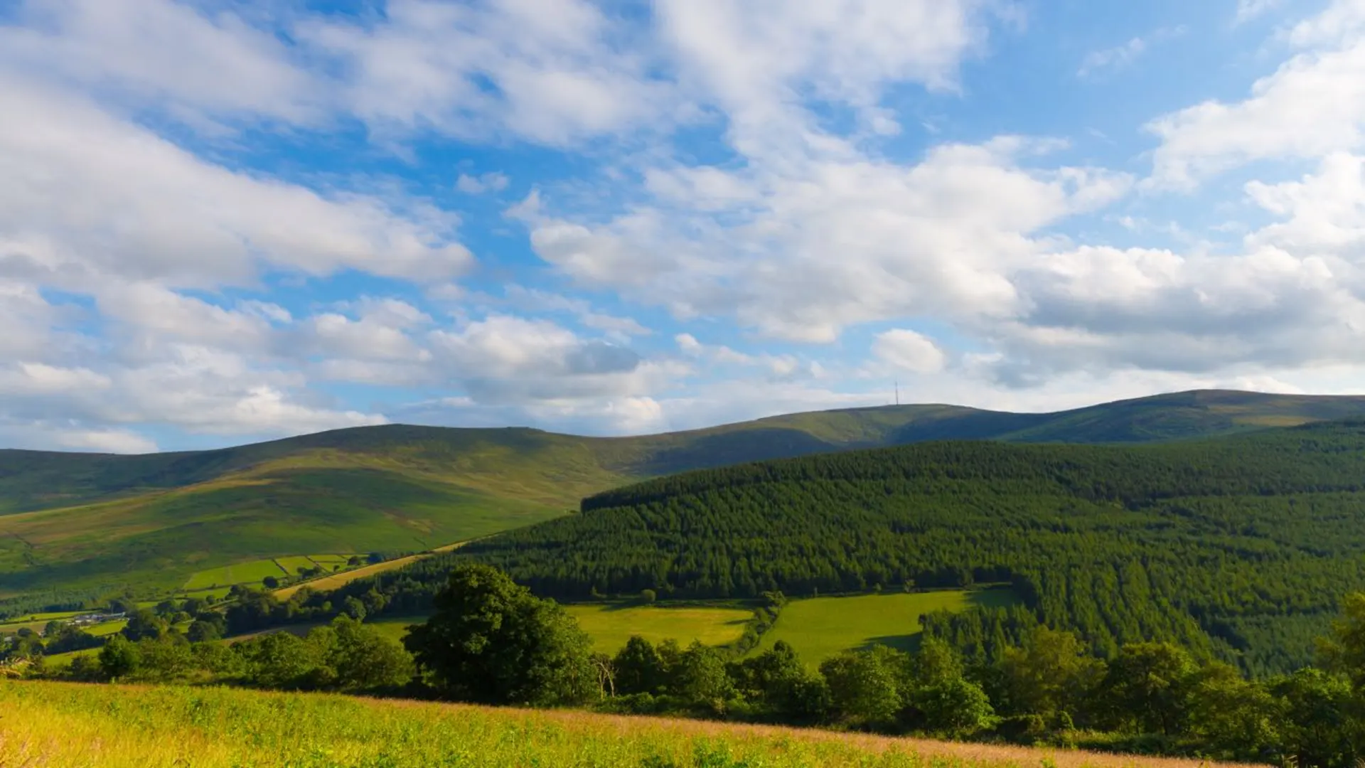
The South Leinster Way takes you through a variety of landscapes, including quiet country roads, leafy forest tracks, and open mountain heathland. One of the early highlights is the ascent of Mount Leinster, which stands at 796 meters (2612 feet) and is the highest peak in the region. From here, you'll enjoy panoramic views of the surrounding countryside.
As you continue, the trail meanders through the charming village of Borris, where you can admire the 16th-century Borris House and the remarkable 19th-century viaduct. The route also passes by the Clashganny Lock on the River Barrow, offering a glimpse into the area's rich heritage linked to the river's navigation system.
Flora and Fauna
The South Leinster Way provides an opportunity to observe the diverse flora and fauna of the region. The trail's varied habitats support a range of wildlife, including deer, foxes, and a variety of bird species. The woodlands are home to native trees such as oak and ash, while the open mountain areas feature heather and gorse, particularly vibrant during the blooming season.
Historical Significance
The trail traverses a region steeped in history, with ancient ring forts and standing stones dotting the landscape. The area's past is also reflected in the ruins of old cottages and farmsteads, remnants of a time when these lands were more densely populated.
Preparation and Planning
To fully enjoy the South Leinster Way, it's important to be well-prepared. Ensure you have suitable hiking boots, weather-appropriate clothing, and enough food and water for the journey. Accommodations along the route vary from B&Bs to self-catering cottages, so plan your stops accordingly. It's also wise to carry a first-aid kit and a mobile phone for emergencies.
Conclusion
The South Leinster Way offers a rich tapestry of natural beauty, historical intrigue, and a true sense of tranquility. Whether you're seeking a multi-day adventure or planning to tackle sections of the trail, this route promises an unforgettable experience in the heart of Ireland's countryside.

What to expect?
Activity types
Comments and Reviews
User comments, reviews and discussions about the South Leinster Way, Ireland.
4.7
average rating out of 5
30 rating(s)