Download
3D Flyover
Add to list
More
36.8 km
~2 days
710 m
Multi-Day
“Embark on the Adena Trace Loop for an Indiana adventure blending historical depths with the splendor of nature.”
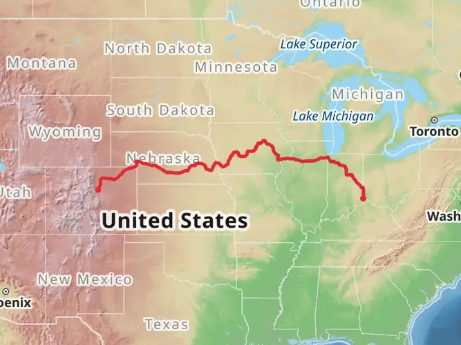
The Adena Trace Loop is a captivating journey through the diverse landscapes of Indiana, offering hikers an immersive experience in both natural beauty and historical significance. Spanning approximately 37 kilometers (about 23 miles) with an elevation gain of roughly 700 meters (around 2300 feet), this loop trail is nestled near Franklin County and is considered to have a medium difficulty rating.
Getting to the Trailhead
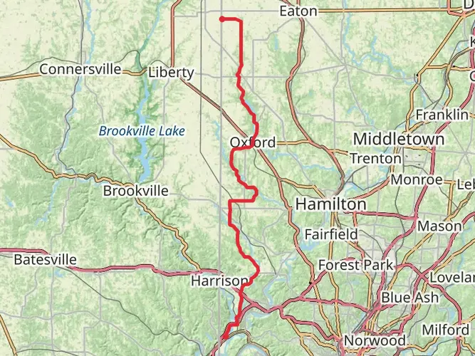
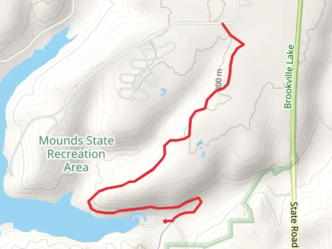
To reach the starting point of the Adena Trace Loop, hikers can drive to the nearest significant landmark, the Brookville Lake Dam, located near Brookville, Indiana. There is no direct public transportation to the trailhead, so accessing it by car is the most feasible option. Parking is available in the vicinity of the dam, which serves as a good reference point for the beginning of the hike.
Navigating the Trail
Hikers can utilize the HiiKER app to navigate the trail, ensuring they stay on the correct path throughout their journey. The app provides detailed maps and waypoints that are particularly useful in areas where the trail may be less defined.
Trail Experience
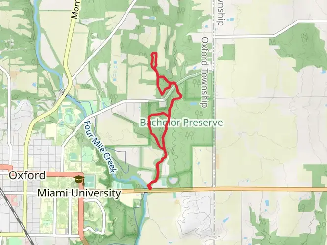
As you embark on the Adena Trace Loop, you'll traverse through a variety of terrains, including dense hardwood forests, rolling hills, and open meadows. The trail is well-marked, with occasional steep inclines and declines that contribute to its medium difficulty rating. The first section of the trail takes you through a lush woodland area, where the canopy of trees provides shade and a habitat for local wildlife.
Historical Significance
The region holds historical importance, as it is named after the Adena culture, an early Native American civilization known for their mound-building. As you hike, you may come across remnants of this ancient culture, adding a layer of historical intrigue to your outdoor adventure.
Flora and Fauna
Throughout the hike, you'll have the opportunity to observe a diverse array of plant and animal life. Spring and summer months are particularly vibrant, with wildflowers blooming along the trail's edges. Wildlife sightings may include white-tailed deer, wild turkeys, and various bird species, making it a rewarding experience for nature enthusiasts.
Landmarks and Scenic Views
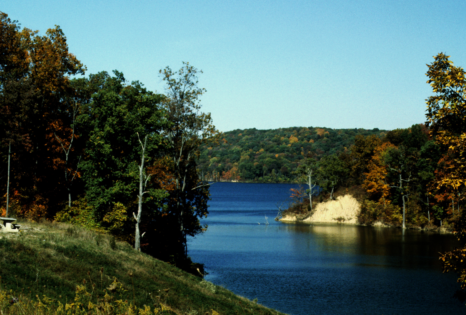
Approximately halfway through the loop, hikers will encounter scenic overlooks offering panoramic views of the surrounding hills and valleys. These vantage points are perfect for rest breaks and photo opportunities. The trail also meanders close to the shores of Brookville Lake, providing a chance to enjoy the tranquil waterside environment.
Preparation and Safety
Before setting out on the Adena Trace Loop, hikers should prepare adequately by packing sufficient water, snacks, and a first-aid kit. Weather conditions can change rapidly, so it's advisable to bring layers of clothing to adapt to varying temperatures. Sturdy hiking boots are recommended to navigate the mixed terrain comfortably and safely.
Conclusion
The Adena Trace Loop is a trail that offers a rich tapestry of natural beauty, wildlife, and a glimpse into the historical past of Indiana. Whether you're a seasoned hiker or someone looking to explore the great outdoors, this trail provides a memorable experience with each step.

What to expect?
Activity types
Frequently asked questions
How long does it take to hike the Adena Trace Loop in Franklin County, Indiana?
The Adena Trace Loop is 36.83 km, or about 22.9 miles, so most hikers treat it as a long full-day effort or an overnight trip. With 710 m of climbing spread across rolling terrain around Brookville Lake, a typical pace puts it in the roughly 8 to 12 hour range for strong day hikers.
Where do you park for the Adena Trace Loop near Brookville Lake?
The usual access point for the Adena Trace Loop is near Brookville Lake Dam by Brookville, Indiana. Brookville Lake trail information notes that the loop continues by crossing the dam to the Wolf Creek Trail, and the spillway or dam area is the standard reference point for starting and parking near the route.
Is the Adena Trace Loop a backpacking trail or a day hike?
The Adena Trace Loop works better as a backpacking route than a casual day hike for most people. At 36.83 km with 710 m of elevation gain, it is long enough to split into two days, but strong hikers do complete it in a single day when starting early and moving efficiently.
Can you camp on the Adena Trace Loop at Brookville Lake?
Camping options exist along or near the Adena Trace Loop at Brookville Lake, and Indiana DNR includes it on its backpacking trail list for longer natural-surface routes with camping access. Older local coverage notes that camping is not generally allowed just anywhere along the south side of the lake, so overnight plans should center on established camping areas near Brookville Lake rather than informal dispersed sites.
How hard is the Adena Trace Loop and does it have much elevation?
The Adena Trace Loop is listed as easy overall, but the numbers still make it a substantial outing. The route covers 36.83 km and gains 710 m, so even without technical terrain it includes enough climbing and distance to feel demanding over the course of a full loop.
What landmarks or sections are on the Adena Trace Loop around Brookville Lake?
The Adena Trace Loop circles the southern half of Brookville Lake and connects named sections including Wolf Creek Trail and Bonwell Trail. Brookville Lake trail guidance specifically notes crossing the dam to reach Wolf Creek, which makes the dam one of the key landmarks on the loop.
Comments and Reviews
User comments, reviews and discussions about the Adena Trace Loop, Indiana.
4.83
average rating out of 5
12 rating(s)