Download
3D Flyover
Add to list
More
45.7 km
~2 days
83 m
Multi-Day
“Discover the MCT Nickel Plate Trail: a scenic, historic, and wildlife-rich hiking haven in Madison County.”
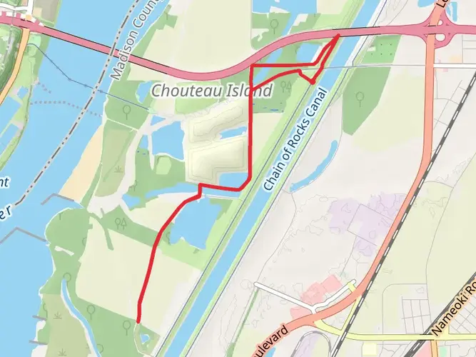
The MCT Nickel Plate Trail stretches approximately 46 kilometers (around 28.5 miles) and offers a relatively flat journey with minimal elevation gain, making it an accessible option for hikers of varying skill levels. The trailhead is conveniently located near Madison County, Illinois, and can be reached by car or public transportation. If you're driving, you can start your journey at the intersection of W. Chain of Rocks Road and IL-3, which is the nearest landmark to the trailhead.
As you embark on this point-to-point trail, you'll find yourself immersed in a mix of urban and rural landscapes. The trail is well-maintained and primarily used for hiking, walking, and cycling, so be prepared to share the path with others enjoying the outdoors.
Historical Significance and Landmarks
The MCT Nickel Plate Trail is steeped in history, following the former corridor of the Nickel Plate Railroad. As you hike, you'll be tracing the same routes once used by trains that played a crucial role in the region's development. Keep an eye out for historical markers and remnants of the railroad's past, which are scattered along the route.
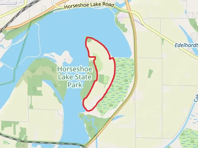
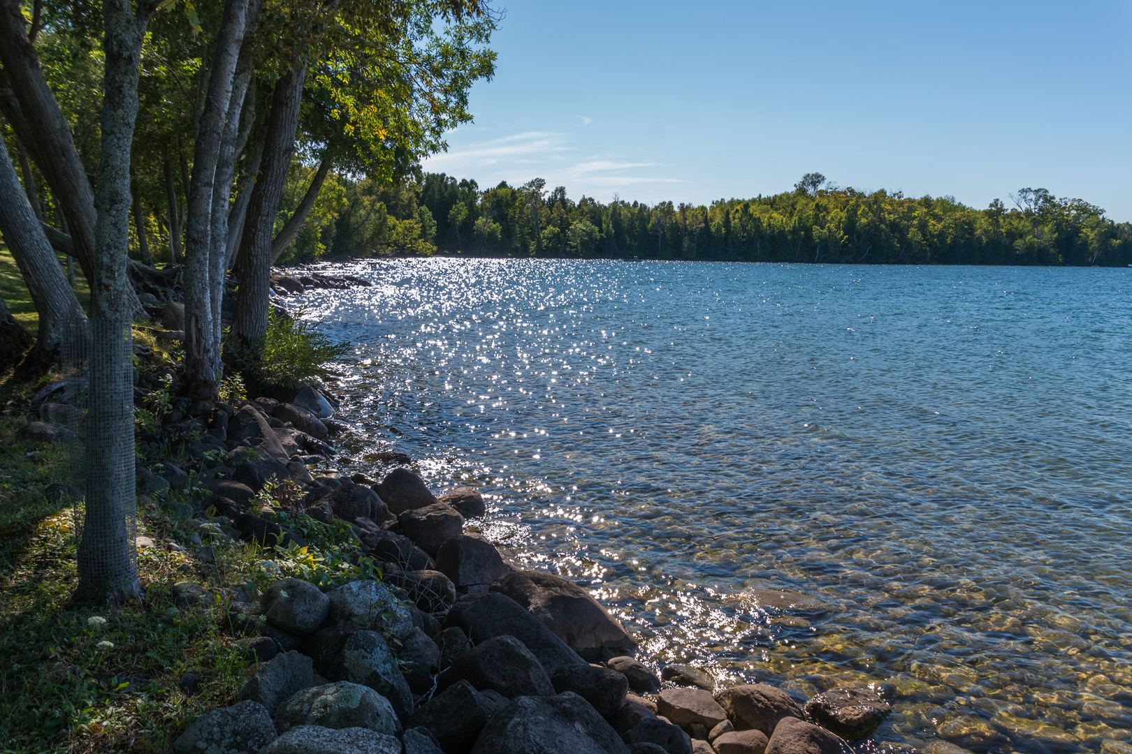
One of the significant landmarks you'll encounter is the Horseshoe Lake State Park, located roughly 16 kilometers (10 miles) from the trailhead. This park is a great spot to observe local wildlife and offers a peaceful setting for a rest or picnic.
Flora and Fauna
Nature enthusiasts will appreciate the diversity of wildlife and plant life along the trail. The surrounding areas are home to a variety of birds, so bring your binoculars if you're a birdwatcher. The trail also winds through different habitats, including woodlands and wetlands, where you can spot native plants and perhaps even some deer or small mammals.
Navigating the Trail
For navigation, HiiKER is an excellent tool to use while hiking the MCT Nickel Plate Trail. It will help you keep track of your progress and ensure you don't miss any points of interest. The trail is well-signed, but having a digital map can be invaluable, especially for pinpointing your location or finding nearby amenities.
Access and Transportation
To reach the start of the trail using public transport, check the local transit schedules for buses that stop near the intersection of W. Chain of Rocks Road and IL-3. If you're returning to your starting point after completing the trail, you'll want to arrange for transportation at the other end, as this is a point-to-point hike.
For those driving, parking is available near the trailhead. Ensure you park in designated areas to avoid any fines or towing.
As you plan your hike on the MCT Nickel Plate Trail, remember to prepare for the weather, as conditions can change. Bring water, snacks, and wear appropriate footwear for the paved surface. Whether you're in it for the exercise, the history, or the natural beauty, this trail offers a unique experience that caters to a wide range of interests.

What to expect?
Activity types
Frequently asked questions
How long does it take to complete the MCT Nickel Plate Trail in Madison County, Illinois?
The MCT Nickel Plate Trail is 45.71 kilometers, or about 28.5 miles, so a full end-to-end hike is usually a full-day effort for strong walkers and can also be split across sections. With only 83 meters of total elevation gain and an easy grade, pace is usually determined more by distance than by climbing.
Where can you park for the MCT Nickel Plate Trail?
Parking for the MCT Nickel Plate Trail is available at several access points, including Longfellow Road and Route 159 in Edwardsville, the Lewis and Clark Community College N.O. Nelson campus, Longfellow and Nelson Avenues in Edwardsville, the County Highway Building in Edwardsville, Miner Park in Glen Carbon, and the Glen Carbon Park and Ride lot at IL-157.
What towns and endpoints does the MCT Nickel Plate Trail connect?
The MCT Nickel Plate Trail runs from South Main Street in New Douglas to Old Edwardsville Road in Pontoon Beach. Along the way it passes through or near communities including Edwardsville and Glen Carbon, linking parks, historic districts, farmland, and other Madison County Transit trail corridors.
Is the MCT Nickel Plate Trail flat and beginner-friendly?
Yes. The MCT Nickel Plate Trail is rated easy and gains only 83 meters over its 45.71-kilometer length, which makes it a notably gentle route for a trail of this distance. The surface is a mix of asphalt and limestone, so it is generally approachable for beginners, families, and anyone looking for a long, low-gradient outing.
What are the main landmarks and points of interest on the MCT Nickel Plate Trail?
Notable stops on the MCT Nickel Plate Trail include Edwardsville Township Park, Glen Carbon Miner Park, the Lewis and Clark Community College N.O. Nelson Campus, the Edwardsville Children’s Museum, and Alhambra Fireman and Legion Park. The route also follows the former Nickel Plate Railroad corridor, which gives the trail its historic identity.
Can you connect to other trails from the MCT Nickel Plate Trail?
Yes. The MCT Nickel Plate Trail connects directly with the MCT Nature Trail, MCT Quercus Grove Trail, and MCT Ronald J. Foster Heritage Trail. Those links make it possible to build much longer outings through the Madison County Transit trail network, especially around Edwardsville and Glen Carbon.
Are dogs allowed on the MCT Nickel Plate Trail, and when is the trail open?
The MCT trail system is open from sunrise to sunset, and the Nickel Plate Trail follows those system-wide operating hours. Current trail rules list walking and similar non-motorized uses as permitted, but dog-specific rules are not clearly stated on the public trail rules page, so leash and pet etiquette should be checked locally before setting out.
Comments and Reviews
User comments, reviews and discussions about the MCT Nickel Plate Trail, Illinois.
4.36
average rating out of 5
14 rating(s)