Download
Preview
Add to list
More
31.0 km
~2 days
940 m
Multi-Day
“Trek the Myvatn Trail's volcanic landscapes, rich wildlife, and historical paths for an immersive Icelandic hiking adventure.”
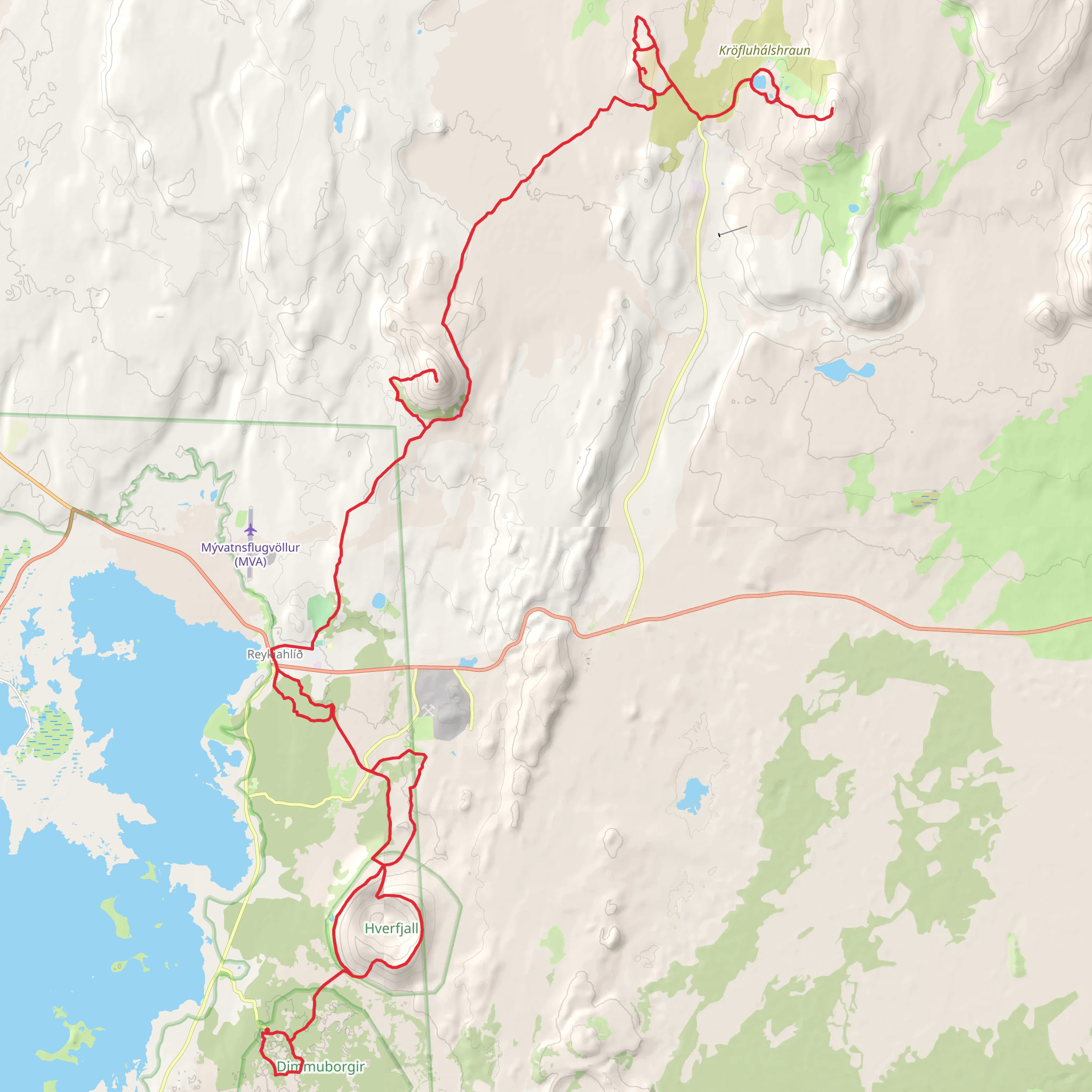
Embarking on the Myvatn Trail, hikers will traverse approximately 31 kilometers (around 19 miles) of diverse landscapes, with an elevation gain of roughly 900 meters (about 2950 feet). This point-to-point trail is nestled in the northeastern region of Iceland, near the small municipality of Skútustaðahreppur, and is rated as medium difficulty, making it accessible to hikers with a moderate level of experience.
Getting to the Trailhead
To reach the starting point of the Myvatn Trail, travelers can drive or take public transportation to the area near Skútustaðahreppur. For those driving, the trailhead is accessible via Route 1, which circles the island. Public transport options include buses that service the Myvatn area, with the closest stop being in the town of Reykjahlíð, from where you can arrange for a taxi or a local shuttle to the trailhead.
Navigating the Trail
Hikers can utilize the HiiKER app to navigate the trail, ensuring they stay on the correct path and can pinpoint their location at any time. The app provides detailed maps and trail information, which is particularly useful in the remote and sometimes challenging terrain of Iceland.
Landmarks and Natural Features
The Myvatn Trail offers a rich tapestry of geological wonders and natural beauty. The trail begins near the pseudocraters of Skútustaðagígar, formed by gas explosions when boiling lava flowed over the wetlands. As hikers progress, they will encounter the striking lava formations and pillars at Dimmuborgir, which are steeped in local folklore and said to be the remains of a troll city.
Further along the trail, the path meanders by the azure waters of the Myvatn Lake, a vital habitat for a variety of bird species, especially ducks. Birdwatchers will delight in the opportunity to spot unique species that are rarely seen elsewhere.
Volcanic Activity and Hot Springs
The Myvatn region is known for its volcanic activity, and the trail offers views of steaming fumaroles and boiling mud pots, particularly in the Hverir geothermal area. The stark, moon-like landscape here is a reminder of the powerful forces that have shaped the land.
Historical Significance
The Myvatn area is not only a natural wonder but also a place of historical importance. The region is home to ancient settlements, and the trail itself may have been used by early inhabitants for travel and trade. The rich history adds an element of intrigue to the hike, as one treads paths that have been used for centuries.
Preparation and Planning
Due to the variable weather conditions in Iceland, hikers should be prepared for sudden changes and dress in layers. Waterproof gear is essential, as well as sturdy hiking boots. It's advisable to carry enough food and water for the duration of the hike, as there are no facilities along the trail. Lastly, always inform someone of your hiking plans and expected return time for safety.
By following these guidelines and being prepared, hikers can fully enjoy the splendor and unique experiences that the Myvatn Trail has to offer.
Comments and Reviews
User comments, reviews and discussions about the The Myvatn Trail, Iceland.
4.71
average rating out of 5
7 rating(s)

