Download
Preview
Add to list
More
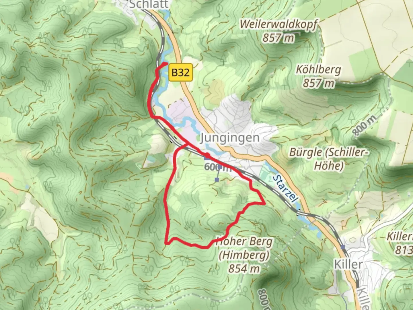
7.1 km
~1 hrs 47 min
230 m
Loop
“Embark on a 7 km loop near Zollernalbkreis, blending waterfalls, history, and moderate hiking challenges.”
Starting your adventure near Zollernalbkreis, Germany, the Wasserfall Weiler Schrofen via Hauweg trail is a captivating 7 km (4.3 miles) loop with an elevation gain of approximately 200 meters (656 feet). This medium-difficulty trail offers a blend of natural beauty, historical significance, and a moderate challenge suitable for most hikers.### Getting There To reach the trailhead, you can drive or use public transport. If driving, set your GPS to the nearest known address: Zollernalbkreis, Germany. For those using public transport, take a train to Balingen station, and from there, a local bus or taxi can take you to the trailhead.### Trail Highlights
Waterfalls and Scenic Views
One of the most striking features of this trail is the Wasserfall Weiler Schrofen, a picturesque waterfall that cascades down the rocky terrain. Located approximately 3 km (1.9 miles) into the hike, the waterfall is a perfect spot for a break and some photography. The sound of rushing water and the lush greenery around it create a serene atmosphere.#### Flora and Fauna The trail winds through dense forests and open meadows, offering a rich tapestry of flora and fauna. In spring and summer, the meadows are dotted with wildflowers, while the forests are home to various bird species and small mammals. Keep an eye out for deer, which are commonly seen in the early morning or late afternoon.### Historical Significance The region around Zollernalbkreis is steeped in history. As you hike, you'll come across remnants of old farmhouses and stone walls that date back several centuries. These structures offer a glimpse into the agricultural past of the area. Additionally, the trail passes near the ruins of an old watchtower, which served as a lookout point during medieval times.### Navigation and Safety Given the moderate difficulty of the trail, it's advisable to use a reliable navigation tool like HiiKER to stay on track. The trail is well-marked, but having a digital map can be very helpful, especially in the denser forest sections. Wear sturdy hiking boots, as some parts of the trail can be rocky and uneven.### Elevation and Terrain The trail starts with a gentle ascent, gaining about 100 meters (328 feet) in the first 2 km (1.2 miles). After reaching the highest point, the trail descends gradually, offering stunning views of the surrounding valleys. The terrain varies from forest paths to open fields, providing a diverse hiking experience.### Practical Tips - Water and Snacks: Carry enough water and some snacks, as there are no facilities along the trail. - Weather: Check the weather forecast before heading out. The trail can be slippery after rain, especially near the waterfall. - Wildlife: While the wildlife is generally harmless, it's always good to be cautious and maintain a safe distance.This trail offers a perfect blend of natural beauty, historical intrigue, and moderate physical challenge, making it a rewarding experience for any hiker.

What to expect?
Activity types
Comments and Reviews
User comments, reviews and discussions about the Wasserfall Weiler Schrofen via Hauweg, Germany.
4.67
average rating out of 5
3 rating(s)