Download
Preview
Add to list
More
8.2 km
~2 hrs 6 min
286 m
Loop
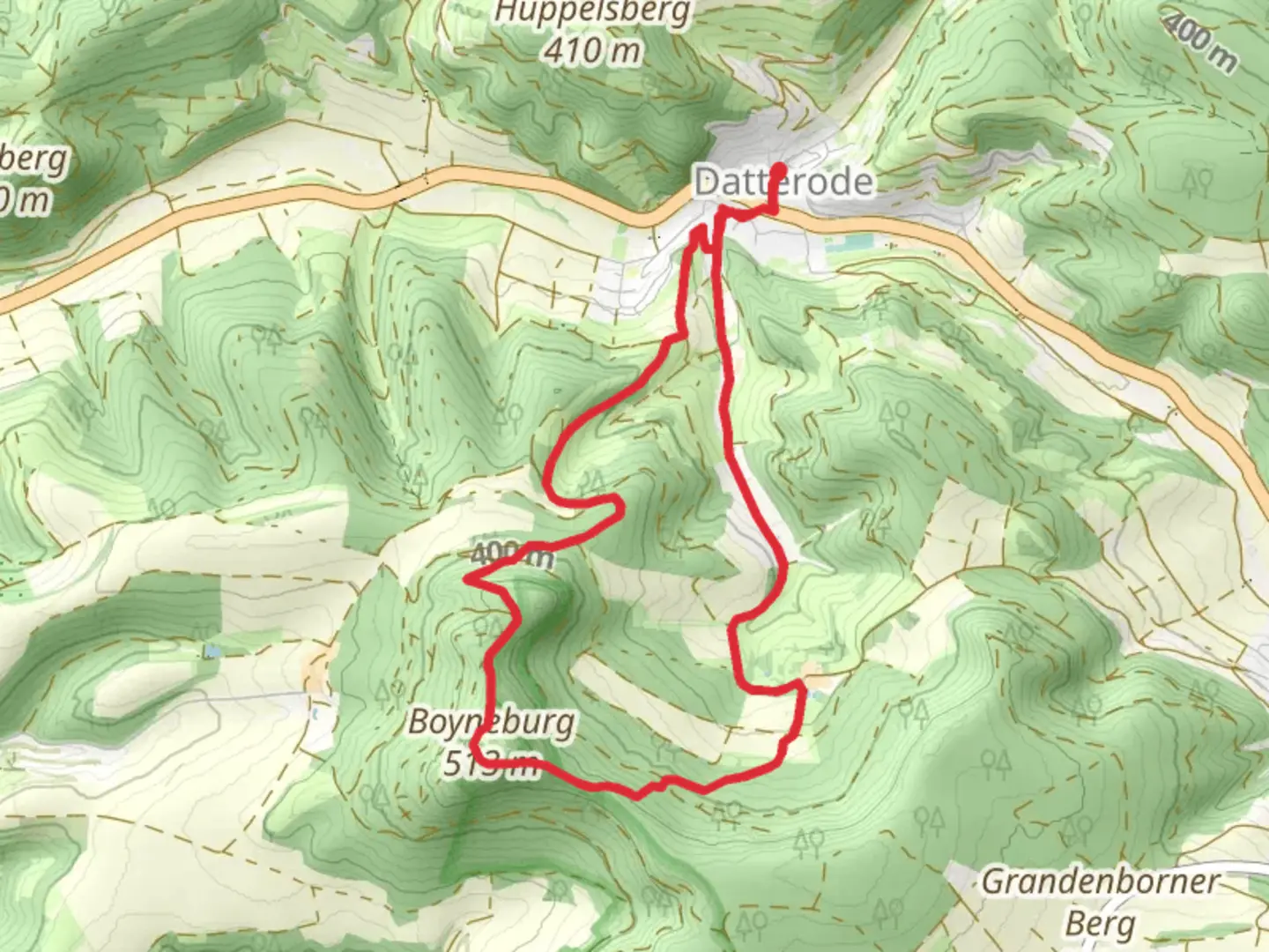
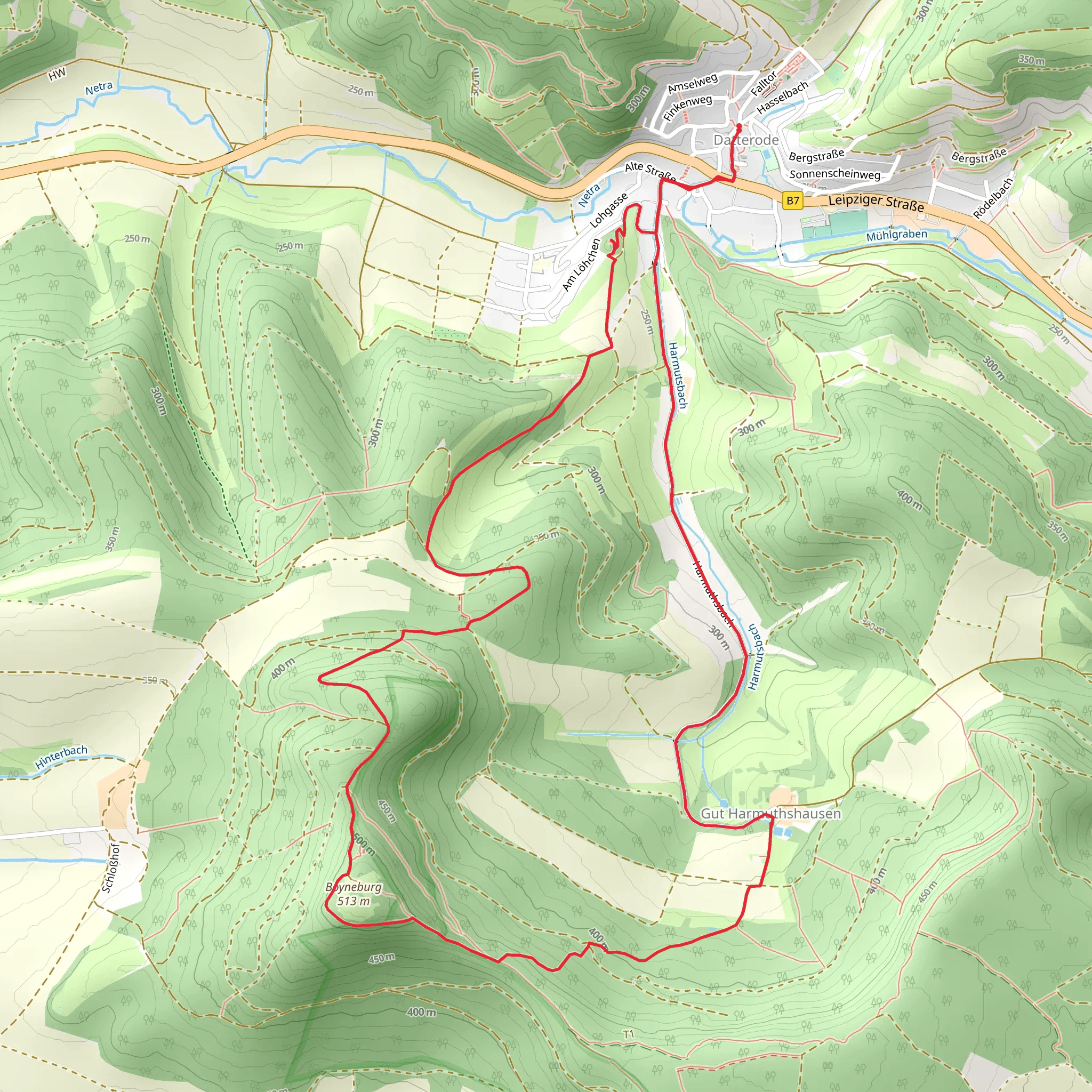
“Experience the Datteroeder Burgweg trail's natural beauty, historical intrigue, and panoramic views in a moderate 8 km loop.”
Starting near Werra-Meißner-Kreis in Germany, this 8 km (approximately 5 miles) loop trail offers a moderate challenge with an elevation gain of around 200 meters (656 feet). The trailhead is easily accessible by car or public transport. If driving, you can park near the village of Datterode. For those using public transport, the nearest significant landmark is the Datterode bus stop, which is serviced by regional buses.
Trail Overview
The Datteroeder Burgweg trail is a delightful mix of natural beauty and historical intrigue. As you embark on this journey, you'll traverse through dense forests, open meadows, and rolling hills. The trail is well-marked, but it's always a good idea to have a reliable navigation tool like HiiKER to ensure you stay on course.
Key Landmarks and Points of Interest
Datterode Village: Starting from the quaint village of Datterode, you'll immediately feel the charm of rural Germany. The village itself is worth a brief exploration, with its traditional half-timbered houses and serene atmosphere.
Burg Ludwigstein: One of the most significant landmarks on this trail is Burg Ludwigstein, a medieval castle that dates back to the 15th century. Located approximately 3 km (1.9 miles) into the hike, the castle offers panoramic views of the surrounding countryside. The elevation gain to this point is about 100 meters (328 feet), making it a moderate climb. The castle has been well-preserved and now serves as a youth hostel and educational center.
Forests and Meadows: As you continue, the trail meanders through lush forests and expansive meadows. During spring and summer, these areas are teeming with wildflowers and various bird species. Keep an eye out for deer and other wildlife that are commonly spotted in this region.
Scenic Overlooks: Around the 5 km (3.1 miles) mark, you'll encounter several scenic overlooks that provide breathtaking views of the Werra Valley. These spots are perfect for a short rest and some photography. The elevation gain here is gradual, adding another 50 meters (164 feet) to your climb.
Historical Significance
The region around Werra-Meißner-Kreis is steeped in history. The trail itself passes through areas that have been inhabited since the Middle Ages. Burg Ludwigstein, in particular, played a crucial role in regional defense and trade during its heyday. The castle's strategic location allowed it to oversee and protect the trade routes that passed through the valley.
Flora and Fauna
The trail is a haven for nature enthusiasts. The forests are predominantly composed of beech and oak trees, providing ample shade during the hike. In the meadows, you'll find a variety of wildflowers, including orchids and lilies. Birdwatchers will be delighted by the presence of species such as the European robin, blackbird, and various types of woodpeckers.
Getting There
For those driving, head towards the village of Datterode in the Werra-Meißner-Kreis district. Parking is available near the trailhead. If you're using public transport, take a regional bus to the Datterode bus stop. From there, it's a short walk to the start of the trail.
Trail Conditions and Safety
The trail is well-maintained but can be muddy after rain, so appropriate footwear is recommended. The moderate difficulty rating means it's suitable for most hikers with a reasonable level of fitness. Always carry enough water, especially during the warmer months, and consider packing a small first aid kit.
By following these guidelines and being prepared, you'll be able to fully enjoy the natural beauty and historical richness that the Datteroeder Burgweg trail has to offer.
Comments and Reviews
User comments, reviews and discussions about the Datteroeder Burgweg, Germany.
4.33
average rating out of 5
3 rating(s)
