Download
Preview
Add to list
More
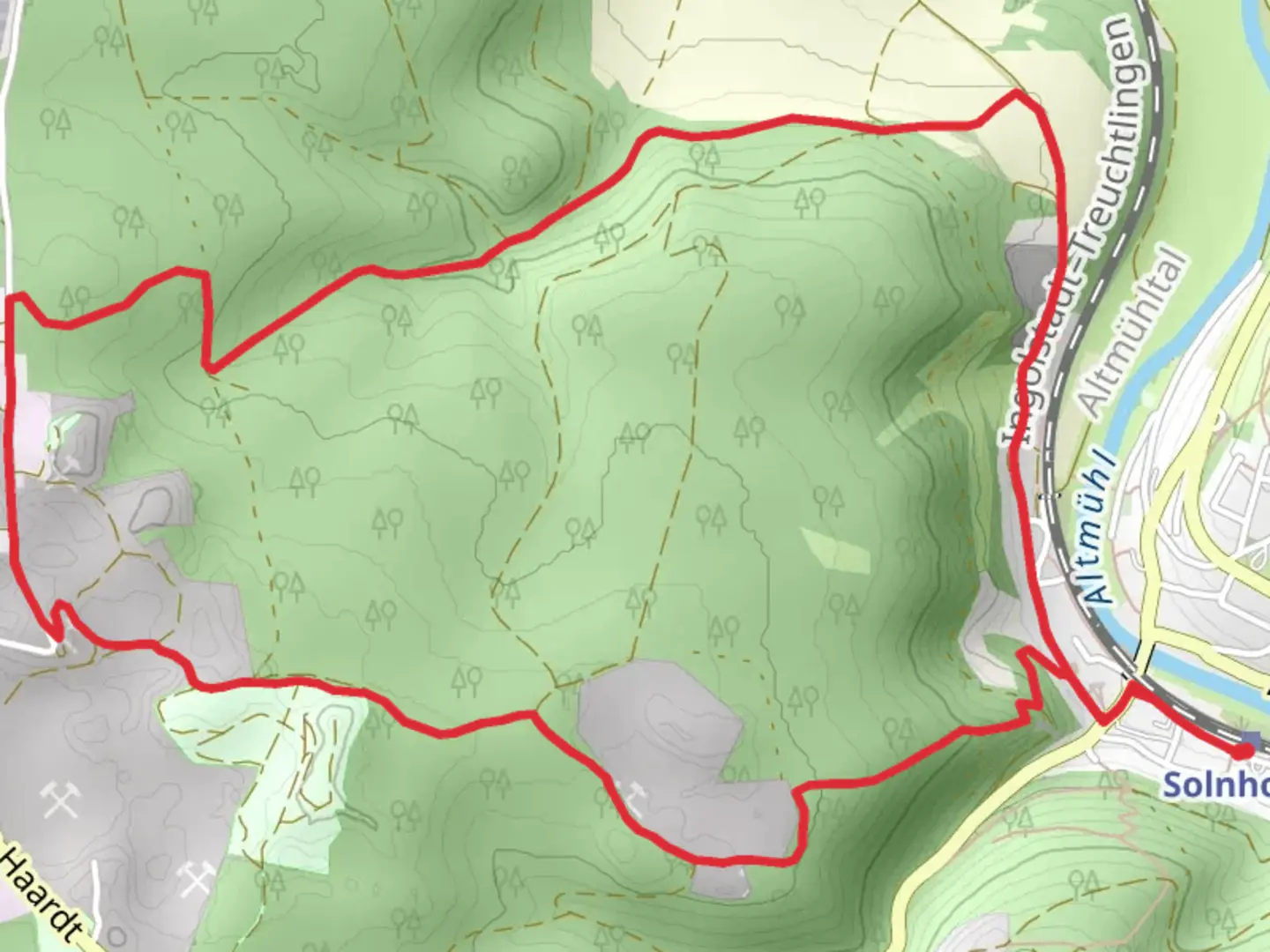
8.1 km
~2 hrs 4 min
275 m
Loop
“Explore lush forests, historical quarries, and scenic vistas on the moderately challenging Solnhofen 5 Loop trail.”
Starting near the charming town of Weißenburg-Gunzenhausen in Germany, the Solnhofen 5 Loop is an 8 km (approximately 5 miles) trail with an elevation gain of around 200 meters (656 feet). This loop trail is rated as medium difficulty, making it suitable for moderately experienced hikers.
Getting There To reach the trailhead, you can either drive or use public transport. If driving, set your GPS to Weißenburg-Gunzenhausen, and you'll find ample parking options near the trailhead. For those using public transport, take a train to Weißenburg station. From there, local buses or a short taxi ride will get you to the starting point.
Trail Navigation For navigation, it's highly recommended to use the HiiKER app, which provides detailed maps and real-time updates to ensure you stay on track.
Trail Highlights The trail begins with a gentle ascent through lush forests, offering a serene start to your hike. As you progress, you'll encounter a mix of deciduous and coniferous trees, providing a rich tapestry of colors, especially in the autumn months.
#### Historical Significance One of the most fascinating aspects of this trail is its proximity to the Solnhofen limestone quarries. This region is world-renowned for its fossil discoveries, including the famous Archaeopteryx, a transitional fossil between dinosaurs and modern birds. As you hike, you'll pass by several informational plaques detailing the geological and paleontological significance of the area.
Mid-Trail Landmarks At approximately the 4 km (2.5 miles) mark, you'll reach a scenic viewpoint offering panoramic views of the Altmühl Valley. This is an excellent spot to take a break and soak in the natural beauty. The elevation gain to this point is about 100 meters (328 feet), making it a moderate climb.
Continuing on, the trail meanders through open meadows and past small streams, providing opportunities to spot local wildlife such as deer, foxes, and a variety of bird species. Keep an eye out for the European green woodpecker, often seen in this area.
Final Stretch The last 2 km (1.2 miles) of the trail take you through a series of rolling hills before descending back into the forest. The descent is gradual, making it a pleasant end to your hike. As you near the trailhead, you'll pass by several traditional Bavarian farmhouses, adding a cultural touch to your journey.
Practical Tips - Wear sturdy hiking boots, as the trail can be uneven in places. - Bring plenty of water and snacks, especially if you plan to take breaks at the scenic viewpoints. - Check the weather forecast before heading out, as the trail can become slippery after rain. - Use the HiiKER app for real-time navigation and updates.
This trail offers a perfect blend of natural beauty, historical significance, and moderate physical challenge, making it a rewarding experience for any hiker.

Comments and Reviews
User comments, reviews and discussions about the Solnhofen 5 Loop, Germany.
average rating out of 5
0 rating(s)