Download
Preview
Add to list
More
13.2 km
~3 hrs 42 min
643 m
Loop
“Embark on the captivating Dreifürstensteig Loop for lush forests, panoramic views, and historical intrigue.”
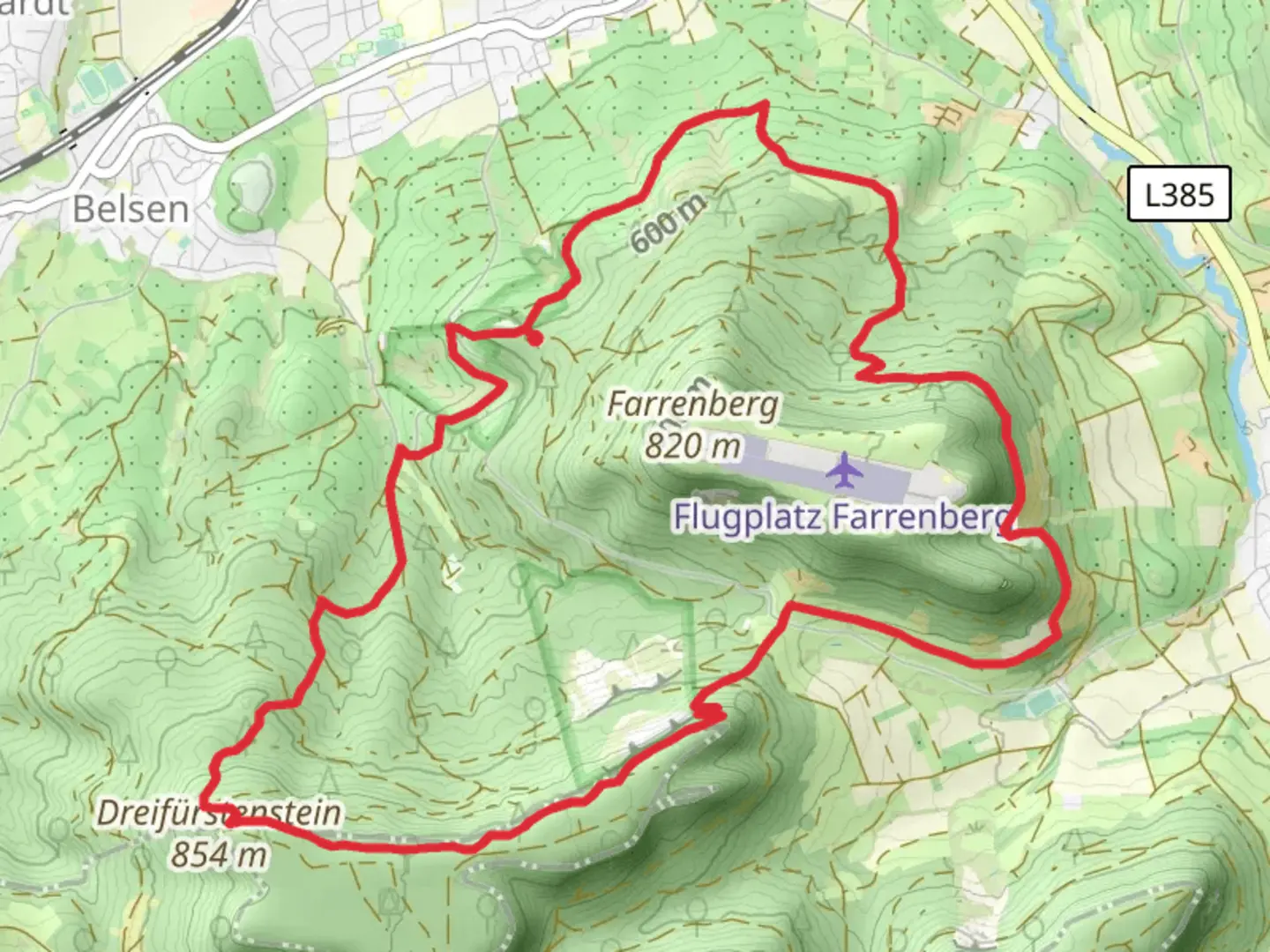
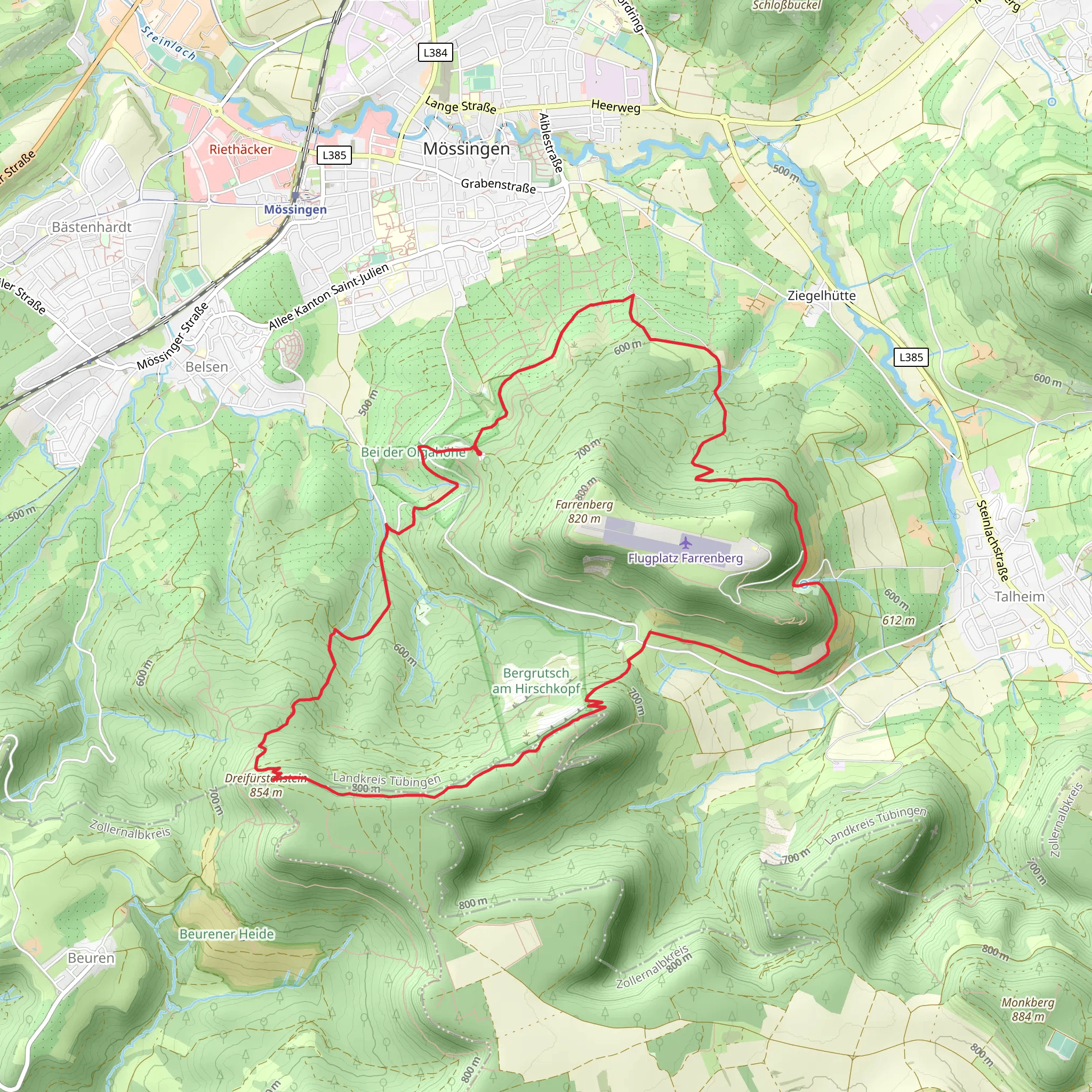
Starting your hike near Tübingen, Germany, the Dreifürstensteig Loop is a captivating 13 km (8 miles) trail with an elevation gain of approximately 600 meters (1,969 feet). This loop trail is rated as medium difficulty, making it suitable for moderately experienced hikers.
Getting There To reach the trailhead, you can drive or use public transport. If driving, set your GPS to the nearest known address: Mössingen, Germany. For public transport, take a train to Tübingen Hauptbahnhof and then a bus to Mössingen. From Mössingen, it's a short walk to the trailhead.
Trail Overview The Dreifürstensteig Loop offers a diverse hiking experience, featuring lush forests, open meadows, and panoramic viewpoints. The trail is well-marked, but it's advisable to use HiiKER for navigation to ensure you stay on track.
Key Sections and Landmarks
#### Initial Ascent Starting from Mössingen, the trail begins with a steady ascent through dense forest. This initial climb covers about 3 km (1.9 miles) and gains roughly 200 meters (656 feet) in elevation. The forest is home to a variety of wildlife, including deer and numerous bird species, so keep your eyes peeled.
#### Dreifürstenstein Around the 5 km (3.1 miles) mark, you'll reach Dreifürstenstein, a significant landmark offering breathtaking views of the Swabian Jura. This spot is historically significant as it marks the meeting point of three former principalities: Württemberg, Hohenzollern, and Fürstenberg. Take a moment to enjoy the panoramic vistas and perhaps a snack break.
#### Open Meadows and Panoramic Views Continuing from Dreifürstenstein, the trail opens up into expansive meadows. This section is relatively flat and offers stunning views of the surrounding landscape. You'll cover about 4 km (2.5 miles) through these meadows, with minimal elevation change. The meadows are often dotted with wildflowers in the spring and summer, adding a splash of color to your hike.
#### Descent and Return The final section of the trail involves a descent back into the forest, covering the remaining 6 km (3.7 miles) and losing about 400 meters (1,312 feet) in elevation. This part of the trail can be steep and rocky, so watch your footing. The forest canopy provides a cool, shaded environment, making it a pleasant end to your hike.
Historical Significance The Dreifürstensteig Loop is not just a natural wonder but also a historical journey. The Dreifürstenstein itself is a testament to the region's complex political history, where three principalities once converged. This historical context adds an enriching layer to your hiking experience.
Wildlife and Flora The trail is a haven for nature enthusiasts. In addition to deer and birds, you might encounter foxes and various small mammals. The flora is equally diverse, with oak, beech, and pine trees dominating the forested sections, while the meadows boast a variety of wildflowers and grasses.
Preparation Tips Given the medium difficulty rating, ensure you have sturdy hiking boots and sufficient water. The trail can be muddy after rain, so waterproof gear is advisable. Using HiiKER for navigation will help you stay on the correct path and make the most of your hike.
Embark on the Dreifürstensteig Loop for a blend of natural beauty, historical intrigue, and a moderately challenging hike.
What to expect?
Activity types
Comments and Reviews
User comments, reviews and discussions about the Dreifürstensteig Loop, Germany.
4.57
average rating out of 5
7 rating(s)
