Download
Preview
Add to list
More
10.7 km
~2 hrs 30 min
216 m
Loop
“This 11 km loop near Tirschenreuth blends scenic beauty, historical landmarks, and moderate hiking challenges.”
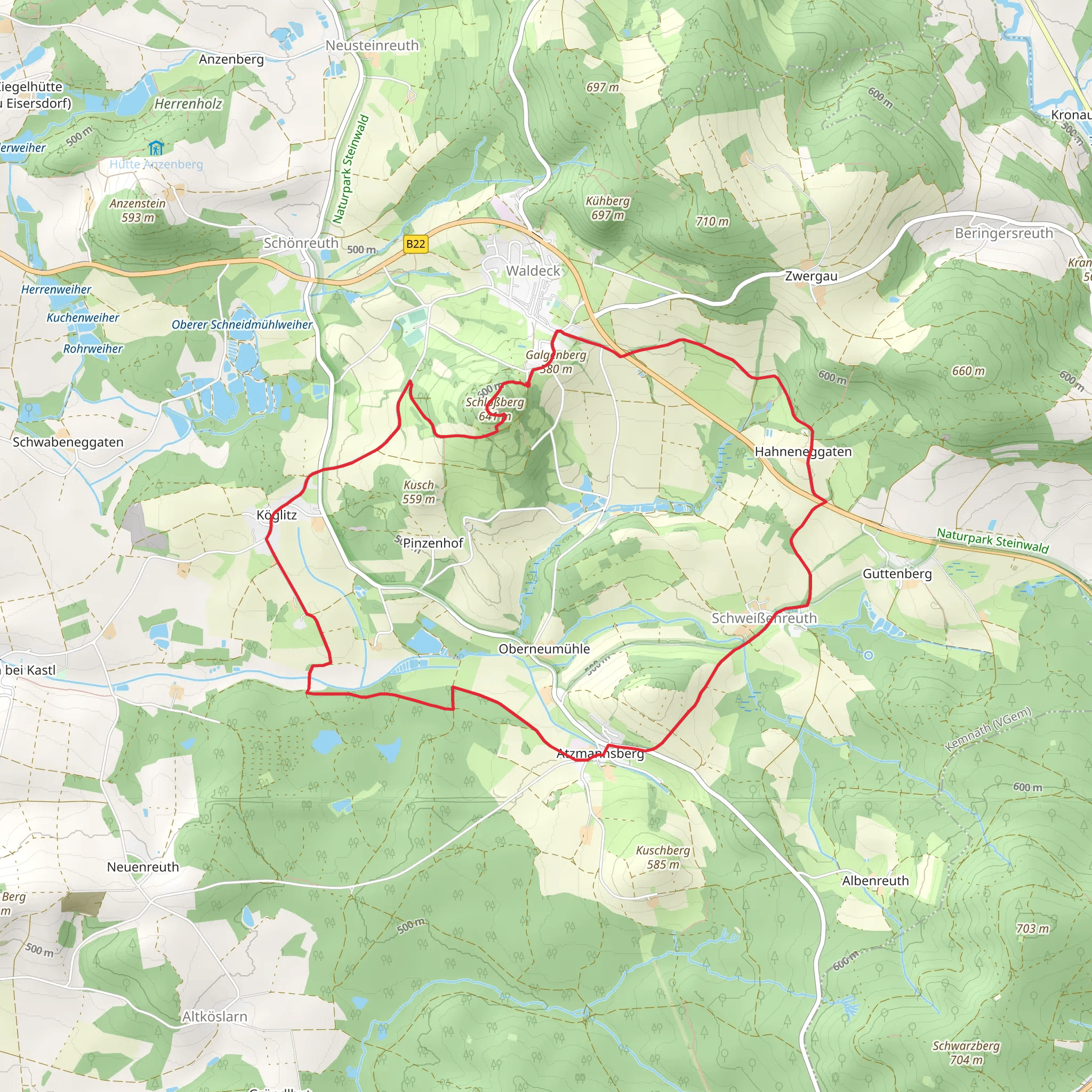
Starting near the charming town of Tirschenreuth in Germany, this 11 km (approximately 6.8 miles) loop trail offers a delightful mix of natural beauty and historical intrigue. The trailhead is conveniently accessible by car, with parking available near the town center. For those using public transport, Tirschenreuth is well-connected by regional buses, making it easy to reach from nearby cities.
Trail Overview
The trail begins with a gentle ascent, gaining around 200 meters (656 feet) in elevation over the course of the hike. The initial section follows the Marterlweg, a path known for its serene woodland scenery and historical waymarkers. These waymarkers, or "Marterl," are small religious monuments that date back centuries, offering a glimpse into the region's rich cultural heritage.
Key Landmarks and Points of Interest
As you progress along the Marterlweg, you'll encounter several notable landmarks. Approximately 3 km (1.9 miles) into the hike, you'll reach the first significant viewpoint, offering panoramic views of the surrounding Bavarian countryside. This is an excellent spot for a short break and some photography.
Continuing along the trail, you'll transition onto the Waldeck Rundweg. This section of the hike is characterized by its diverse flora and fauna. Keep an eye out for local wildlife, including deer and various bird species. The dense forest canopy provides ample shade, making it a pleasant walk even on warmer days.
Historical Significance
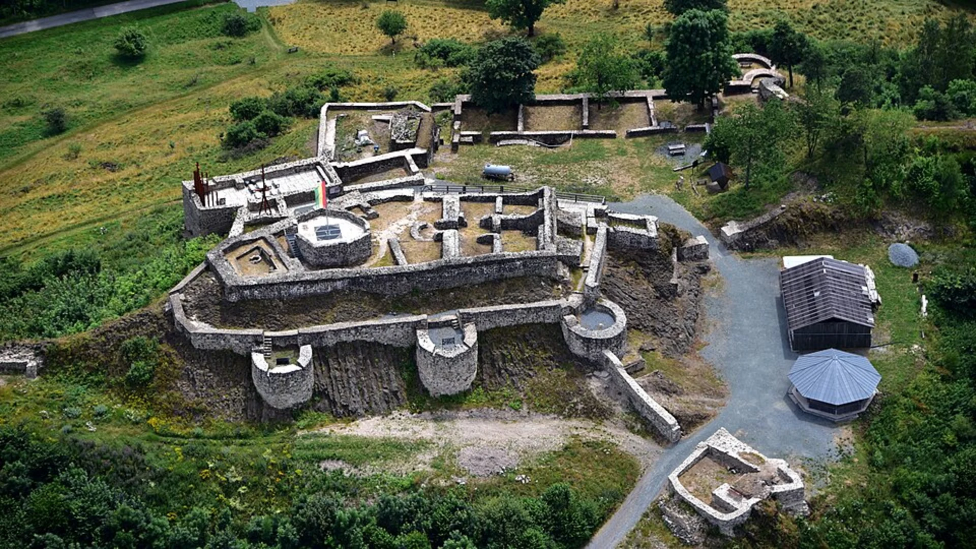
Around the 7 km (4.3 miles) mark, you'll come across the ruins of Waldeck Castle. This medieval fortress, though now in ruins, once played a crucial role in the region's defense. The castle's strategic location offers commanding views of the surrounding area, and interpretive signs provide historical context about its significance and the battles fought here.
Navigation and Safety
The trail is well-marked, but it's always a good idea to have a reliable navigation tool. HiiKER is an excellent app for this purpose, offering detailed maps and real-time tracking to ensure you stay on course. The terrain is varied but manageable, with some rocky sections that may require careful footing, especially after rain.
Final Stretch
The final portion of the hike loops back towards Tirschenreuth, descending gradually through picturesque meadows and farmland. This section is relatively easy, allowing you to relax and enjoy the scenery as you make your way back to the trailhead.
Overall, this trail offers a balanced mix of natural beauty, historical landmarks, and moderate physical challenge, making it an ideal choice for hikers looking to explore the Bavarian countryside.
What to expect?
Activity types
Comments and Reviews
User comments, reviews and discussions about the Schlossberg via Marterlweg and Waldeck Rundweg, Germany.
4.67
average rating out of 5
3 rating(s)

