Download
Preview
Add to list
More
9.5 km
~2 hrs 7 min
132 m
Loop
“Explore the Großer Finsterberg via Leitweg trail for scenic views, historical sites, and diverse wildlife.”
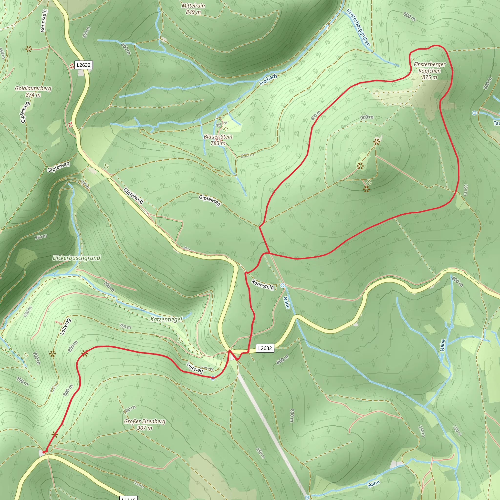
Starting near Suhl, Germany, the Großer Finsterberg via Leitweg trail is a captivating 10 km (6.2 miles) loop with an elevation gain of approximately 100 meters (328 feet). This medium-difficulty hike offers a blend of natural beauty, historical significance, and a touch of adventure.
Getting There To reach the trailhead, you can drive or use public transport. If driving, head towards Suhl and look for parking near the trailhead, which is conveniently located close to the city. For those using public transport, Suhl is well-connected by train and bus services. From the Suhl train station, you can take a local bus or taxi to the trailhead.
Trail Navigation For navigation, it's highly recommended to use HiiKER, which provides detailed maps and real-time updates to ensure you stay on track.
Trail Highlights
#### Initial Ascent The trail begins with a gentle ascent through a dense forest, offering a serene start to your hike. The initial 2 km (1.2 miles) will take you through a mix of deciduous and coniferous trees, providing ample shade and a cool environment. Keep an eye out for local wildlife such as deer and various bird species.
#### Historical Significance Around the 3 km (1.9 miles) mark, you'll come across remnants of old mining operations. This area was historically significant for its iron ore mining, which dates back to the 19th century. Informational plaques provide insights into the mining techniques and the lives of the miners who once worked here.
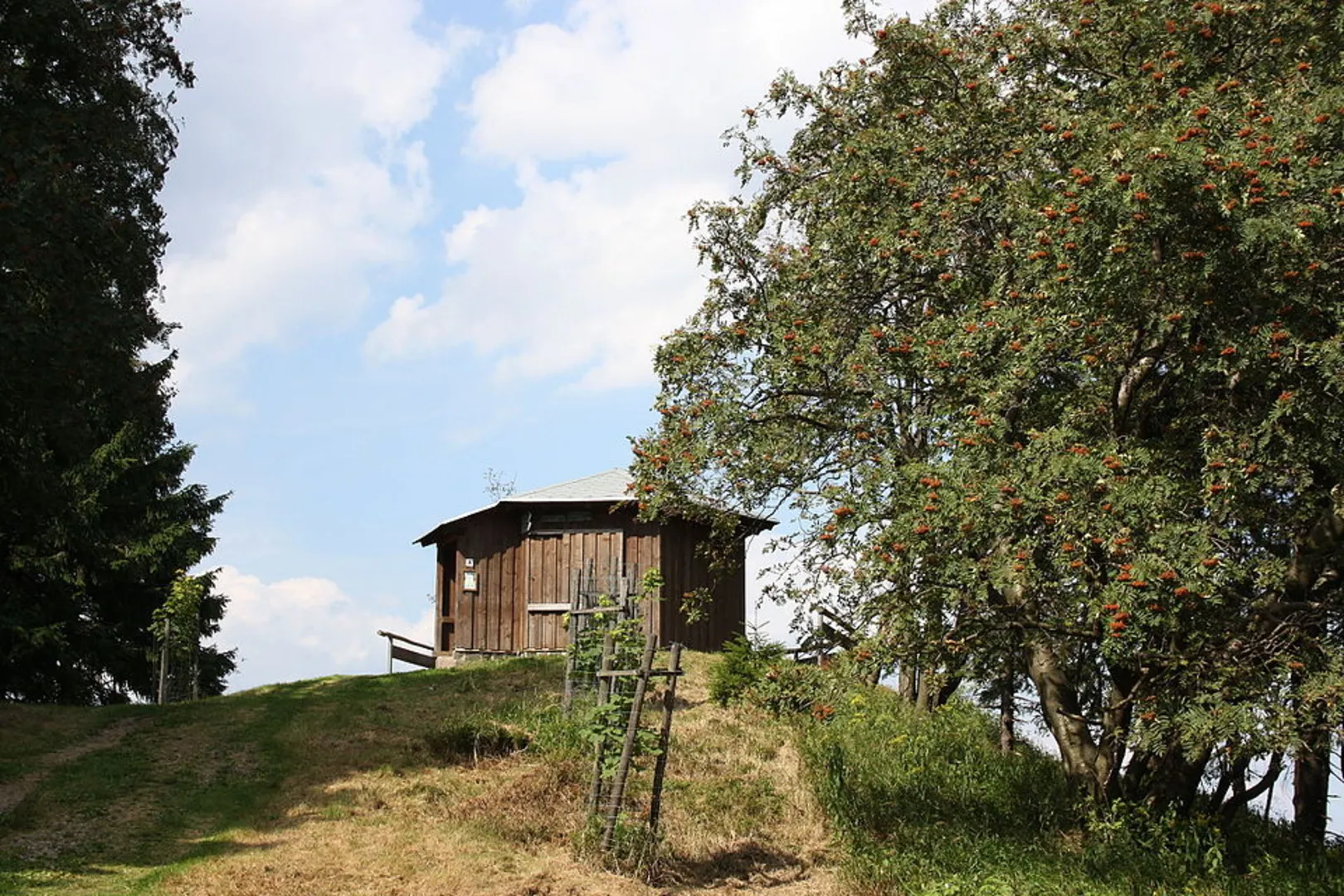
#### Großer Finsterberg Summit At approximately 5 km (3.1 miles), you'll reach the summit of Großer Finsterberg. Standing at 944 meters (3,097 feet) above sea level, this is the highest point of the trail. The summit offers panoramic views of the Thuringian Forest and the surrounding valleys. It's an ideal spot for a break and some photography.
#### Descent and Scenic Views The descent begins after the summit, leading you through open meadows and offering stunning vistas of the landscape. Around the 7 km (4.3 miles) mark, you'll pass by a picturesque stream, perfect for a quick rest and some nature photography.
#### Flora and Fauna Throughout the trail, you'll encounter a diverse range of flora and fauna. The Thuringian Forest is home to various plant species, including wildflowers and ferns. Wildlife sightings may include foxes, hares, and a variety of bird species, making it a delightful experience for nature enthusiasts.
Final Stretch The last 3 km (1.9 miles) of the trail loop back towards the starting point, taking you through a mix of forested areas and open fields. The terrain is relatively flat, making for a comfortable end to your hike. As you approach the trailhead, you'll pass by several traditional German houses, adding a cultural touch to your journey.
Preparation Tips - Wear sturdy hiking boots, as the trail can be uneven in places. - Bring sufficient water and snacks, especially if you plan to take breaks at the summit or by the stream. - Check the weather forecast and dress in layers, as the weather can change rapidly in the Thuringian Forest. - Use HiiKER for navigation to ensure you stay on the correct path and to access real-time trail information.
This trail offers a perfect blend of natural beauty, historical intrigue, and moderate physical challenge, making it a rewarding experience for hikers of all levels.
What to expect?
Activity types
Comments and Reviews
User comments, reviews and discussions about the Großer Finsterberg via Leitweg, Germany.
5.0
average rating out of 5
1 rating(s)

