Download
Preview
Add to list
More
9.7 km
~2 hrs 45 min
498 m
Loop
“Embark on the Teufelsschmiede trail for a captivating blend of nature, history, and moderate adventure.”
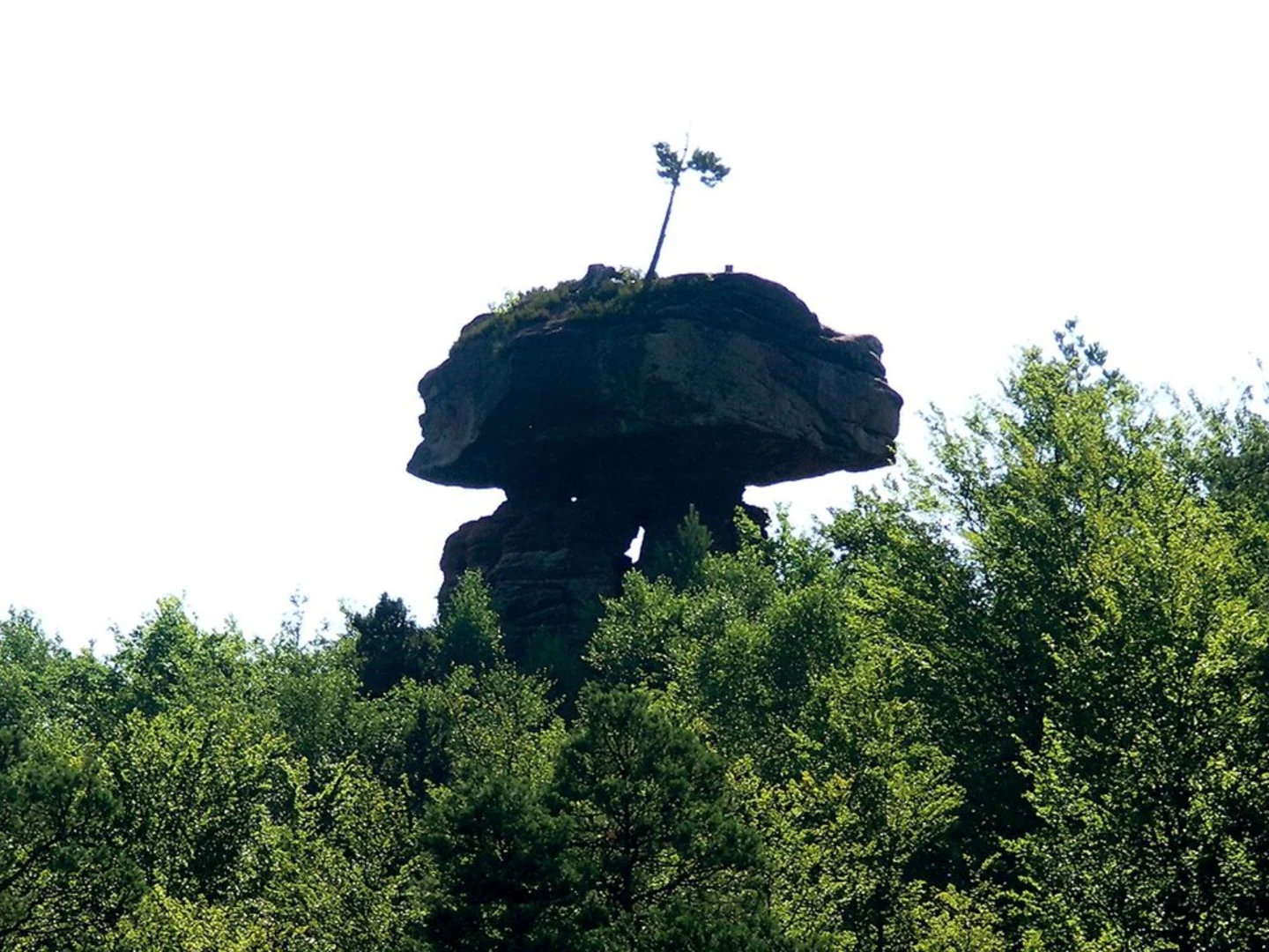
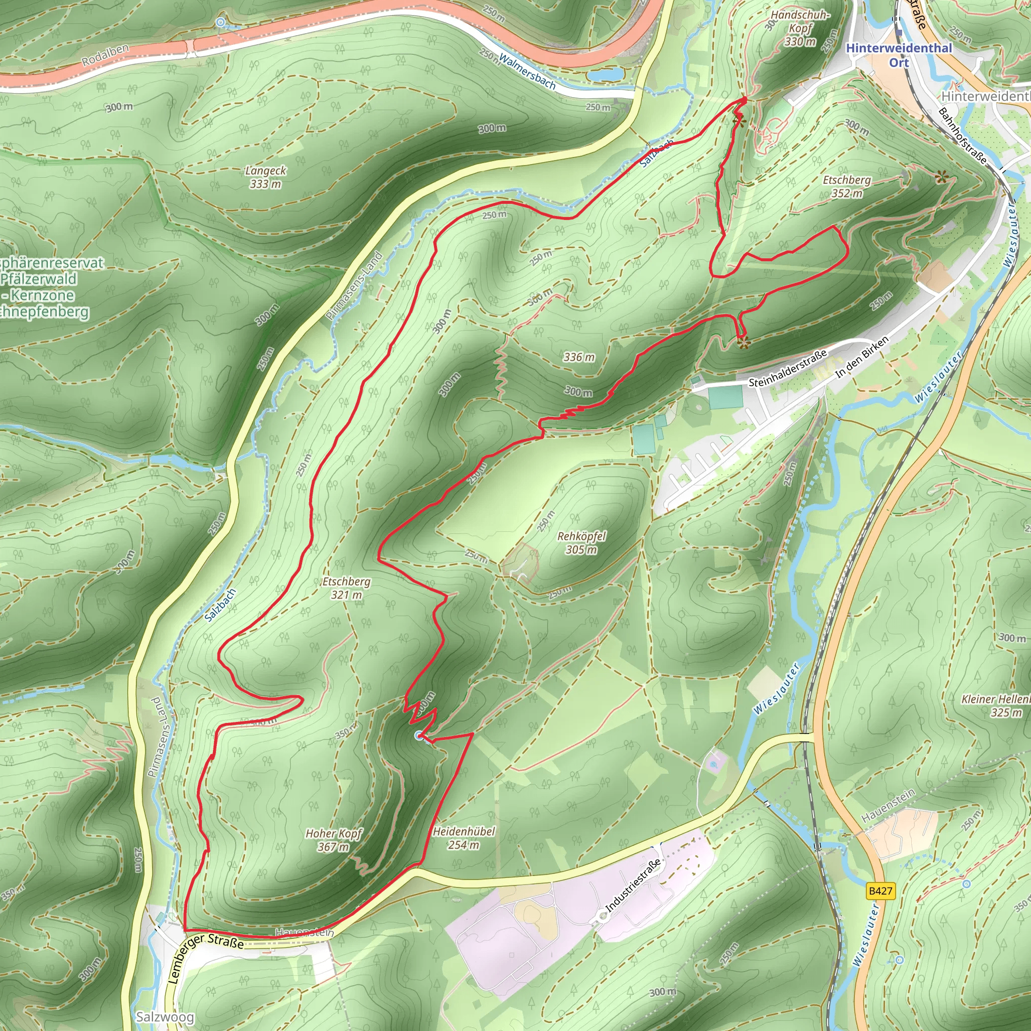
Starting your hike near the charming town of Hinterweidenthal in the Südwestpfalz region of Germany, the Teufelsschmiede via Hinterweidenthaler trail offers a captivating 10 km (6.2 miles) loop with an elevation gain of approximately 400 meters (1,312 feet). This medium-difficulty trail is perfect for those looking to immerse themselves in the natural beauty and historical richness of the area.### Getting There To reach the trailhead, you can either drive or use public transportation. If you're driving, set your GPS to Hinterweidenthal, Südwestpfalz, Germany. There is ample parking available near the trailhead. For those using public transport, take a train to Hinterweidenthal Ort station, which is well-connected to major cities like Kaiserslautern and Pirmasens. From the station, it's a short walk to the trailhead.### Trail Highlights and Landmarks As you embark on the trail, you'll first encounter dense forests that are home to a variety of wildlife, including deer, foxes, and numerous bird species. Keep an eye out for the vibrant flora, especially during spring and summer when wildflowers are in full bloom.#### Teufelsschmiede (Devil's Forge) One of the most significant landmarks on this trail is the Teufelsschmiede, or Devil's Forge. This rock formation is steeped in local legend, believed to be the site where the devil himself forged weapons. The formation is located approximately 4 km (2.5 miles) into the hike, with an elevation gain of about 200 meters (656 feet) by this point. The views from here are spectacular, offering panoramic vistas of the surrounding forest and valleys.#### Historical Significance The Südwestpfalz region is rich in history, dating back to Roman times. As you hike, you'll come across remnants of ancient settlements and possibly even old Roman roads. The area was also significant during the medieval period, and you might spot ruins of old castles and fortifications along the way.### Navigation and Safety Given the moderate difficulty of the trail, it's advisable to use a reliable navigation tool like HiiKER to keep track of your progress and ensure you stay on the correct path. The trail is well-marked, but having a digital map can be incredibly useful, especially in dense forested areas where visibility might be limited.### Flora and Fauna The trail is a haven for nature enthusiasts. The mixed deciduous and coniferous forests provide a habitat for a variety of wildlife. You might spot red deer, wild boar, and a plethora of bird species, including woodpeckers and owls. The flora is equally diverse, with oak, beech, and pine trees dominating the landscape. During the spring and summer months, the forest floor is carpeted with wildflowers, adding a splash of color to your hike.### Final Stretch As you near the end of the loop, the trail descends gradually, offering a gentle finish to your hike. The last 2 km (1.2 miles) take you through more open terrain, providing a different perspective of the landscape. You'll eventually loop back to your starting point near Hinterweidenthal, where you can relax and perhaps enjoy a meal at one of the local eateries.This trail offers a perfect blend of natural beauty, historical intrigue, and moderate physical challenge, making it a must-visit for any hiking enthusiast.
What to expect?
Activity types
Comments and Reviews
User comments, reviews and discussions about the Teufelsschmiede via Hinterweidenthaler, Germany.
4.67
average rating out of 5
6 rating(s)

