Download
Preview
Add to list
More
11.4 km
~2 hrs 53 min
374 m
Loop
“This 11 km loop trail near Südwestpfalz blends scenic beauty, historical intrigue, and moderate hiking challenges.”
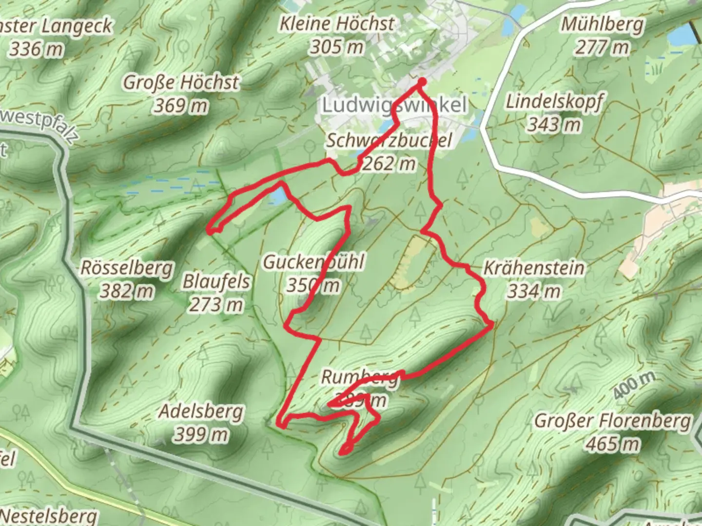
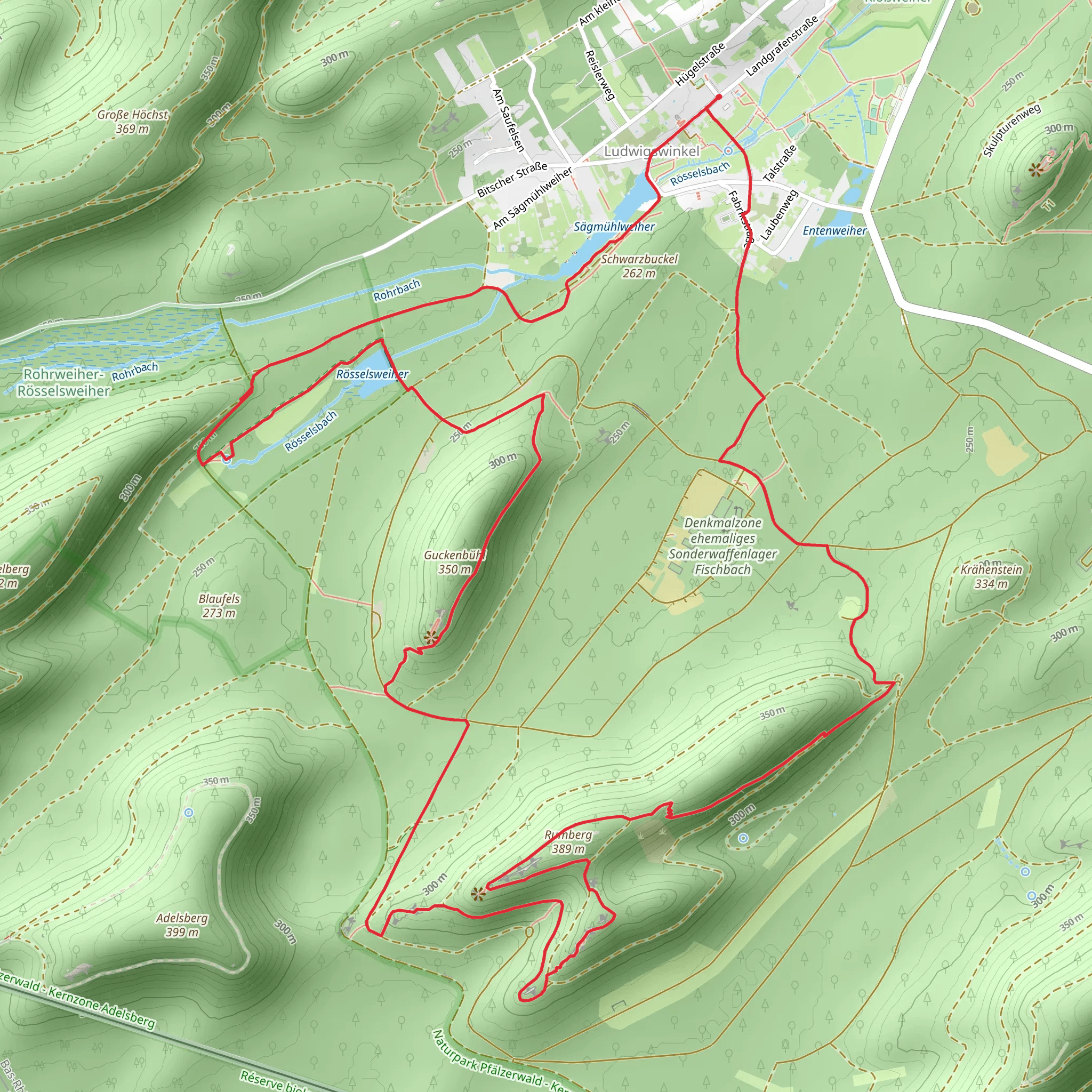
Starting near the charming town of Südwestpfalz in Germany, this 11 km (approximately 6.8 miles) loop trail offers a delightful mix of natural beauty and historical intrigue. With an elevation gain of around 300 meters (approximately 984 feet), the trail is rated as medium difficulty, making it suitable for moderately experienced hikers.
Getting There To reach the trailhead, you can either drive or use public transport. If driving, head towards Südwestpfalz and look for parking near the town center or designated trail parking areas. For those using public transport, the nearest significant landmark is the Pirmasens Hauptbahnhof (Pirmasens Main Station). From there, local buses or a short taxi ride can take you to the trailhead.
Trail Highlights
#### Roesselsbach The trail begins with a gentle ascent along the Roesselsbach stream. This section is particularly scenic, with lush greenery and the soothing sounds of flowing water accompanying you. Keep an eye out for local wildlife such as deer and various bird species that frequent the area. The first 2 km (1.2 miles) of the trail offer a gradual elevation gain of about 50 meters (164 feet), making it a pleasant warm-up.
#### Rumberg As you continue, you'll reach the Rumberg section, which is known for its dense forest and serene atmosphere. This part of the trail is slightly more challenging, with an elevation gain of around 100 meters (328 feet) over the next 3 km (1.9 miles). The forest is home to a variety of flora, including ancient oak and beech trees. During autumn, the foliage transforms into a stunning array of colors, making it a photographer's paradise.
#### Roesselsweiher The trail then leads you to the Roesselsweiher, a picturesque pond that serves as a perfect spot for a short break. The area around the pond is rich in history, with remnants of old mills and waterworks that date back to the medieval period. This section is relatively flat, allowing you to catch your breath and enjoy the tranquil surroundings. The pond is located approximately 6 km (3.7 miles) into the hike.
Historical Significance The region around Südwestpfalz has a rich history, with evidence of human settlement dating back to the Roman era. Along the trail, you may come across historical markers and information boards that provide insights into the area's past. The remnants of old mills near Roesselsweiher are particularly noteworthy, offering a glimpse into the region's industrial heritage.
Navigation and Safety For navigation, it's highly recommended to use the HiiKER app, which provides detailed maps and real-time updates. The trail is well-marked, but having a reliable navigation tool ensures you stay on track. Be prepared for varying weather conditions, as the forested sections can become slippery after rain. Proper hiking boots and a rain jacket are advisable.
Final Stretch The final 2 km (1.2 miles) of the trail take you through open meadows and farmland, offering panoramic views of the surrounding countryside. This section is relatively easy, with a gentle descent back to the trailhead. As you complete the loop, you'll find yourself back near Südwestpfalz, where you can explore the town's quaint streets and perhaps enjoy a well-deserved meal at a local restaurant.
This 11 km loop trail offers a perfect blend of natural beauty, historical significance, and moderate physical challenge, making it a rewarding experience for any hiker.
What to expect?
Activity types
Comments and Reviews
User comments, reviews and discussions about the Roesselsbach, Rumberg and Roesselsweiher Loop, Germany.
4.57
average rating out of 5
7 rating(s)
