Download
Preview
Add to list
More
6.5 km
~1 hrs 44 min
271 m
Loop
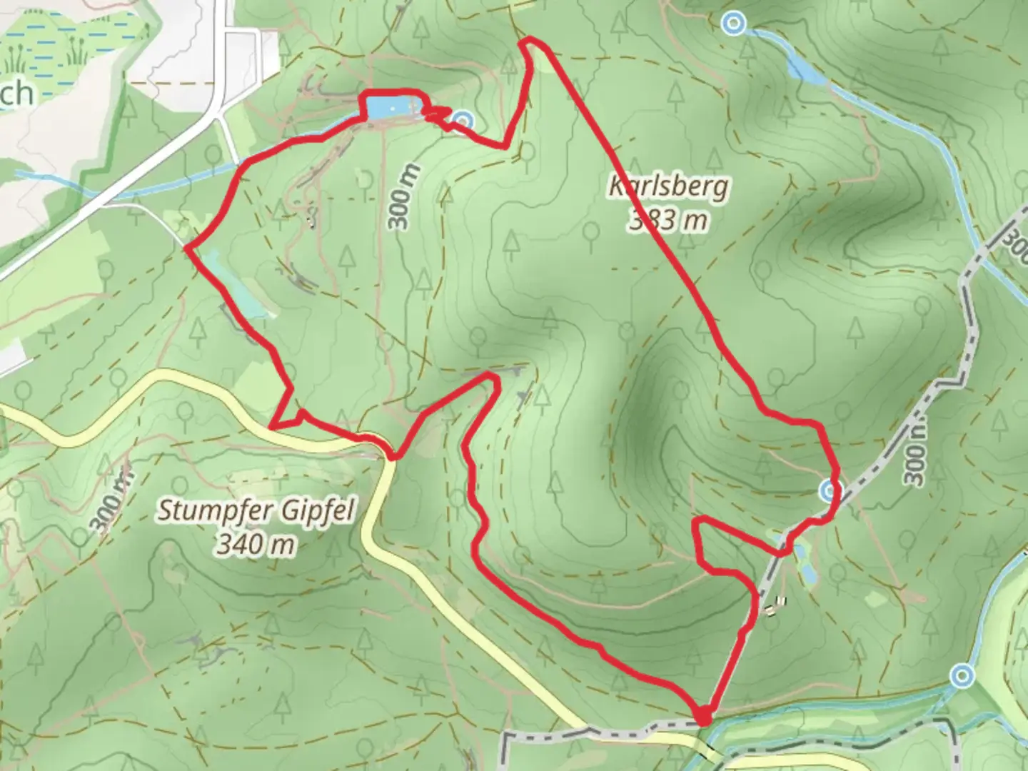
“Explore the scenic 6 km Karlsbergweiher loop, rich in natural beauty and historical intrigue.”
Starting your hike near Südwestpfalz, Germany, the Karlsbergweiher via Am Schießhaus and Hocherbergweg trail offers a delightful 6 km (approximately 3.7 miles) loop with an elevation gain of around 200 meters (656 feet). This medium-difficulty trail is perfect for those looking to immerse themselves in the natural beauty and historical richness of the region.
Getting There To reach the trailhead, you can drive or use public transport. If driving, set your GPS to the nearest known address: Am Schießhaus, 66953 Pirmasens, Germany. For public transport, take a train to Pirmasens Hauptbahnhof and then a local bus to the Am Schießhaus stop. From there, it's a short walk to the trailhead.
Trail Overview The trail begins near the serene Karlsbergweiher, a picturesque pond that sets a tranquil tone for your hike. As you start, you'll follow the path towards Am Schießhaus, a historical shooting range that dates back to the early 20th century. This area is rich in history, and you might even spot remnants of old structures that were once used for training.
Nature and Wildlife As you continue, the trail meanders through dense forests, offering a canopy of trees that provide shade and a cool atmosphere. Keep an eye out for local wildlife such as deer, foxes, and a variety of bird species. The forest floor is often carpeted with wildflowers in the spring and summer, adding a splash of color to your hike.
Significant Landmarks About 2 km (1.2 miles) into the hike, you'll reach the Hocherbergweg section. This part of the trail offers a moderate climb, gaining approximately 100 meters (328 feet) in elevation. The effort is well worth it, as you'll be rewarded with stunning views of the surrounding Südwestpfalz region. On clear days, you can see for miles, making it an excellent spot for a rest and some photography.
Historical Significance The Südwestpfalz region has a rich history dating back to Roman times. As you hike, you'll come across several informational plaques that provide insights into the area's past, including its role in various historical events and its significance in local folklore.
Navigation For navigation, it's highly recommended to use the HiiKER app, which provides detailed maps and real-time updates to ensure you stay on track. The trail is well-marked, but having a reliable navigation tool can enhance your hiking experience.
Final Stretch The final stretch of the trail loops back towards Karlsbergweiher. This section is relatively flat and offers a gentle descent, making it a relaxing end to your hike. As you approach the pond, take a moment to enjoy the peaceful surroundings and perhaps even have a picnic by the water.
This 6 km loop is a fantastic way to explore the natural beauty and historical depth of the Südwestpfalz region. Whether you're a seasoned hiker or a casual walker, this trail offers something for everyone.

What to expect?
Activity types
Comments and Reviews
User comments, reviews and discussions about the Karlsbergweiher via Am Schießhaus and Hocherbergweg, Germany.
4.33
average rating out of 5
3 rating(s)