Download
Preview
Add to list
More
14.8 km
~3 hrs 38 min
406 m
Loop
“The Püngelbach via Schrauffweg trail offers a scenic 15 km loop with natural beauty and historical landmarks.”
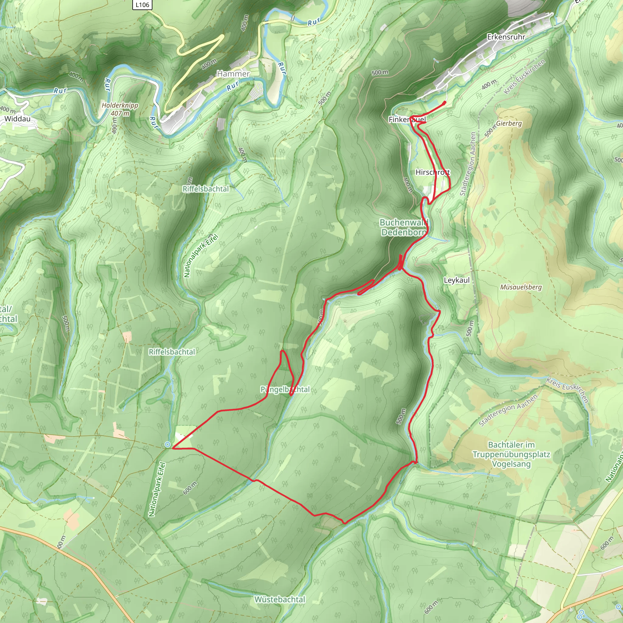
Starting near Städteregion Aachen, Germany, the Püngelbach via Schrauffweg trail is a 15 km (approximately 9.3 miles) loop with an elevation gain of around 400 meters (about 1,312 feet). This medium-difficulty hike offers a blend of natural beauty, historical landmarks, and diverse wildlife, making it a rewarding experience for outdoor enthusiasts.
Getting There To reach the trailhead, you can either drive or use public transport. If driving, set your GPS to the nearest known address in Städteregion Aachen. For those using public transport, take a train or bus to Aachen Hauptbahnhof, and from there, local buses can take you closer to the trailhead. Check local schedules for the most convenient routes.
Trail Overview The trail begins with a gentle ascent, allowing you to ease into the hike. As you progress, the path becomes more varied, featuring both forested areas and open meadows. The Schrauffweg section is particularly scenic, offering panoramic views of the surrounding countryside.
Key Landmarks and Points of Interest - **Püngelbach Stream**: Early in the hike, you'll encounter the Püngelbach stream. This serene waterway is a great spot for a short break and some nature photography. - **Schrauffweg Ridge**: At approximately 5 km (3.1 miles) into the hike, you'll reach the Schrauffweg ridge. This area provides stunning views and is a perfect place for a picnic. - **Historical Sites**: The region around Städteregion Aachen is rich in history. Look out for old stone markers and remnants of historical structures along the trail. These landmarks offer a glimpse into the area's past, including its significance during various European conflicts.
Flora and Fauna The trail is home to a variety of plant and animal species. In the forested sections, you'll find oak, beech, and pine trees. Keep an eye out for local wildlife such as deer, foxes, and a variety of bird species. The meadows are often filled with wildflowers, especially in the spring and summer months.
Navigation To ensure you stay on track, it's advisable to use the HiiKER app. This tool provides detailed maps and real-time navigation, helping you to avoid any wrong turns and ensuring a smooth hiking experience.
Elevation Profile The trail's elevation gain is gradual, with the most significant climbs occurring in the first half of the hike. The highest point is reached around the 7 km (4.3 miles) mark, after which the trail descends back towards the starting point. The total elevation gain is around 400 meters (1,312 feet), making it manageable for most hikers with a moderate level of fitness.
Practical Tips - **Footwear**: Wear sturdy hiking boots, as the trail can be uneven in places. - **Weather**: Check the weather forecast before you go. The trail can be slippery after rain, so be prepared for muddy conditions. - **Supplies**: Bring enough water and snacks, as there are no facilities along the trail. - **Wildlife**: While encounters with wildlife are generally safe, it's always best to keep a respectful distance.
By following these guidelines and being well-prepared, you'll be able to fully enjoy the Püngelbach via Schrauffweg trail and all it has to offer.
What to expect?
Activity types
Comments and Reviews
User comments, reviews and discussions about the Püngelbach via Schrauffweg, Germany.
4.67
average rating out of 5
3 rating(s)

