Download
Preview
Add to list
More
61.7 km
~3 days
319 m
Multi-Day
“Embark on a scenic hike around Lake Schwerin, mingling with history, nature, and fairy-tale castles.”
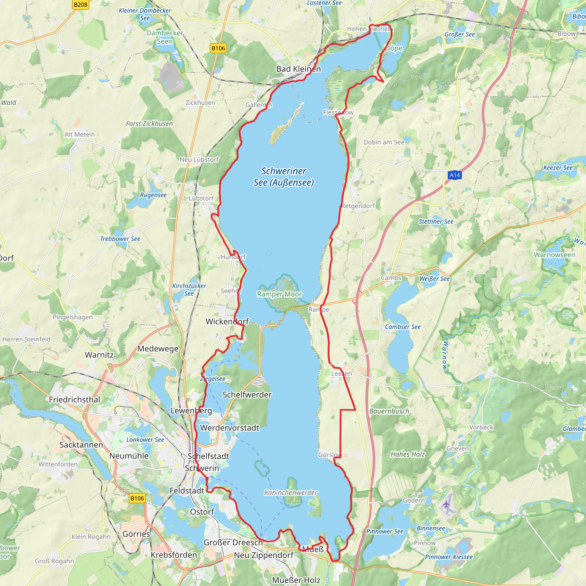
Embarking on the Schweriner See Rundtour, hikers will traverse approximately 62 kilometers (about 38.5 miles) around the picturesque Lake Schwerin (Schweriner See), the fourth largest lake in Germany. With an elevation gain of around 300 meters (roughly 984 feet), the trail offers a moderately challenging experience that loops back to its starting point near the historic city of Schwerin.
Getting to the Trailhead
The trailhead is conveniently located near Schwerin, which is easily accessible by public transport or car. For those opting for public transport, Schwerin's main train station, Hauptbahnhof, serves as a central hub with connections from various German cities. From there, local buses can take you closer to the lake, where you can start your hike. If driving, parking is available near the trailhead, which can be found close to the Schwerin Castle, a significant landmark and a must-see attraction in itself.
Navigating the Trail
As you set out on your journey, the HiiKER app will be an invaluable tool for navigation, providing detailed maps and waypoints to ensure you stay on the correct path. The trail is well-marked, but having a digital companion can help with planning breaks, locating amenities, and identifying points of interest along the way.
Landmarks and Nature
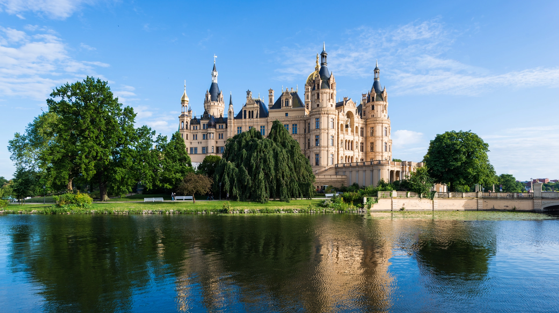
The Schweriner See Rundtour is not only a feast for the eyes but also a journey through history. The trail skirts the edge of Lake Schwerin, offering hikers panoramic views of the water and the lush, green landscapes that surround it. The Schwerin Castle, with its fairy-tale architecture, is a highlight and is visible from various points along the trail. This castle, along with the gardens, is a testament to the region's historical significance, once home to the dukes and grand dukes of Mecklenburg.
As you progress, the trail will lead you through quaint villages and past ancient churches, each with its own story. The town of Bad Kleinen, located roughly 14 kilometers (about 8.7 miles) from the starting point, is a perfect spot to rest and enjoy local hospitality.
Wildlife and Flora
Nature enthusiasts will appreciate the diverse wildlife and flora. The lake's shores are a habitat for various bird species, making it an excellent location for birdwatching. Keep an eye out for ospreys and white-tailed eagles, which are known to nest in the area. The surrounding forests and fields are home to deer, hares, and numerous small mammals, while the lake itself is teeming with fish.
Trail Conditions and Tips
The trail is mostly flat with gentle inclines, making it suitable for hikers of varying skill levels. However, the distance does require a good level of fitness. It's recommended to tackle this trail over several days, allowing time to explore and enjoy the scenery without rushing. There are designated camping spots and guesthouses along the route for overnight stays.
Weather conditions can change, so be prepared with appropriate clothing and gear. The trail can be hiked year-round, but spring through autumn offers the most pleasant temperatures and scenery.
Preparation and Safety
Before setting out, ensure you have adequate water and food supplies, as well as a first-aid kit. It's also wise to inform someone of your hiking plan and expected return time. Always check the weather forecast and trail conditions beforehand, and be prepared for the possibility of sections being muddy or flooded after heavy rain.
Remember, the Schweriner See Rundtour is not just a hike; it's an opportunity to immerse yourself in the natural beauty and historical tapestry of northern Germany. Whether you're a seasoned hiker or someone looking to explore at a leisurely pace, this trail offers a rewarding experience for all.
Comments and Reviews
User comments, reviews and discussions about the Schweriner See Rundtour, Germany.
4.8
average rating out of 5
5 rating(s)

