Download
Preview
Add to list
More
10.1 km
~2 hrs 44 min
432 m
Loop
“This 10 km loop trail in Sächsische Schweiz-Osterzgebirge offers stunning viewpoints, historical landmarks, and diverse wildlife.”
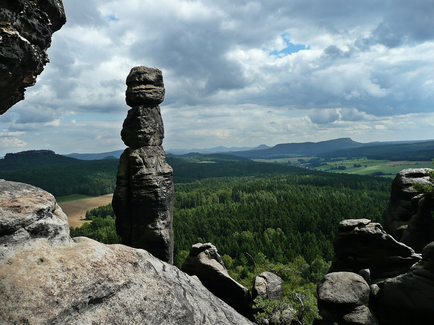
Starting near the picturesque region of Sächsische Schweiz-Osterzgebirge in Germany, this 10 km (6.2 miles) loop trail offers a moderate challenge with an elevation gain of approximately 400 meters (1,312 feet). The trailhead is conveniently accessible by both public transport and car. If you're using public transport, you can take a train to the nearby town of Bad Schandau and then a bus to the starting point. For those driving, parking is available near the trailhead.### Initial Ascent and Schoene AussichtThe trail begins with a gradual ascent, leading you through dense forests typical of the Saxon Switzerland National Park. After about 2 km (1.2 miles), you'll reach the first significant viewpoint, Schoene Aussicht, which translates to "Beautiful View." Here, you can take a moment to enjoy panoramic views of the Elbe Sandstone Mountains. The elevation gain to this point is around 150 meters (492 feet), making it a good spot for a short break.### Bundesfels and Historical SignificanceContinuing on, the trail takes you towards Bundesfels, another notable rock formation. This section of the trail is rich in history, as the area was once a strategic lookout point during various historical conflicts. The sandstone formations have been shaped over millions of years, offering a glimpse into the geological history of the region. At around the 5 km (3.1 miles) mark, you'll have ascended another 100 meters (328 feet), bringing the total elevation gain to approximately 250 meters (820 feet).### Pfaffenstein and WildlifeAs you approach the 7 km (4.3 miles) mark, you'll encounter Pfaffenstein, a prominent table hill that offers another excellent viewpoint. This area is also a haven for wildlife, including deer, foxes, and a variety of bird species. The final ascent to Pfaffenstein adds another 100 meters (328 feet) of elevation gain, making it the highest point on the trail at around 350 meters (1,148 feet) above the starting elevation.### Oberer Rundweg and DescentThe trail then loops back via the Oberer Rundweg, a higher path that offers a different perspective of the landscape. This section is relatively flat, allowing you to enjoy the scenery without much additional effort. As you descend back towards the trailhead, you'll complete the remaining 50 meters (164 feet) of elevation loss, bringing the total elevation gain and loss to around 400 meters (1,312 feet).### Navigation and SafetyFor navigation, it's highly recommended to use the HiiKER app, which provides detailed maps and real-time updates. The trail is well-marked, but having a reliable navigation tool can enhance your hiking experience and ensure you stay on the right path.### Getting ThereTo reach the trailhead, you can take a train to Bad Schandau and then a bus to the starting point. If you're driving, parking is available near the trailhead, making it convenient for those coming by car.This trail offers a blend of natural beauty, historical significance, and moderate physical challenge, making it a rewarding experience for hikers of all levels.

What to expect?
Activity types
Comments and Reviews
User comments, reviews and discussions about the Schoene Aussicht, Bundesfels and Pfaffenstein via Oberer Rundweg, Germany.
4.75
average rating out of 5
4 rating(s)