Download
Preview
Add to list
More
11.7 km
~2 hrs 34 min
139 m
Point-to-Point
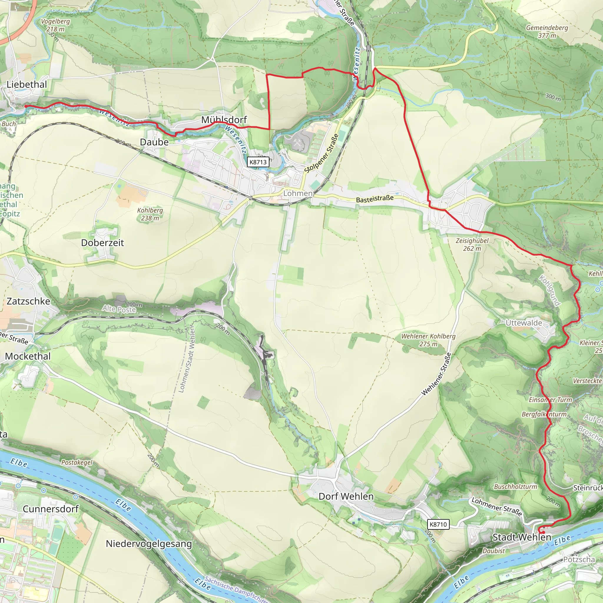
“Embark on a scenic 12 km hike through lush landscapes, historic sites, and breathtaking views in Saxon Switzerland.”
Starting near the picturesque region of Sächsische Schweiz-Osterzgebirge in Germany, this 12 km (approximately 7.5 miles) point-to-point trail offers a delightful mix of natural beauty and historical intrigue. The trailhead is conveniently accessible by both public transport and car. If you're taking public transport, you can catch a train to Pirna and then a bus to Liebethal. For those driving, there are parking facilities available near the trailhead.
Trail Overview
The trail begins in Liebethal, a charming village known for its serene landscapes and historical significance. As you set off, you'll be greeted by gentle rolling hills and lush greenery. The initial part of the trail is relatively flat, making it a pleasant warm-up for the journey ahead.
Key Landmarks and Points of Interest
Liebethaler Grund: About 2 km (1.2 miles) into the hike, you'll enter the Liebethaler Grund, a scenic gorge that is part of the Saxon Switzerland National Park. This area is renowned for its dramatic rock formations and the tranquil Wesenitz River that flows through it. Keep an eye out for the Richard Wagner Monument, a tribute to the famous composer who found inspiration in these very surroundings.
Daubemühle: Approximately 4 km (2.5 miles) from the start, you'll come across the historic Daubemühle, an old mill that dates back to the 16th century. This spot offers a great opportunity to take a break and enjoy a snack while soaking in the historical ambiance.
Flora and Fauna
As you continue, the trail meanders through dense forests and open meadows, offering a diverse range of flora and fauna. Look out for native wildlife such as deer, foxes, and a variety of bird species. The forested sections are particularly beautiful in the autumn when the leaves turn vibrant shades of red and gold.
Elevation and Terrain
The trail features an elevation gain of around 100 meters (approximately 328 feet), which is spread out over the course of the hike. The terrain is varied, with some sections being rocky and uneven, so sturdy hiking boots are recommended. The most significant ascent occurs around the 8 km (5 miles) mark, where you'll climb a series of switchbacks leading to a stunning viewpoint overlooking the Elbe River.
Historical Significance
The region is steeped in history, with many of the trails and landmarks dating back centuries. The Saxon Switzerland area was a popular destination for Romantic artists and writers in the 19th century, and their influence can still be felt today. The trail itself follows ancient paths that have been used by locals for generations.
Navigation
To ensure you stay on track, it's advisable to use the HiiKER app, which provides detailed maps and real-time navigation. The trail is well-marked, but having a reliable navigation tool can enhance your hiking experience and provide peace of mind.
Final Stretch
As you approach Stadt Wehlen, the trail descends gently towards the town, offering panoramic views of the Elbe River and the surrounding countryside. Stadt Wehlen is a quaint town with cobblestone streets and historic buildings, making it a perfect endpoint for your hike. Here, you can explore local cafes, visit the town's church, or simply relax by the river.
This trail offers a perfect blend of natural beauty, historical landmarks, and moderate physical challenge, making it an ideal choice for hikers looking to explore the stunning landscapes of Saxon Switzerland.
What to expect?
Activity types
Comments and Reviews
User comments, reviews and discussions about the Liebethal to Stadt Wehlen Walk, Germany.
4.6
average rating out of 5
5 rating(s)

