Download
Preview
Add to list
More
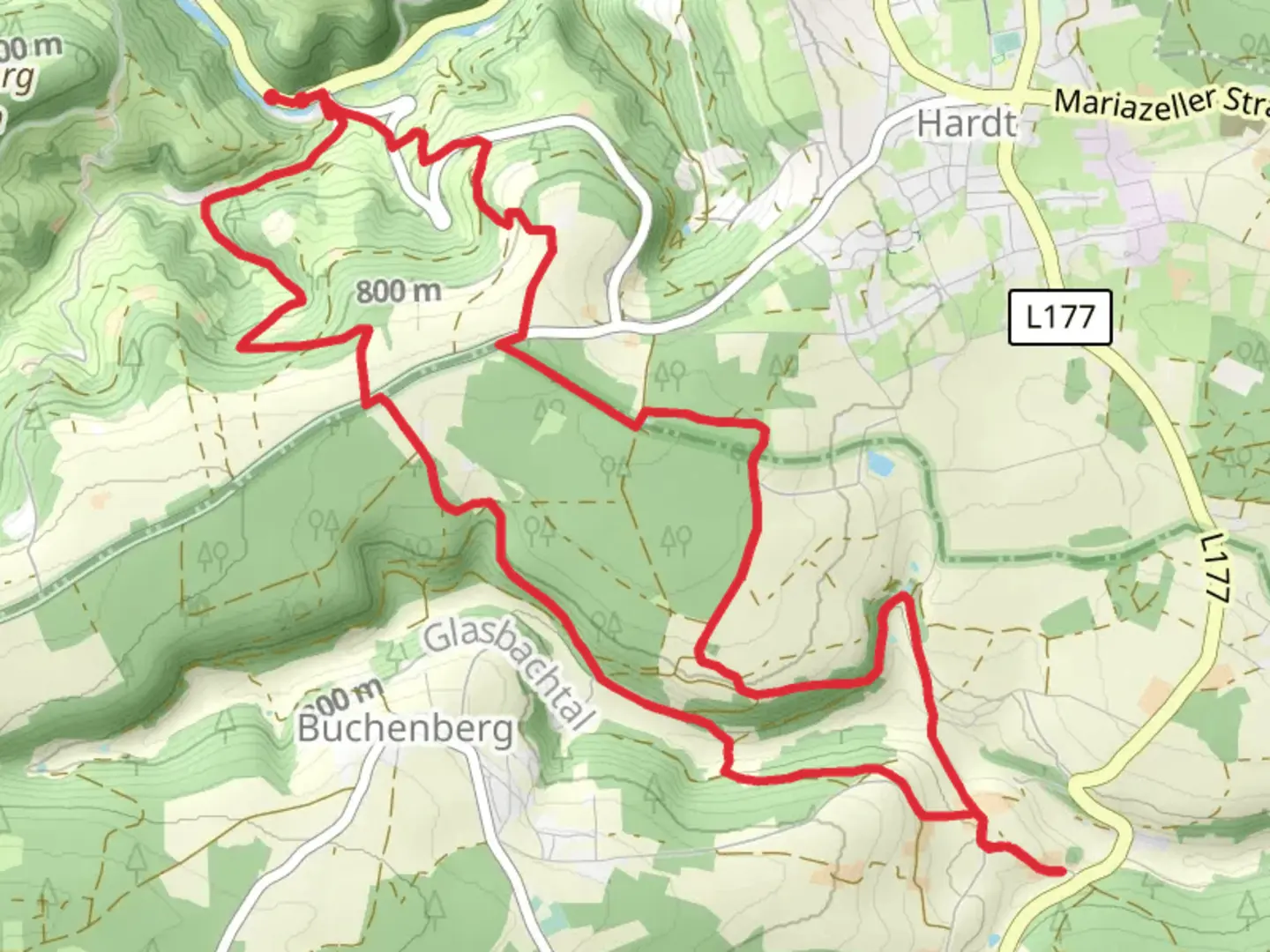
14.2 km
~3 hrs 40 min
501 m
Point-to-Point
“Embark on a scenic 14 km Black Forest hike near Rottweil, blending natural beauty and historical intrigue.”
Starting near the picturesque town of Rottweil, Germany, the Mulpenbuehl and Ostweg Loop offers a delightful 14 km (approximately 8.7 miles) journey through the Black Forest region. With an elevation gain of around 500 meters (about 1,640 feet), this trail is rated as medium difficulty, making it suitable for moderately experienced hikers.### Getting There To reach the trailhead, you can either drive or use public transport. If driving, set your GPS to Rottweil, a historic town known for its medieval architecture and the Rottweil Tower. For those using public transport, Rottweil is well-connected by train, with regular services from major cities like Stuttgart and Freiburg. From the Rottweil train station, local buses or a short taxi ride can take you to the trailhead.### Trail Highlights and Navigation The trail begins near Rottweil and quickly immerses you in the serene beauty of the Black Forest. As you start, you'll notice the dense canopy of trees providing ample shade, making it a pleasant hike even during warmer months. The trail is well-marked, but it's always a good idea to have a reliable navigation tool like HiiKER to ensure you stay on track.### Mulpenbuehl Section The first section of the trail, known as Mulpenbuehl, takes you through lush forested areas and open meadows. Around the 3 km (1.9 miles) mark, you'll encounter a gentle ascent, gaining approximately 150 meters (492 feet) in elevation. This part of the trail offers stunning views of the surrounding landscape, with occasional glimpses of Rottweil in the distance.### Ostweg Section As you transition into the Ostweg section, the trail becomes more varied, with a mix of forest paths and rocky terrain. At around 7 km (4.3 miles), you'll reach the highest point of the trail, offering panoramic views of the Black Forest. This is a great spot to take a break and enjoy the scenery. The descent from this point is gradual, making it easier on the knees.### Historical Significance Rottweil is one of the oldest towns in Baden-Württemberg, with a history dating back to Roman times. The region is dotted with historical landmarks, including the Rottweil Tower, which was once part of the town's fortifications. As you hike, you'll pass by several ancient ruins and historical markers that tell the story of the area's rich past.### Flora and Fauna The Black Forest is renowned for its biodiversity. Along the trail, you'll encounter a variety of plant species, from towering pines to delicate wildflowers. Wildlife is abundant, with chances to spot deer, foxes, and a variety of bird species. Keep an eye out for the rare Black Forest capercaillie, a large woodland grouse native to the region.### Practical Tips - Footwear: Given the mixed terrain, sturdy hiking boots are recommended. - Weather: The weather can be unpredictable, so pack layers and a waterproof jacket. - Water and Snacks: There are no facilities along the trail, so bring enough water and snacks to last the entire hike. - Navigation: Use HiiKER for real-time trail updates and navigation assistance.This trail offers a perfect blend of natural beauty, historical intrigue, and moderate physical challenge, making it a rewarding experience for any hiker.

What to expect?
Activity types
Comments and Reviews
User comments, reviews and discussions about the Mulpenbuehl and Ostweg Loop, Germany.
4.8
average rating out of 5
5 rating(s)