Download
Preview
Add to list
More
13.7 km
~3 hrs 47 min
629 m
Point-to-Point
“Embark on a scenic 14 km hike through lush forests, basalt formations, and panoramic views in Rhön-Grabfeld.”
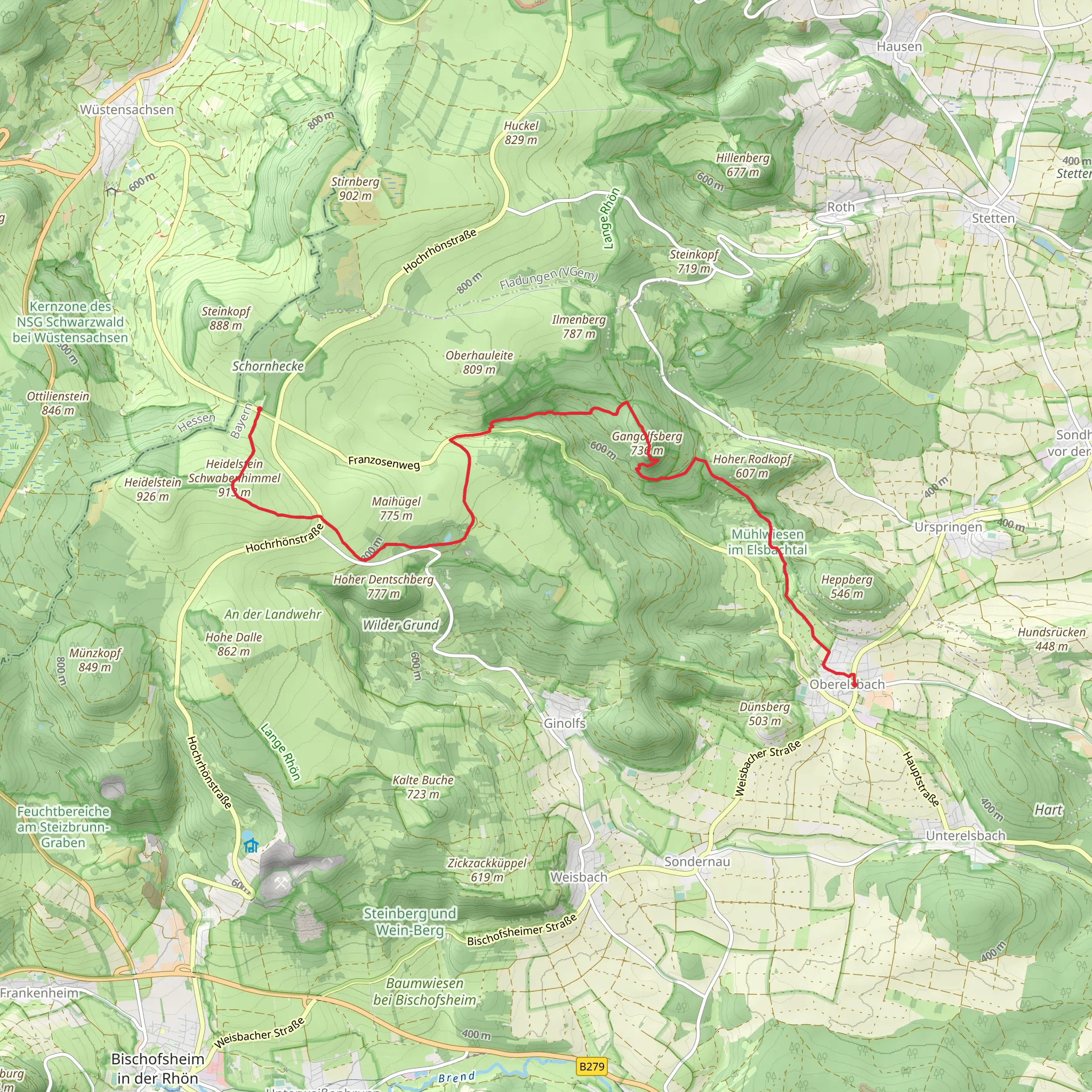
Starting near Rhön-Grabfeld, Germany, this 14 km (approximately 8.7 miles) point-to-point trail offers a medium difficulty hike with an elevation gain of around 600 meters (approximately 1,970 feet). The trailhead is easily accessible by car or public transport. If driving, you can park near the village of Oberelsbach. For those using public transport, the nearest significant landmark is the Oberelsbach bus stop, which is well-connected to the surrounding areas.
Trail Overview
The hike begins with a gentle ascent through lush forests, providing a serene start to your journey. As you progress, the trail becomes steeper, leading you to the Gangolfsberg, a basalt mountain that stands as a testament to the region's volcanic past. The basalt columns here are a geological marvel, and the panoramic views from the top are breathtaking.
Gangolfsberg and Basaltsee
At approximately 4 km (2.5 miles) into the hike, you'll reach the Gangolfsberg summit. The basalt columns are a highlight, offering a unique landscape that is both rugged and beautiful. Just a short distance from the summit, you'll find the Basaltsee, a small lake formed in a former basalt quarry. This is a perfect spot for a short break, allowing you to take in the tranquil surroundings.
Heidelstein and Schwabenhimmel
Continuing on, the trail leads you towards the Heidelstein, another significant peak in the Rhön Mountains. At around the 9 km (5.6 miles) mark, you'll begin the ascent to the Heidelstein summit. The climb is challenging but rewarding, with expansive views of the Rhön Biosphere Reserve. The area is rich in flora and fauna, so keep an eye out for rare plant species and local wildlife.
As you descend from Heidelstein, you'll approach the Schwabenhimmel, a picturesque meadow that offers a stark contrast to the rocky terrain of the peaks. This area is particularly beautiful in the spring and summer months when wildflowers are in full bloom.
Historical Significance
The Rhön region has a rich history, with evidence of human settlement dating back to the Bronze Age. The basalt formations are remnants of volcanic activity that occurred millions of years ago, shaping the landscape into what it is today. The area was also a significant border region during the Cold War, with parts of the trail offering glimpses into this historical period.
Navigation and Safety
Given the varied terrain and elevation changes, it's advisable to use a reliable navigation tool like HiiKER to stay on track. The trail is well-marked, but having a digital map can be invaluable, especially in dense forested areas where visibility might be limited.
Getting There
To reach the trailhead, you can drive to Oberelsbach, where parking is available. If using public transport, take a bus to the Oberelsbach bus stop, which is the nearest significant landmark. From there, it's a short walk to the starting point of the trail.
Prepare adequately with water, snacks, and appropriate hiking gear, as the trail can be demanding in certain sections. Enjoy the diverse landscapes, historical landmarks, and the natural beauty that this trail has to offer.
What to expect?
Activity types
Comments and Reviews
User comments, reviews and discussions about the Gangolfsberg, Basaltsee and Heidelstein Schwabenhimmel from Oberelsbach, Germany.
5.0
average rating out of 5
1 rating(s)

