Download
Preview
Add to list
More
14.1 km
~3 hrs 46 min
574 m
Loop
“Experience a 14 km loop of natural beauty, historical ruins, and panoramic Rhine River views.”
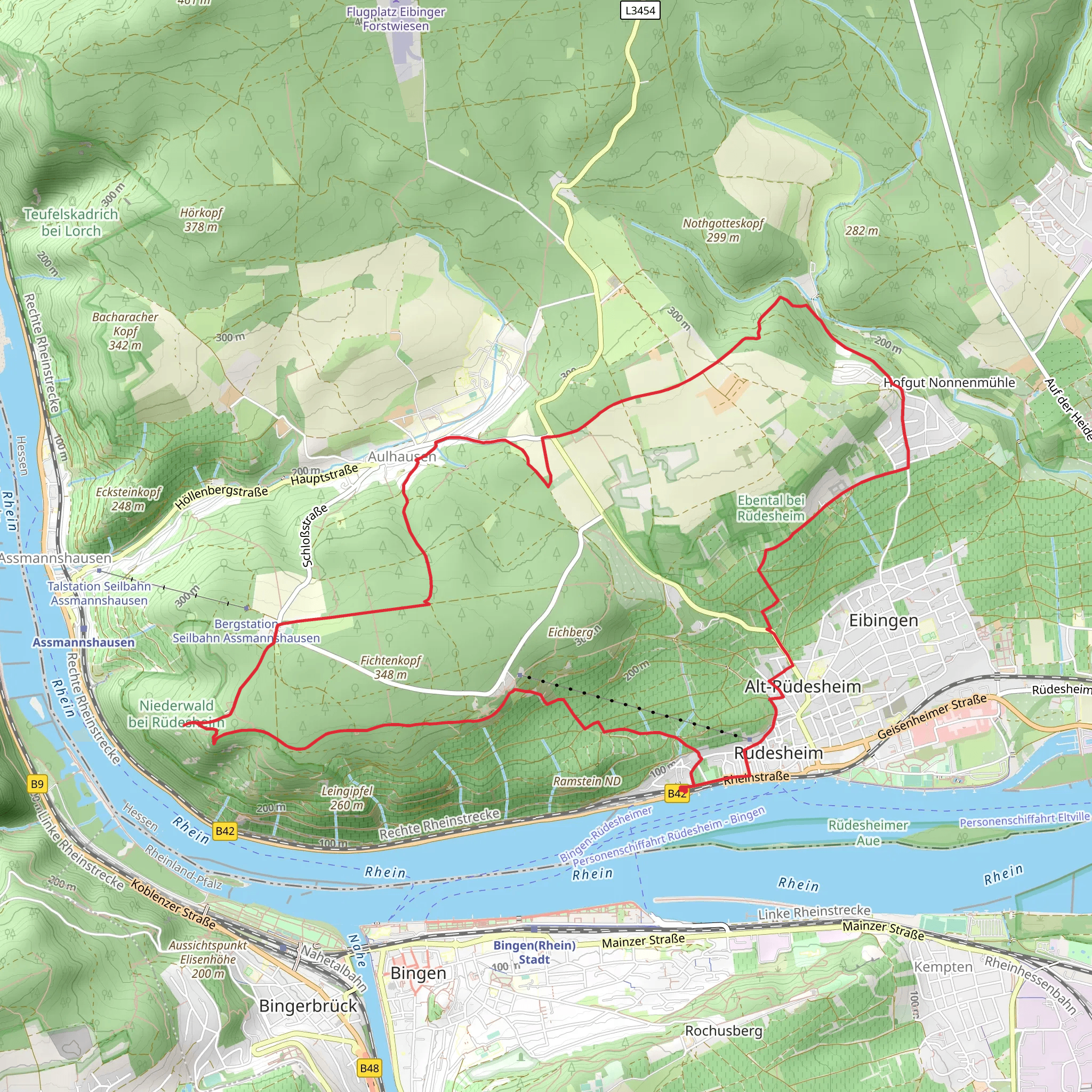
Starting near Rheingau-Taunus-Kreis, Germany, the Rheinsteig Zuweg Aulhausen and Hassenweg trail offers a captivating 14 km (approximately 8.7 miles) loop with an elevation gain of around 500 meters (1,640 feet). This medium-difficulty trail is perfect for those looking to immerse themselves in the natural beauty and historical richness of the region.
Getting There To reach the trailhead, you can either drive or use public transport. If driving, set your GPS to Rheingau-Taunus-Kreis, and look for parking near the village of Aulhausen. For public transport, take a train to Rüdesheim am Rhein, which is the nearest major town. From Rüdesheim, you can catch a local bus or taxi to Aulhausen, which is just a short ride away.
Trail Overview The trail begins near Aulhausen and quickly immerses you in the lush landscapes of the Rheingau region. As you start your hike, you'll ascend gradually through dense forests, offering a serene and shaded environment. The initial 3 km (1.9 miles) will take you through a mix of deciduous and coniferous trees, providing a rich tapestry of flora.
Historical Significance Around the 4 km (2.5 miles) mark, you'll come across the ruins of Ehrenfels Castle. This medieval castle, dating back to the 13th century, offers a glimpse into the region's storied past. The castle was once a strategic fortification along the Rhine River, and its ruins are a testament to the area's historical significance.
Scenic Vistas Continuing on, the trail opens up to offer breathtaking views of the Rhine River. At approximately 6 km (3.7 miles), you'll reach a vantage point that provides panoramic views of the river valley below. This is an excellent spot for a break and some photography.
Wildlife and Nature As you proceed, keep an eye out for local wildlife. The Rheingau region is home to a variety of bird species, including hawks and woodpeckers. You might also spot deer and wild boar in the more secluded parts of the forest. The trail is particularly beautiful in the spring and autumn, when the foliage is either in full bloom or displaying vibrant fall colors.
Navigation For navigation, it's highly recommended to use the HiiKER app, which provides detailed maps and real-time updates. The trail is well-marked, but having a reliable navigation tool will ensure you stay on track, especially in the more remote sections.
Final Stretch The last 4 km (2.5 miles) of the trail will take you through the Hassenweg area, characterized by rolling hills and vineyards. This part of the hike is relatively easier, with gentle descents leading you back towards Aulhausen. The vineyards here are part of the famous Rheingau wine region, known for its exceptional Riesling wines.
Practical Tips - Wear sturdy hiking boots, as some sections can be rocky and uneven. - Carry enough water and snacks, especially during the warmer months. - Check the weather forecast before heading out, as conditions can change rapidly. - If you're hiking in the autumn, be mindful of hunting seasons and stick to the marked trails.
This trail offers a perfect blend of natural beauty, historical landmarks, and scenic vistas, making it a must-visit for any hiking enthusiast.
What to expect?
Activity types
Comments and Reviews
User comments, reviews and discussions about the Rheinsteig Zuweg Aulhausen and Hassenweg, Germany.
4.6
average rating out of 5
5 rating(s)

