Fichtenkopf, Binger Loch Blick and Rastplatz Ehrenfelsblick via Hessenweg
Download
Preview
Add to list
More
13.4 km
~3 hrs 53 min
726 m
Loop
“Explore natural beauty and historical intrigue on the captivating 13 km Hessenweg trail near Rheingau-Taunus-Kreis.”
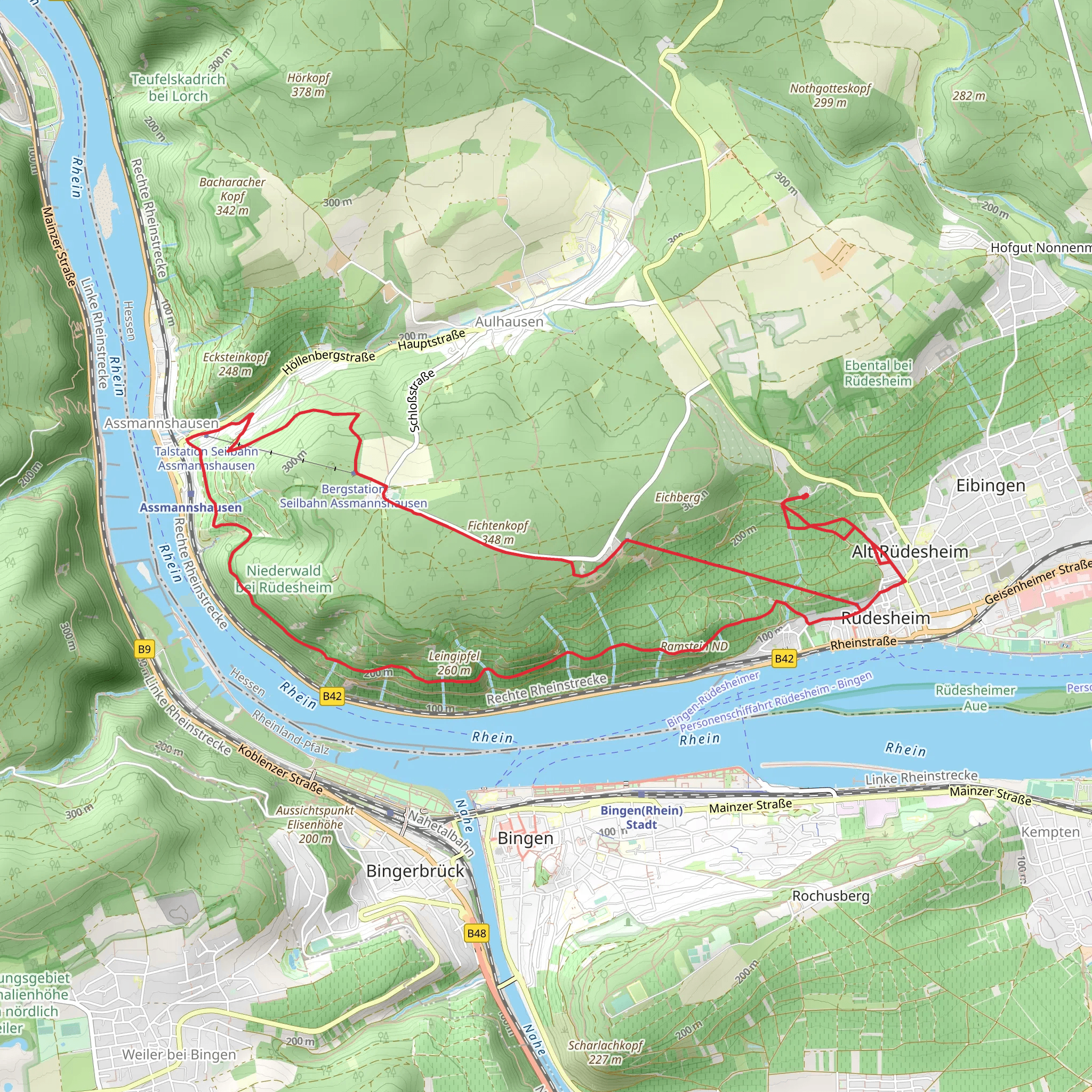
Starting your adventure near Rheingau-Taunus-Kreis, Germany, the Fichtenkopf, Binger Loch Blick and Rastplatz Ehrenfelsblick via Hessenweg trail offers a captivating 13 km (8 miles) loop with an elevation gain of approximately 700 meters (2,300 feet). This medium-difficulty trail is perfect for those looking to immerse themselves in the natural beauty and historical richness of the region.
Getting There To reach the trailhead, you can drive or use public transport. If driving, set your GPS to Rheingau-Taunus-Kreis, Germany, and look for parking near the Hessenweg trailhead. For public transport, take a train to the nearest major station, such as Wiesbaden Hauptbahnhof, and then a local bus to the Rheingau-Taunus-Kreis area. From there, it's a short walk to the trailhead.
Trail Highlights #### Fichtenkopf The trail begins with a gradual ascent towards Fichtenkopf, a forested area known for its dense pine trees. As you hike through this section, you'll gain about 200 meters (650 feet) in elevation over the first 3 km (1.9 miles). The forest is home to a variety of wildlife, including deer and numerous bird species, so keep your eyes peeled.
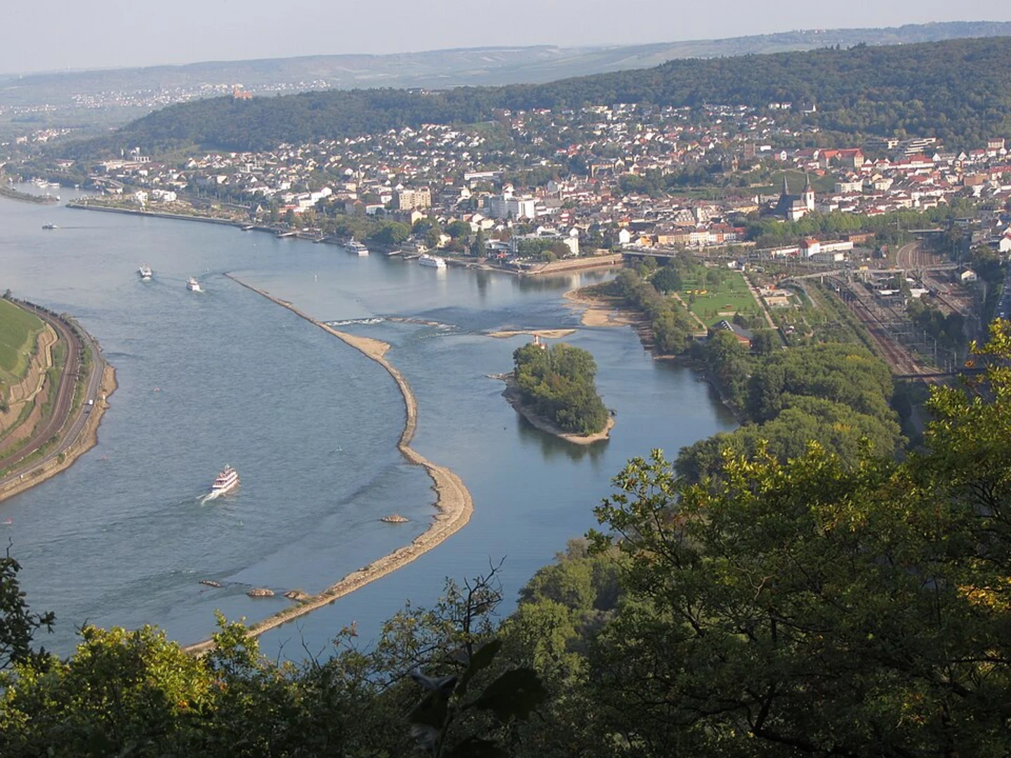
#### Binger Loch Blick Around the 5 km (3.1 miles) mark, you'll reach Binger Loch Blick, a viewpoint offering stunning vistas of the Rhine River and the surrounding valley. This is a great spot to take a break and soak in the panoramic views. The elevation gain to this point is about 400 meters (1,300 feet).
#### Rastplatz Ehrenfelsblick Continuing along the loop, you'll come to Rastplatz Ehrenfelsblick at approximately 8 km (5 miles). This rest area provides another excellent viewpoint, this time overlooking the Ehrenfels Castle ruins. The castle dates back to the 13th century and played a significant role in the region's medieval history. The elevation here is around 600 meters (1,970 feet).
Navigation and Safety Using HiiKER for navigation is highly recommended to ensure you stay on track. The trail is well-marked, but having a reliable navigation tool can provide peace of mind. Be prepared for some steep sections, particularly as you approach the viewpoints. Good hiking boots and trekking poles can be beneficial.
Flora and Fauna The trail traverses a variety of ecosystems, from dense pine forests to open meadows. In spring and summer, the meadows are adorned with wildflowers, attracting butterflies and bees. The forested areas are home to foxes, badgers, and a variety of bird species, making it a great trail for wildlife enthusiasts.
Historical Significance The region is steeped in history, with the Ehrenfels Castle being a notable landmark. Built in the early 13th century, the castle was a strategic fortification along the Rhine River. It was partially destroyed during the Thirty Years' War but remains a fascinating historical site. The trail also passes near several ancient trade routes, adding to its historical allure.
Final Stretch The final 5 km (3.1 miles) of the trail descend gradually back towards the trailhead, offering a mix of forested paths and open landscapes. This section provides a gentle cooldown after the more strenuous climbs earlier in the hike.
This trail offers a perfect blend of natural beauty, wildlife, and historical intrigue, making it a rewarding experience for any hiker.
What to expect?
Activity types
Comments and Reviews
User comments, reviews and discussions about the Fichtenkopf, Binger Loch Blick and Rastplatz Ehrenfelsblick via Hessenweg, Germany.
4.4
average rating out of 5
5 rating(s)
