Download
Preview
Add to list
More
7.6 km
~2 hrs 8 min
372 m
Loop
“Explore lush Odenwald forests, medieval ruins, and panoramic views on this 8 km Heiligkreuzsteinach loop trail.”
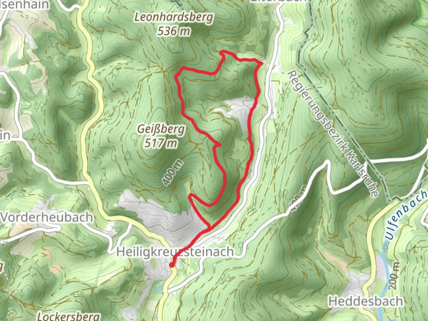
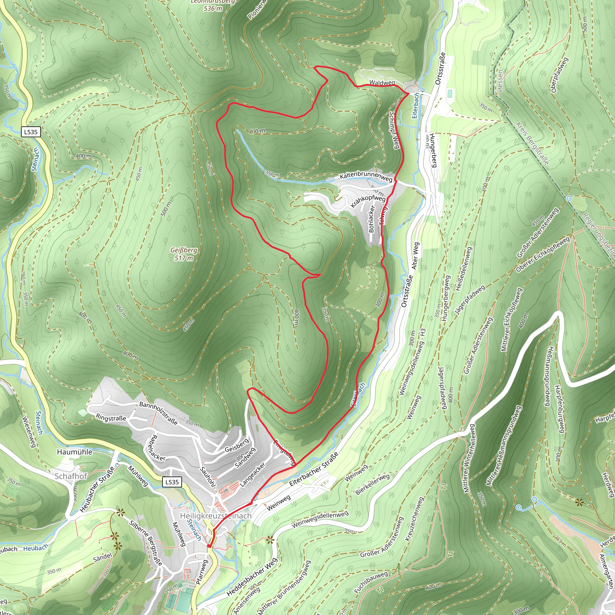
Starting your adventure near the charming town of Heiligkreuzsteinach in the Rhein-Neckar-Kreis region of Germany, this 8 km (approximately 5 miles) loop trail offers a delightful mix of natural beauty and historical intrigue. With an elevation gain of around 300 meters (about 984 feet), this medium-difficulty hike is perfect for those looking to immerse themselves in the serene landscapes of the Odenwald forest.
Getting There To reach the trailhead, you can either drive or use public transport. If you're driving, set your GPS to Heiligkreuzsteinach, and you'll find parking options near the town center. For those using public transport, take a train to Heidelberg and then a bus to Heiligkreuzsteinach. The bus ride offers scenic views of the surrounding countryside, making for a pleasant start to your day.
Trail Navigation For navigation, it's highly recommended to use the HiiKER app, which provides detailed maps and real-time updates to ensure you stay on track. The trail is well-marked, but having a reliable navigation tool can enhance your hiking experience.
Trail Highlights As you begin your hike, you'll quickly find yourself enveloped by the lush greenery of the Odenwald forest. The trail meanders through dense woodlands, offering a cool and shaded path, especially refreshing during the warmer months.
#### Historical Significance About 2 km (1.2 miles) into the hike, you'll come across the ruins of an old castle, Burg Waldeck. This medieval structure dates back to the 12th century and offers a glimpse into the region's rich history. Take a moment to explore the ruins and imagine the lives of those who once inhabited this fortress.
Flora and Fauna The trail is a haven for nature enthusiasts. Keep an eye out for a variety of bird species, including woodpeckers and owls. The forest floor is often carpeted with wildflowers in the spring, and you might even spot deer grazing in the early morning or late afternoon.
Midpoint and Elevation Gain Around the 4 km (2.5 miles) mark, you'll reach the highest point of the trail, offering panoramic views of the surrounding valleys and hills. This is a great spot to take a break, have a snack, and soak in the breathtaking scenery. The elevation gain is gradual, making it manageable for most hikers, but be prepared for a few steeper sections.
Descending Back As you begin your descent, the trail opens up to more open landscapes, including meadows and small streams. The sound of flowing water adds a tranquil element to the hike, and the open areas provide excellent opportunities for photography.
Final Stretch The last 2 km (1.2 miles) of the trail bring you back into the forest, eventually leading you back to Heiligkreuzsteinach. The loop nature of the trail means you'll end where you started, making logistics simple and straightforward.
Practical Tips - Wear sturdy hiking boots, as some sections can be rocky and uneven. - Bring plenty of water, especially during the summer months. - A light snack or picnic can be enjoyable at the midpoint. - Check the weather forecast before heading out, as the trail can be slippery after rain.
This hike offers a perfect blend of natural beauty, historical landmarks, and moderate physical challenge, making it a rewarding experience for both novice and experienced hikers alike.
What to expect?
Activity types
Comments and Reviews
User comments, reviews and discussions about the Heiligkreuzsteinach Loop, Germany.
5.0
average rating out of 5
1 rating(s)
