Download
Preview
Add to list
More
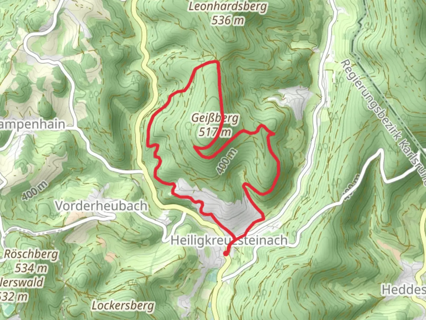
8.4 km
~2 hrs 23 min
428 m
Loop
“Experience stunning views, diverse landscapes, and historical intrigue on this rewarding 8 km loop trail.”
Starting near the picturesque Rhein-Neckar-Kreis in Germany, this 8 km (approximately 5 miles) loop trail offers a delightful mix of natural beauty and moderate challenge, making it perfect for hikers looking for a rewarding day out. With an elevation gain of around 400 meters (about 1,312 feet), the trail provides a good workout while treating you to stunning views and diverse landscapes.
Getting There To reach the trailhead, you can either drive or use public transport. If you're driving, set your GPS to the nearest known address, which is the town of Neckargemünd. From there, follow local signage to the trailhead. For those using public transport, take a train to Neckargemünd station. From the station, local buses or a short taxi ride will get you to the starting point.
Trail Navigation For navigation, it's highly recommended to use the HiiKER app, which provides detailed maps and real-time updates to ensure you stay on track.
Trail Highlights
#### Geissberg Starting off, the trail takes you through dense forests and gradually ascends towards Geissberg. The initial 2 km (1.2 miles) are relatively gentle, allowing you to warm up as you walk through a canopy of deciduous trees. Keep an eye out for local wildlife such as deer and various bird species. The forest floor is often carpeted with wildflowers in the spring, adding a splash of color to your hike.
#### Hohenoeder Hoehe As you continue, the trail becomes steeper, gaining most of its elevation in the next 3 km (1.8 miles). This section can be challenging, but the effort is well worth it. Upon reaching Hohenoeder Hoehe, you'll be rewarded with panoramic views of the surrounding valleys and hills. This is a great spot to take a break, have a snack, and soak in the scenery. On clear days, you can see as far as the Odenwald mountain range.
Historical Significance The region around Rhein-Neckar-Kreis is steeped in history. During your hike, you'll come across several historical markers and ruins. One notable landmark is the remnants of an old watchtower, dating back to the medieval period. These ruins offer a glimpse into the area's past, where such structures were used for surveillance and defense.
Flora and Fauna The trail is rich in biodiversity. In addition to the common deer and birds, you might spot foxes and, if you're lucky, a wild boar. The flora varies with the seasons; spring brings a burst of wildflowers, while autumn offers a stunning display of fall foliage.
Final Stretch The last 3 km (1.8 miles) of the trail loop back towards the starting point, descending gradually through mixed forests and open meadows. This section is less strenuous, allowing you to cool down and enjoy the final leg of your hike. The trail is well-marked, but using HiiKER will ensure you don't miss any turns.
Practical Tips - Wear sturdy hiking boots, as some sections can be rocky and uneven. - Bring enough water and snacks, especially if you plan to take breaks and enjoy the views. - Check the weather forecast before heading out, as the trail can be slippery after rain. - Be mindful of local wildlife and maintain a respectful distance.
This trail offers a perfect blend of natural beauty, moderate physical challenge, and historical intrigue, making it a must-visit for any hiking enthusiast.

Comments and Reviews
User comments, reviews and discussions about the Geissberg and Hohenoeder Hoehe, Germany.
average rating out of 5
0 rating(s)