Download
Preview
Add to list
More
13.8 km
~3 hrs 48 min
627 m
Point-to-Point
“The Kamp-Bornhofen to Kestert Walk offers 14 kilometers of scenic views, historical landmarks, and moderate hiking challenges.”
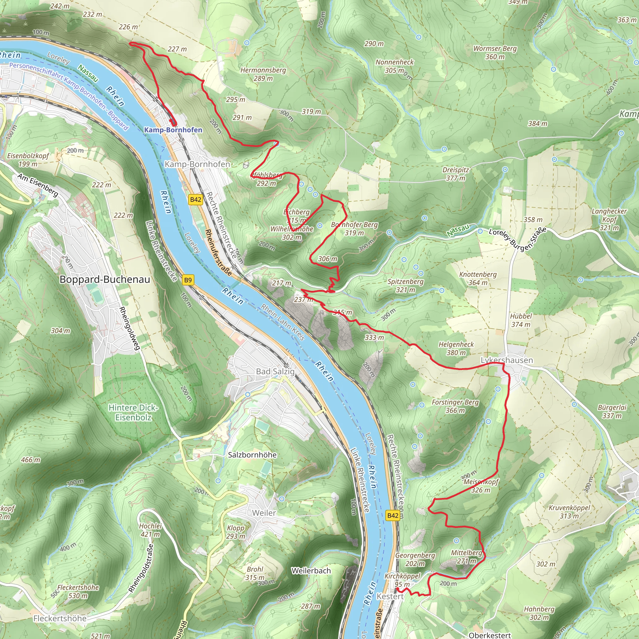
Starting near Rhein-Lahn-Kreis, Germany, the Kamp-Bornhofen to Kestert Walk via Brömserkopf is a point-to-point trail that spans approximately 14 kilometers (around 8.7 miles) with an elevation gain of about 600 meters (approximately 1,970 feet). This trail is rated as medium difficulty, making it suitable for hikers with a moderate level of fitness and some hiking experience.
Getting There To reach the trailhead, you can either drive or use public transportation. If you're driving, you can park near Kamp-Bornhofen, a small town along the Rhine River. For those using public transport, take a train to Kamp-Bornhofen station, which is well-connected by regional trains. From the station, it's a short walk to the start of the trail.
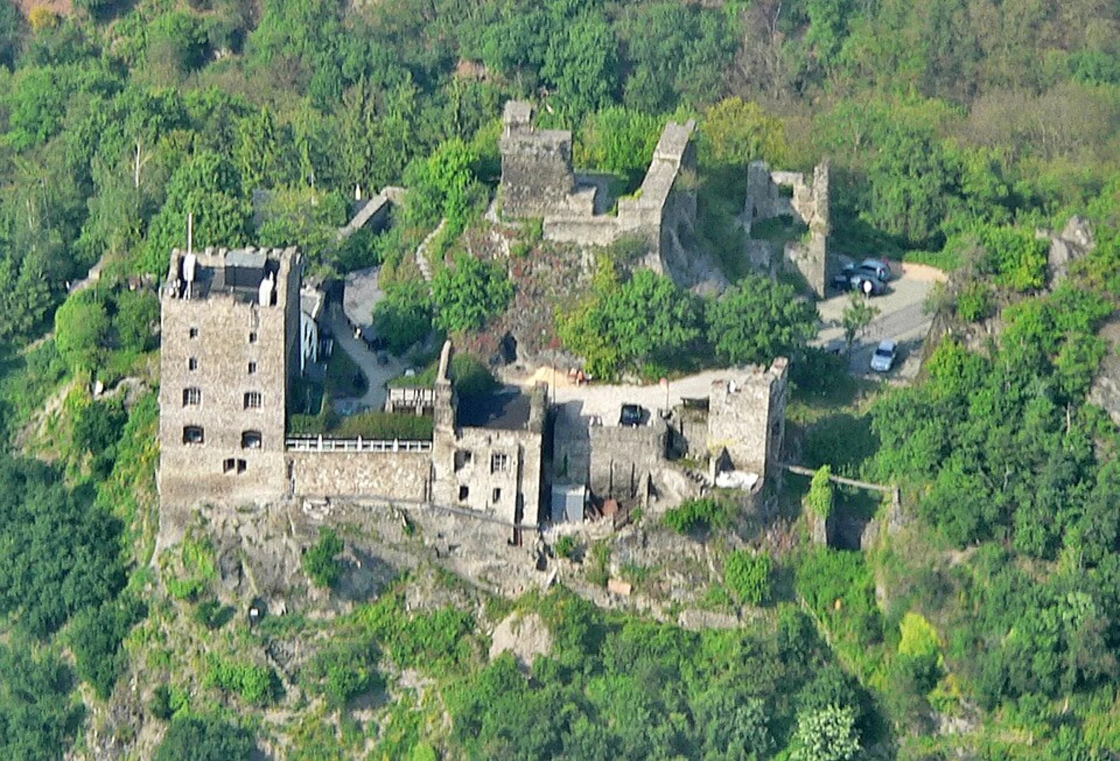
Trail Overview The trail begins in Kamp-Bornhofen, a picturesque town known for its twin castles, Liebenstein and Sterrenberg, often referred to as the "Hostile Brothers." These castles are a significant historical landmark and offer a glimpse into the medieval history of the region. As you start your hike, you'll be treated to stunning views of the Rhine River and the surrounding valley.
Nature and Wildlife As you ascend, the trail takes you through dense forests and open meadows, providing a diverse range of flora and fauna. Keep an eye out for local wildlife such as deer, foxes, and a variety of bird species. The forested areas are particularly beautiful in the autumn when the leaves change color, creating a vibrant tapestry of reds, oranges, and yellows.
Key Landmarks Around the 5-kilometer (3.1-mile) mark, you'll reach Brömserkopf, the highest point of the trail. This vantage point offers panoramic views of the Rhine Valley and is an excellent spot for a rest and some photography. The elevation gain to this point is approximately 300 meters (around 985 feet), so be prepared for a steady climb.
Continuing on, the trail descends towards the town of Kestert. Along the way, you'll pass through several small villages and vineyards, which are characteristic of the Rhine region. These vineyards are part of the UNESCO World Heritage Upper Middle Rhine Valley, known for its wine production and scenic landscapes.
Historical Significance The entire region is steeped in history, with numerous castles, fortresses, and ruins dotting the landscape. The trail itself follows ancient paths that have been used for centuries, adding a layer of historical intrigue to your hike. The Rhine River has been a crucial waterway for trade and transport since Roman times, and many of the towns along the trail have historical significance dating back to the medieval period.
Navigation and Safety For navigation, it's highly recommended to use HiiKER, which provides detailed maps and real-time updates. The trail is well-marked, but having a reliable navigation tool will ensure you stay on track and can find alternative routes if needed.
Final Stretch As you approach Kestert, the trail descends more steeply, so take care with your footing, especially if the ground is wet. The final stretch offers more stunning views of the Rhine River and the surrounding hills. Kestert is a charming town with several options for dining and accommodation, making it a perfect endpoint for your hike.
This trail offers a blend of natural beauty, historical landmarks, and moderate physical challenge, making it a rewarding experience for any hiker.
Comments and Reviews
User comments, reviews and discussions about the Kamp-Bornhofen to Kestert Walk via Brömserkopf, Germany.
4.6
average rating out of 5
5 rating(s)

