Unterer Gönninger See, Oberer Gönninger See and Roßberg Loop via Schwabische Alb Nordrand Weg
Download
Preview
Add to list
More
12.0 km
~3 hrs 19 min
557 m
Loop
“This scenic 12 km loop in Schwabische Alb blends natural beauty, historical landmarks, and diverse wildlife.”
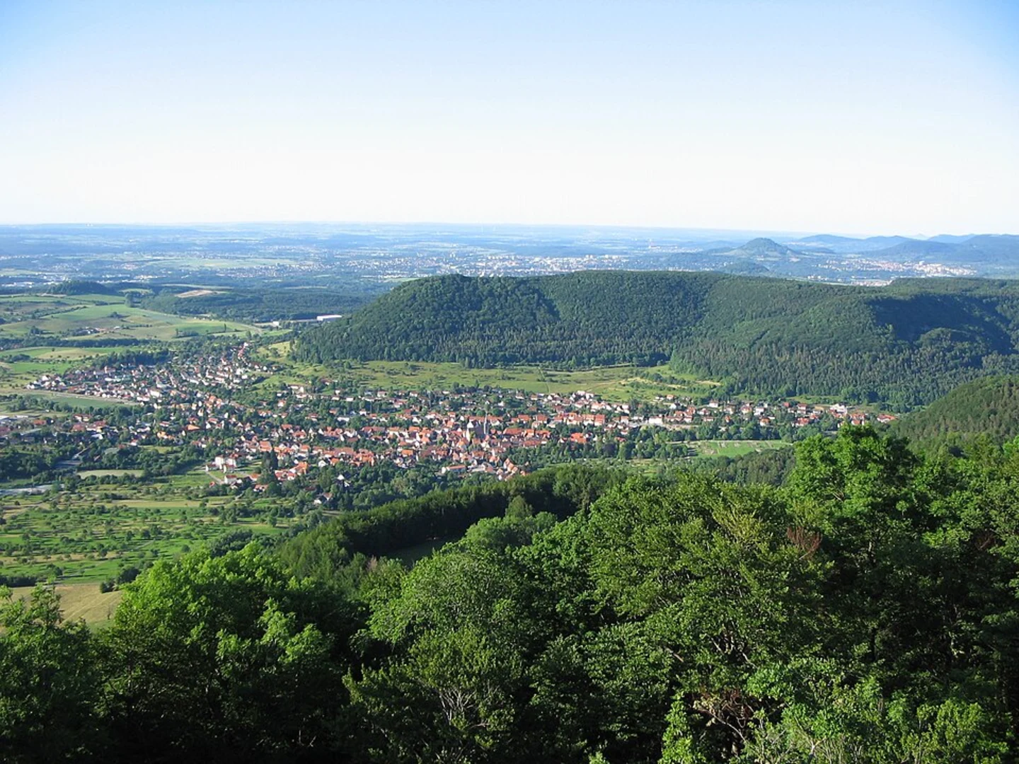
Starting near Reutlingen, Germany, the Unterer Gönninger See, Oberer Gönninger See and Roßberg Loop via Schwabische Alb Nordrand Weg is a scenic 12 km (7.5 miles) loop trail with an elevation gain of approximately 500 meters (1,640 feet). This medium-difficulty trail offers a blend of natural beauty, historical landmarks, and diverse wildlife, making it a rewarding experience for hikers.### Getting There To reach the trailhead, you can either drive or use public transport. If driving, head towards Gönningen, a district of Reutlingen, and park near the Gönninger See. For those using public transport, take a train to Reutlingen Hauptbahnhof and then a bus to Gönningen. The nearest significant landmark to the trailhead is the Gönninger See, a picturesque lake that marks the beginning of your adventure.### Trail Highlights#### Unterer Gönninger See Starting at Unterer Gönninger See, you'll be greeted by a serene lake surrounded by lush greenery. This area is perfect for a brief rest or a picnic before you begin your hike. The lake is home to various bird species, so keep an eye out for ducks, swans, and other waterfowl.#### Oberer Gönninger See Approximately 2 km (1.2 miles) into the hike, you'll reach Oberer Gönninger See. This lake is slightly more elevated and offers stunning views of the surrounding hills. The trail around this lake is well-marked and provides ample opportunities for photography.#### Schwabische Alb Nordrand Weg As you continue, you'll join the Schwabische Alb Nordrand Weg, a historic trail that has been used for centuries. This section of the hike is rich in history, with ancient stone markers and remnants of old trade routes. The trail here is moderately challenging, with a steady incline that will take you through dense forests and open meadows.#### Roßberg Around the 6 km (3.7 miles) mark, you'll begin your ascent to Roßberg. This is the most challenging part of the hike, with an elevation gain of about 300 meters (984 feet) over a short distance. The effort is well worth it, as the summit offers panoramic views of the Schwabian Alps and the surrounding countryside. On a clear day, you can see as far as the Black Forest.### Flora and Fauna The trail is abundant with diverse flora and fauna. In the spring and summer, wildflowers blanket the meadows, and the forests are alive with the sounds of birds and small mammals. Deer and wild boar are also common in this region, so be cautious and respectful of wildlife.### Navigation To ensure you stay on track, use the HiiKER app for real-time navigation and trail updates. The app provides detailed maps and can alert you to any changes in the trail conditions.### Historical Significance The Schwabische Alb region is steeped in history, with evidence of human settlement dating back to the Paleolithic era. The trail itself has been a vital route for traders and travelers for centuries. Along the way, you'll encounter ancient stone markers and possibly even remnants of old fortifications.### Practical Tips - Wear sturdy hiking boots, as the trail can be rocky and uneven in places. - Bring plenty of water and snacks, especially if you plan to picnic by the lakes. - Check the weather forecast before you go, as conditions can change rapidly in the mountains. - Be mindful of the local wildlife and maintain a safe distance.This 12 km loop offers a perfect blend of natural beauty, historical intrigue, and moderate physical challenge, making it an ideal choice for hikers looking to explore the Schwabische Alb region.

What to expect?
Activity types
Comments and Reviews
User comments, reviews and discussions about the Unterer Gönninger See, Oberer Gönninger See and Roßberg Loop via Schwabische Alb Nordrand Weg, Germany.
5.0
average rating out of 5
1 rating(s)