Download
Preview
Add to list
More
4.6 km
~1 hrs 9 min
140 m
Loop
“Discover the Greuthau via Schafbergweg trail: a 5 km loop of nature, history, and scenic views.”
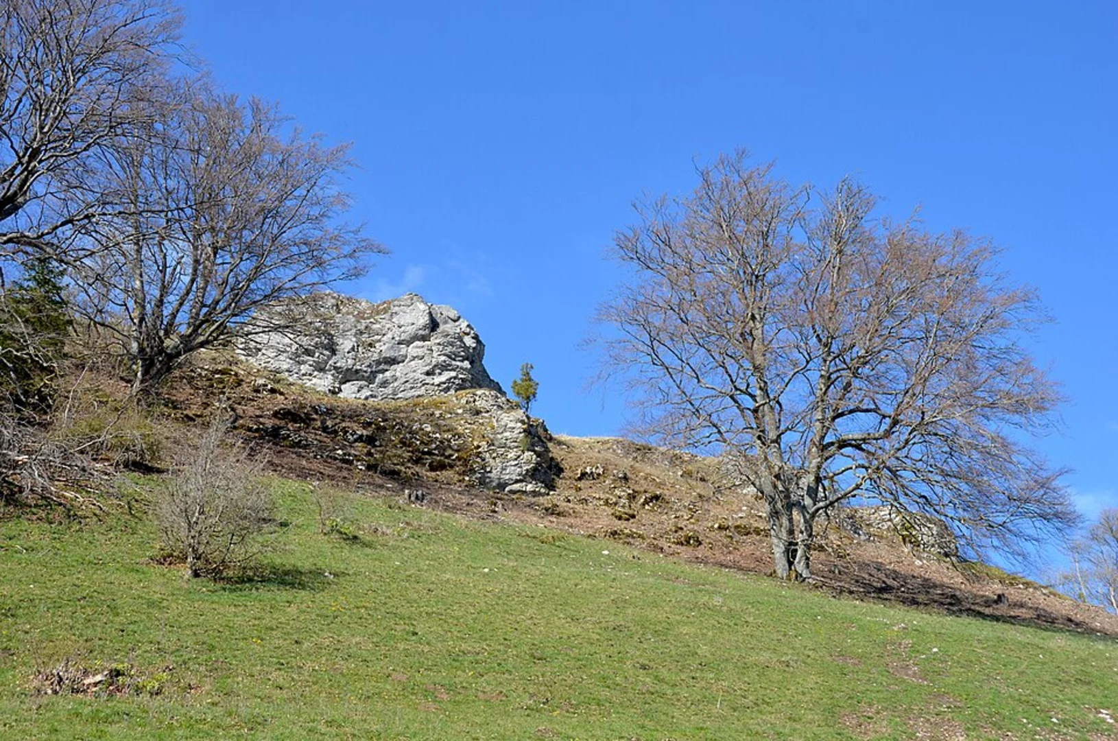
Starting near Reutlingen, Germany, the Greuthau via Schafbergweg trail is a delightful loop that spans approximately 5 kilometers (3.1 miles) with an elevation gain of around 100 meters (328 feet). This medium-difficulty trail offers a blend of natural beauty, historical significance, and accessible navigation.### Getting There To reach the trailhead, you can either drive or use public transport. If driving, head towards Reutlingen and look for parking near the outskirts of the town, close to the starting point of the trail. For those using public transport, Reutlingen is well-connected by train and bus services. From the Reutlingen Hauptbahnhof (main train station), you can take a local bus to a stop near the trailhead.### Trail Navigation The trail is well-marked and can be easily navigated using the HiiKER app, which provides detailed maps and real-time GPS tracking. Make sure to download the trail map before you start, as cell service can be spotty in some areas.### Key Landmarks and Points of Interest - Schafbergweg: As you begin your hike, you'll follow the Schafbergweg path. This section is relatively flat and offers a gentle introduction to the trail. Keep an eye out for the lush greenery and occasional wildlife, including deer and various bird species.
- Greuthau Forest: About 2 kilometers (1.2 miles) into the hike, you'll enter the Greuthau Forest. This dense woodland area is home to a variety of flora and fauna. The forest floor is often carpeted with wildflowers in the spring and summer months, making it a picturesque spot for photography.- Elevation Gain: As you approach the halfway mark, you'll encounter a gradual incline that leads to the highest point of the trail. This section offers panoramic views of the surrounding countryside, including the Swabian Jura mountain range in the distance. The elevation gain here is about 100 meters (328 feet), but the path is well-maintained and manageable for most hikers.### Historical Significance The region around Reutlingen has a rich history dating back to the Roman era. While hiking, you may come across remnants of ancient Roman roads and settlements. The area was also significant during the medieval period, serving as a strategic location for various historical events. Keep an eye out for informational plaques along the trail that provide insights into the historical context of the region.### Wildlife and Nature The trail is a haven for nature enthusiasts. In addition to the common deer and bird species, you might spot foxes, hares, and even the occasional wild boar. The diverse plant life includes oak, beech, and pine trees, as well as a variety of shrubs and wildflowers. The trail is particularly beautiful in the autumn when the foliage turns vibrant shades of red, orange, and yellow.### Practical Tips
- Footwear: Wear sturdy hiking boots, as some sections of the trail can be uneven and rocky.
- Weather: Check the weather forecast before you go. The trail can become slippery after rain, so it's best to avoid hiking during or immediately after heavy rainfall.
- Supplies: Bring enough water and snacks, as there are no facilities along the trail. A small first-aid kit is also recommended.
- Respect Nature: Stick to the marked paths to protect the local flora and fauna. Carry out all trash and leave no trace.This trail offers a perfect blend of natural beauty, historical intrigue, and manageable challenge, making it a rewarding experience for hikers of all levels.

What to expect?
Activity types
Comments and Reviews
User comments, reviews and discussions about the Greuthau via Schafbergweg, Germany.
4.5
average rating out of 5
2 rating(s)