Download
Preview
Add to list
More
11.4 km
~2 hrs 21 min
50 m
Loop
“Explore the 11 km Kiel Canal loop near Rendsburg, blending history, nature, and engineering marvels.”
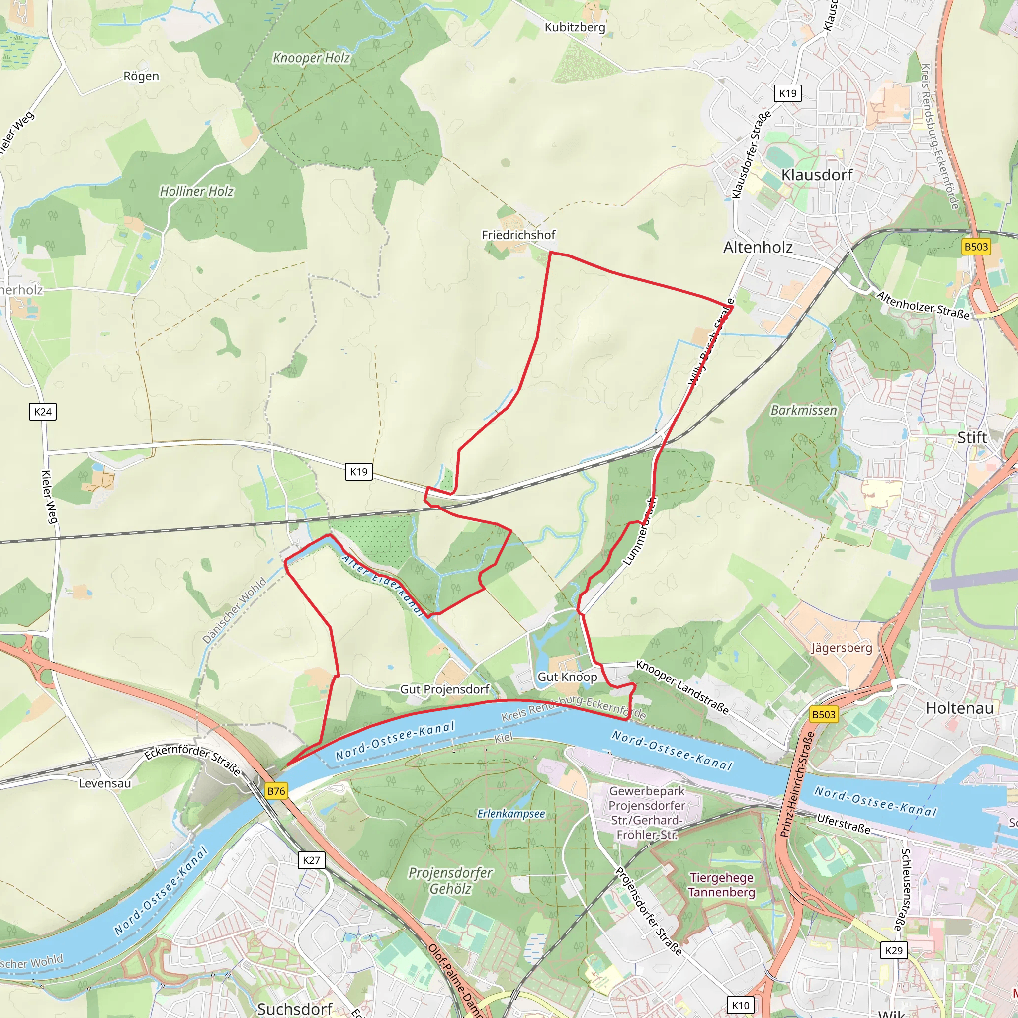
Starting near Rendsburg-Eckernförde in Germany, the Kiel Canal via Friedrichshofer Weg trail is a delightful 11 km (approximately 6.8 miles) loop with virtually no elevation gain, making it an accessible yet engaging hike for those looking to explore the region. The trailhead is conveniently located near the Rendsburg High Bridge, a significant landmark that also serves as a great starting point for your adventure.
Getting There For those traveling by public transport, Rendsburg is well-connected by train. From the Rendsburg train station, you can take a short bus ride or even walk to the trailhead near the Rendsburg High Bridge. If you're driving, there are parking facilities available near the bridge, making it easy to start your hike without any hassle.
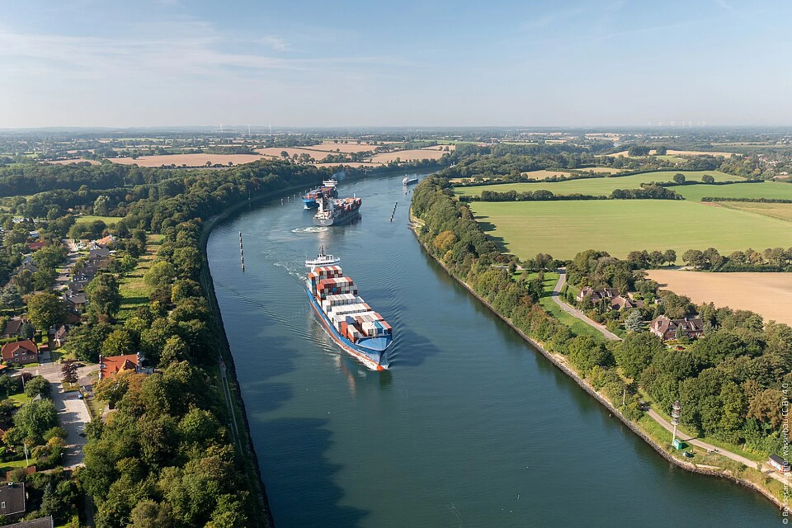
Trail Highlights As you embark on this loop trail, you'll be treated to a variety of landscapes and points of interest. The Kiel Canal itself is a marvel of engineering, being one of the busiest artificial waterways in the world. You'll walk alongside this impressive canal for a significant portion of the hike, offering plenty of opportunities to watch ships of all sizes pass by.
#### Historical Significance The Kiel Canal, originally known as the Kaiser-Wilhelm-Kanal, was completed in 1895 and has since been a crucial maritime route. The canal significantly shortened the journey for ships traveling between the North Sea and the Baltic Sea, bypassing the longer route around the Jutland Peninsula. As you walk along the canal, you'll come across various historical markers and information boards that provide insights into the canal's construction and its importance over the years.
Nature and Wildlife The trail also offers a rich tapestry of natural beauty. The surrounding area is home to a variety of flora and fauna. Keep an eye out for local bird species, especially near the water. The canal's banks are often lined with lush greenery, providing a serene backdrop for your hike. In the spring and summer months, wildflowers add a splash of color to the landscape.
Navigation and Safety Given the trail's moderate difficulty rating, it's suitable for most hikers, including families. However, it's always wise to be prepared. Use the HiiKER app for accurate navigation and to stay updated on any trail conditions. The path is well-marked, but having a reliable navigation tool can enhance your hiking experience.
Points of Interest Around the halfway mark, you'll come across the charming village of Schacht-Audorf. This is a great spot to take a break, perhaps at a local café, and soak in the local culture. The village offers a glimpse into the everyday life of the region's residents and is a pleasant detour from the natural scenery.
As you loop back towards the starting point, you'll pass through Friedrichshofer Weg, a picturesque section of the trail that offers a peaceful, wooded environment. This part of the hike is particularly enjoyable in the autumn when the leaves change color, creating a stunning natural tapestry.
Final Stretch The final stretch of the trail brings you back to the Rendsburg High Bridge, where you can take a moment to appreciate the engineering marvel once more. The bridge itself is an iconic structure, and if you have time, consider exploring the nearby Rendsburg Transporter Bridge, one of the last remaining transporter bridges in the world.
This 11 km loop offers a perfect blend of historical intrigue, natural beauty, and modern engineering, making it a must-do for anyone visiting the Rendsburg-Eckernförde area.
What to expect?
Activity types
Comments and Reviews
User comments, reviews and discussions about the Kiel Canal via Friedrichshofer Weg, Germany.
4.17
average rating out of 5
6 rating(s)

