Download
Preview
Add to list
More
12.4 km
~3 hrs 39 min
709 m
Loop
“Explore captivating waterfalls, peaks, and historic ruins on this 12 km moderately challenging Black Forest trail.”
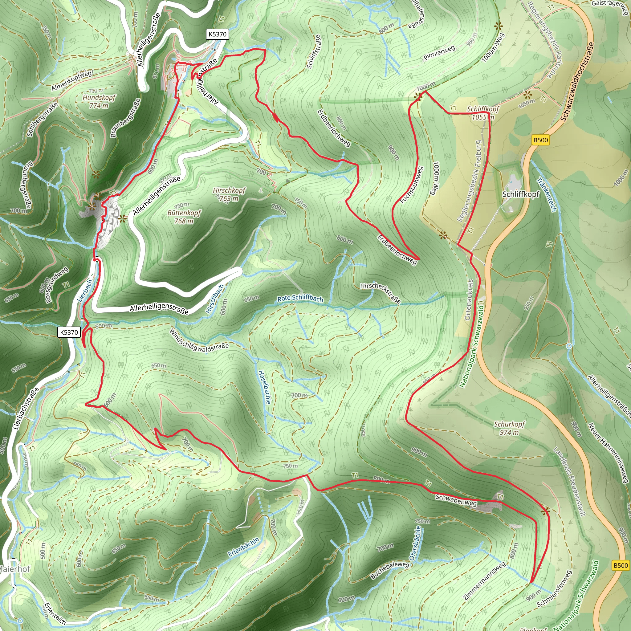
Starting near Ortenaukreis, Germany, the Allerheiligen Wasserfälle, Schliffkopf and Schurkopf Loop is a captivating 12 km (7.5 miles) trail with an elevation gain of approximately 700 meters (2,300 feet). This loop trail is rated as medium difficulty, making it suitable for moderately experienced hikers.
Getting There To reach the trailhead, you can drive or use public transport. If driving, set your GPS to Allerheiligen Monastery, a well-known landmark near the trailhead. For public transport, take a train to Oppenau and then a bus to Allerheiligen. The monastery is a convenient starting point and offers parking facilities.
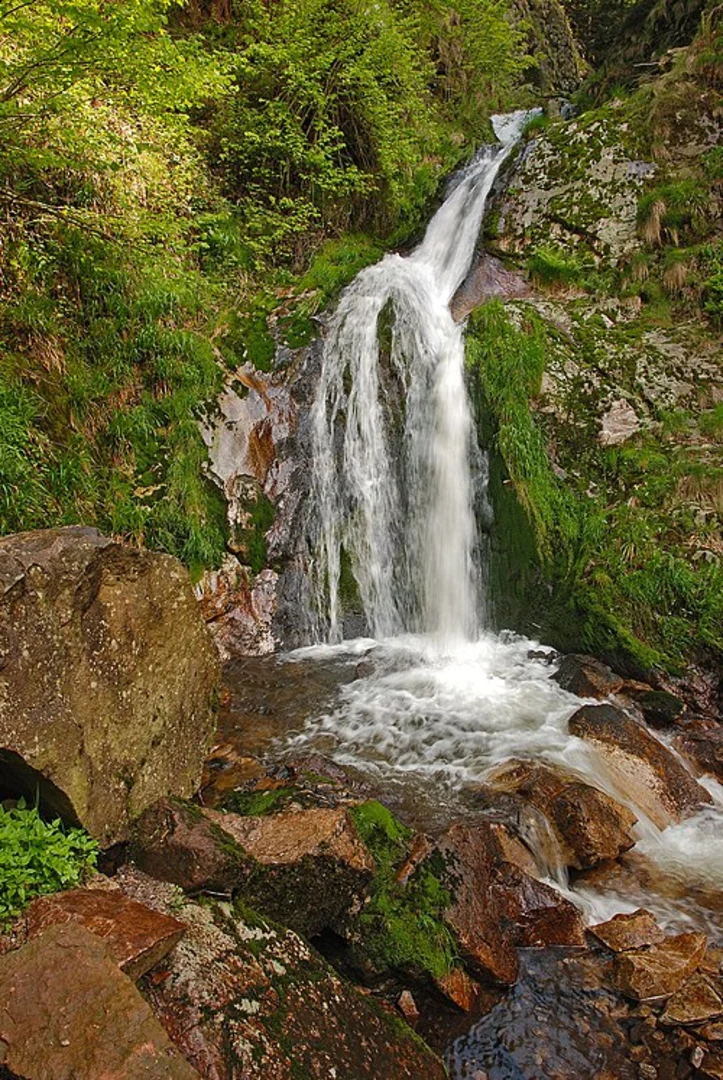
Trail Highlights #### Allerheiligen Waterfalls The trail begins with a visit to the Allerheiligen Waterfalls, a series of cascading falls that are both picturesque and serene. The waterfalls are a significant natural landmark, and the sound of rushing water sets a calming tone for the hike. The falls are located about 1 km (0.6 miles) from the trailhead, with an initial elevation gain of around 100 meters (328 feet).
#### Schliffkopf Continuing on, the trail ascends towards Schliffkopf, a prominent peak in the Black Forest. This section involves a steady climb, gaining approximately 400 meters (1,312 feet) over 4 km (2.5 miles). The summit offers panoramic views of the surrounding forest and valleys, making it a perfect spot for a rest and some photography.
#### Schurkopf From Schliffkopf, the trail leads to Schurkopf, another notable peak. This part of the hike is less strenuous, with a gradual elevation gain of about 200 meters (656 feet) over 3 km (1.9 miles). The path meanders through dense forest, offering opportunities to spot local wildlife such as deer, foxes, and various bird species.
Historical Significance The region is steeped in history, particularly around the Allerheiligen Monastery. Founded in the 12th century, the monastery was a significant religious site until it was destroyed by fire in the 19th century. The ruins are accessible from the trail and provide a fascinating glimpse into the area's past.
Navigation and Safety For navigation, it is highly recommended to use the HiiKER app, which provides detailed maps and real-time updates. The trail is well-marked, but having a reliable navigation tool ensures you stay on track.
Flora and Fauna The trail traverses diverse ecosystems, from lush riverbanks near the waterfalls to alpine meadows at higher elevations. In spring and summer, the area is adorned with wildflowers, while autumn brings a stunning display of fall foliage. Keep an eye out for local wildlife, including red squirrels, woodpeckers, and the occasional wild boar.
Final Stretch The final part of the loop descends back towards the starting point, covering the remaining 4 km (2.5 miles) with a gentle decline. This section offers a mix of open meadows and forested paths, providing a relaxing end to the hike.
This trail offers a blend of natural beauty, historical intrigue, and moderate physical challenge, making it a rewarding experience for those who undertake it.
What to expect?
Activity types
Comments and Reviews
User comments, reviews and discussions about the Allerheiligen Wasserfälle, Schliffkopf and Schurkopf Loop, Germany.
4.78
average rating out of 5
9 rating(s)

