Download
Preview
Add to list
More
15.1 km
~3 hrs 49 min
487 m
Point-to-Point
“Traverse the Allgäu Alps for a challenging adventure rich in natural beauty and historical intrigue.”
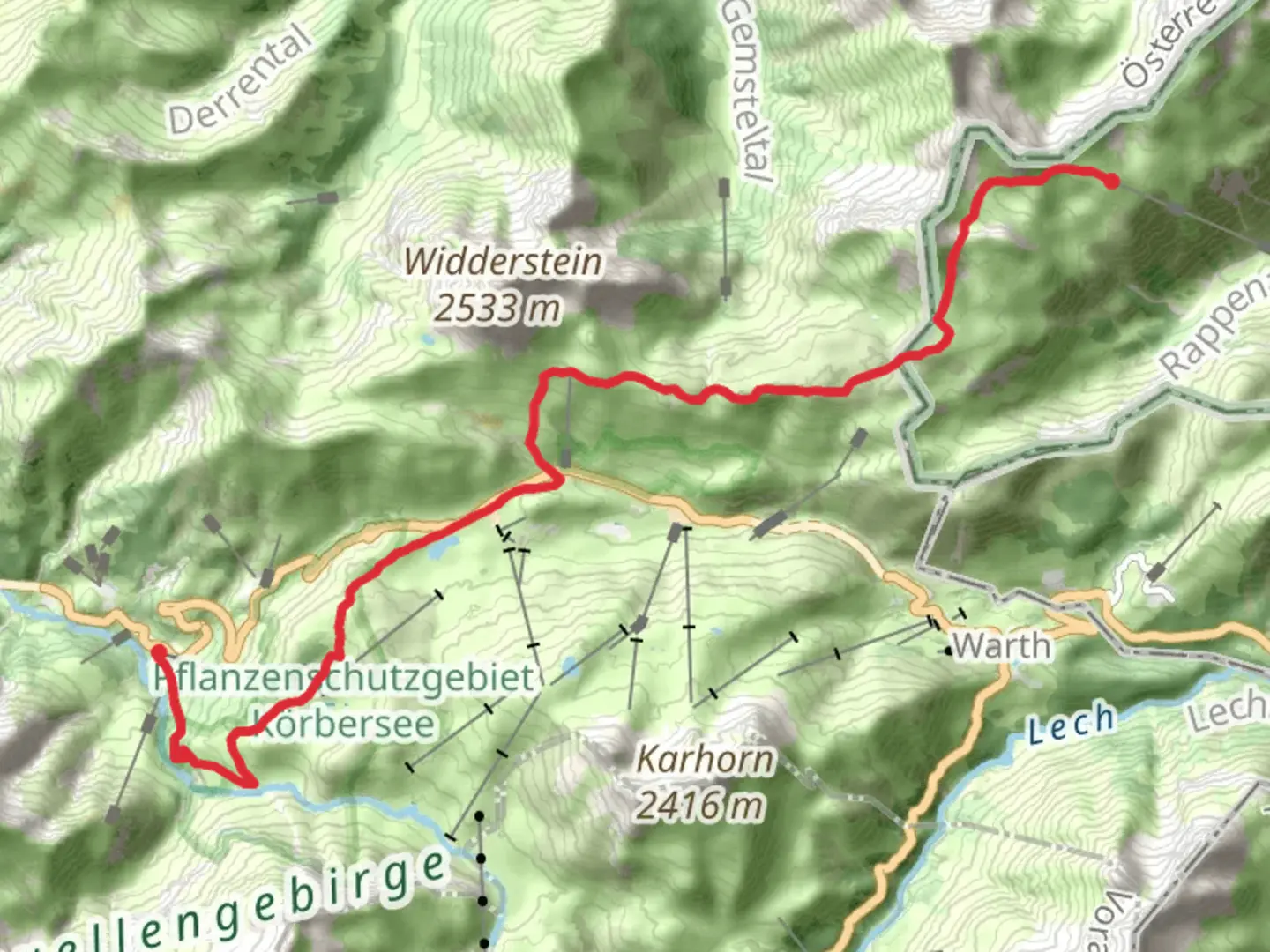
Starting your journey near Oberallgäu, Germany, the Mindelheimer Huette to Schröcken Via Alpina Red trail offers a challenging yet rewarding experience for seasoned hikers. This point-to-point trail stretches approximately 15 kilometers (about 9.3 miles) with an elevation gain of around 400 meters (approximately 1,312 feet), making it a difficult trek that requires preparation and stamina.### Getting ThereTo reach the trailhead, you can travel by car or public transport. If driving, head towards Oberallgäu, where parking is available near the starting point. For those using public transport, take a train or bus to Oberstdorf, a nearby town with connections to the trailhead. From Oberstdorf, local buses or taxis can take you to the starting point near the Mindelheimer Huette.### Trail HighlightsAs you embark on this journey, you'll traverse the stunning landscapes of the Allgäu Alps, a region known for its dramatic peaks and lush valleys. The trail is part of the Via Alpina Red, a long-distance hiking route that spans several countries, offering a unique opportunity to experience the diverse alpine environment.#### Nature and WildlifeThe trail is rich in natural beauty, with diverse flora and fauna. Keep an eye out for alpine wildflowers, which bloom in vibrant colors during the warmer months. The area is also home to various wildlife, including marmots, chamois, and golden eagles. As you hike, you'll pass through dense forests and open meadows, each offering a different perspective of the alpine ecosystem.#### Significant LandmarksOne of the key landmarks along the trail is the Mindelheimer Huette, a mountain hut that serves as a popular starting point for hikers. This hut provides a glimpse into the traditional alpine architecture and offers basic amenities for those who wish to rest before or after their hike. As you continue, you'll encounter panoramic views of the surrounding peaks, including the prominent Widderstein mountain.### Historical SignificanceThe region holds historical significance, with the trail passing through areas that have been traversed by travelers for centuries. The Via Alpina itself is a modern route that connects historical paths used by traders and pilgrims, offering a sense of connection to the past. The trail also provides insights into the cultural heritage of the alpine communities, with traditional villages and farms dotting the landscape.### Navigation and SafetyGiven the trail's difficulty, it's essential to be well-prepared. Use HiiKER for navigation to ensure you stay on track, as the trail can be challenging to follow in certain sections. Weather conditions in the Alps can change rapidly, so pack appropriate gear, including waterproof clothing and sturdy hiking boots. Always check the weather forecast before setting out and be prepared for sudden changes.This trail offers a blend of natural beauty, challenging terrain, and historical intrigue, making it a must-experience for avid hikers seeking adventure in the heart of the Alps.

Comments and Reviews
User comments, reviews and discussions about the Mindelheimer Huette to Schröcken Via Alpina Red, Germany.
4.0
average rating out of 5
1 rating(s)