Download
Preview
Add to list
More
6.6 km
~1 hrs 46 min
272 m
Loop
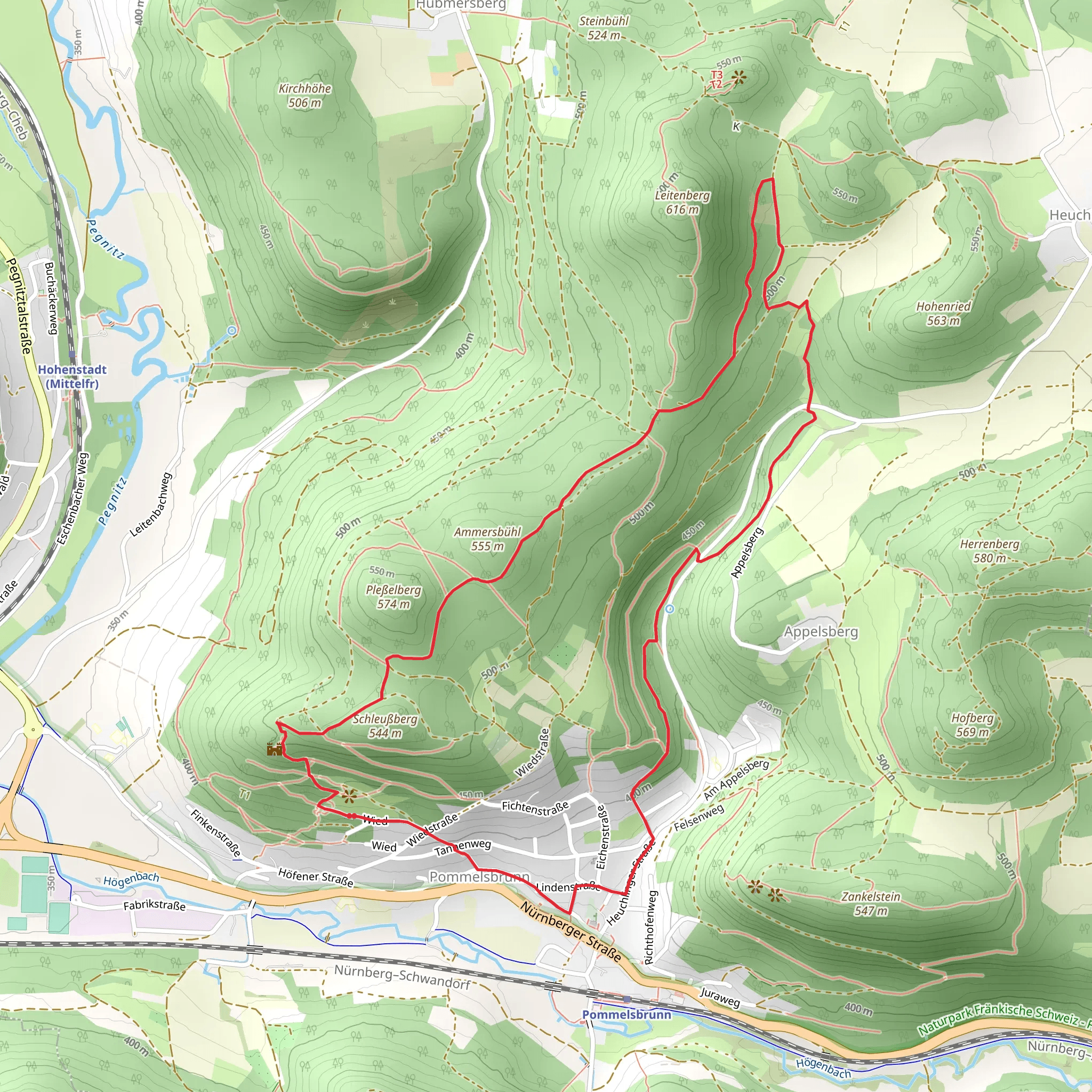
“Explore lush forests, historical landmarks, and panoramic views on this moderately challenging 7 km trail in Nürnberger Land.”
Starting near the picturesque Nürnberger Land in Germany, this 7 km (approximately 4.35 miles) loop trail offers a moderate challenge with an elevation gain of around 200 meters (656 feet). The trailhead is conveniently accessible by both car and public transport. If you're driving, you can park near the village of Altdorf bei Nürnberg. For those using public transport, take a train to Altdorf bei Nürnberg station and then a short bus ride to the trailhead.
Trail Overview
The trail begins with a gentle ascent through lush forests, offering a serene start to your hike. As you progress, you'll encounter the first of the seven summits, Leitenberg. This section is characterized by a mix of deciduous and coniferous trees, providing ample shade and a cool environment, especially during the warmer months.
Significant Landmarks
Leitenberg Summit: At approximately 2 km (1.24 miles) into the hike, you'll reach the Leitenberg summit. This spot offers panoramic views of the surrounding countryside, making it a perfect place for a short break and some photography.
Gelbpunkt Trail Junction: Around the 4 km (2.48 miles) mark, you'll come across the Gelbpunkt trail junction. This is a significant point where the trail loops back towards the starting point. The junction is well-marked, but it's always a good idea to have a reliable navigation tool like HiiKER to ensure you're on the right path.
Flora and Fauna
The trail is rich in biodiversity. You'll likely encounter a variety of bird species, including woodpeckers and songbirds. The forest floor is often carpeted with wildflowers in the spring and summer, adding a splash of color to your hike. Keep an eye out for deer and other small mammals that inhabit the area.
Historical Significance
Nürnberger Land is steeped in history, and this trail is no exception. The region was historically significant during the medieval period, serving as a strategic location for trade and defense. As you hike, you'll notice remnants of old fortifications and possibly even ancient boundary stones that marked territorial limits.
Final Stretch
The final 3 km (1.86 miles) of the trail take you through a series of gentle descents and ascents, winding through more forested areas and open meadows. This section is relatively easy, allowing you to enjoy the natural beauty without too much exertion. You'll eventually loop back to the starting point near Altdorf bei Nürnberg, completing your 7 km journey.
Preparation Tips
Given the moderate difficulty of the trail, it's advisable to wear sturdy hiking boots and bring plenty of water. The trail can be muddy in sections, especially after rain, so be prepared for varying trail conditions. A map or navigation tool like HiiKER is highly recommended to keep you on track.
This trail offers a delightful mix of natural beauty, historical intrigue, and moderate physical challenge, making it a rewarding experience for hikers of all levels.
What to expect?
Activity types
Comments and Reviews
User comments, reviews and discussions about the Wied, 7 Summits Weg Leitenberg and Gelbpunkt Loop, Germany.
5.0
average rating out of 5
1 rating(s)
