Download
Preview
Add to list
More
6.8 km
~1 hrs 40 min
188 m
Loop
“The Amelith, Reiherbach Loop offers a scenic 7 km hike through forests, meadows, and historical sites.”
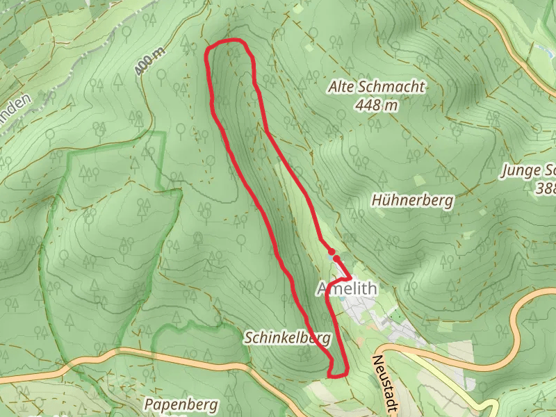
Starting near the charming town of Northeim in Germany, the Amelith, Reiherbach Loop is a delightful 7 km (4.35 miles) trail with an elevation gain of approximately 100 meters (328 feet). This loop trail is rated as medium difficulty, making it suitable for hikers with some experience.### Getting There To reach the trailhead, you can either drive or use public transport. If you're driving, set your GPS to Northeim, and from there, follow local signs to the trailhead. For those using public transport, take a train to Northeim station. From the station, you can catch a local bus or taxi to the trailhead, which is conveniently located near the town.### Trail Overview The trail begins with a gentle ascent through a mixed forest, offering a serene start to your hike. As you progress, you'll encounter a variety of landscapes, including dense woodlands, open meadows, and picturesque streams. The first significant landmark is the Reiherbach stream, which you will follow for a short distance. This area is particularly beautiful in the spring when wildflowers are in full bloom.### Key Landmarks and Points of Interest - Reiherbach Stream: Approximately 2 km (1.24 miles) into the hike, you'll come across the Reiherbach stream. This is a great spot to take a short break and enjoy the tranquil surroundings. - Amelith Quarry: Around the 4 km (2.48 miles) mark, you'll reach the historic Amelith Quarry. This site offers a glimpse into the region's industrial past and is a fascinating spot for history enthusiasts. - Panoramic Viewpoint: At about 5.5 km (3.42 miles), the trail ascends to a viewpoint that offers panoramic views of the surrounding countryside. This is an excellent spot for photography and a well-deserved rest.### Flora and Fauna The trail is rich in biodiversity. Keep an eye out for native wildlife such as deer, foxes, and a variety of bird species. The forested sections are home to oak, beech, and pine trees, while the meadows are dotted with wildflowers and herbs.### Navigation and Safety Given the trail's moderate difficulty, it's advisable to use a reliable navigation tool like HiiKER to stay on track. The trail is well-marked, but having a digital map can be very helpful, especially in the denser forest sections.### Historical Significance The region around Northeim has a rich history dating back to medieval times. The Amelith Quarry, in particular, played a significant role in the local economy during the 19th century. Exploring this area gives you a sense of the historical context and the natural beauty that has shaped the region.### Final Stretch The last segment of the trail descends gently back towards the starting point, passing through more open meadows and offering a relaxing end to your hike. As you approach the trailhead, you'll have a chance to reflect on the diverse landscapes and historical landmarks you've encountered along the way.
What to expect?
Activity types
Comments and Reviews
User comments, reviews and discussions about the Amelith, Reiherbach Loop, Germany.
5.0
average rating out of 5
1 rating(s)

