Fischweiher Randsbach and Angelweiher Petri Heil via Schauinslandweg Hangard
Download
Preview
Add to list
More
10.6 km
~2 hrs 44 min
366 m
Loop
“Explore Neunkirchen's 11 km loop trail for a mix of scenic beauty, moderate challenge, and historical intrigue.”
Starting near Neunkirchen, Germany, this 11 km (approximately 6.8 miles) loop trail offers a delightful mix of natural beauty and moderate physical challenge, with an elevation gain of around 300 meters (approximately 984 feet). The trailhead is conveniently accessible by both car and public transport. If you're driving, you can park near the Schauinslandweg Hangard. For those using public transport, Neunkirchen is well-connected by train and bus services, making it easy to reach the starting point.
Initial Ascent and Scenic Views The trail begins with a gentle ascent, gradually increasing in steepness as you move deeper into the forested area. Early on, you'll be treated to panoramic views of the surrounding countryside, which are particularly stunning during sunrise or sunset. The initial climb covers about 2 km (1.2 miles) and gains roughly 100 meters (328 feet) in elevation, providing a good warm-up for the rest of the hike.
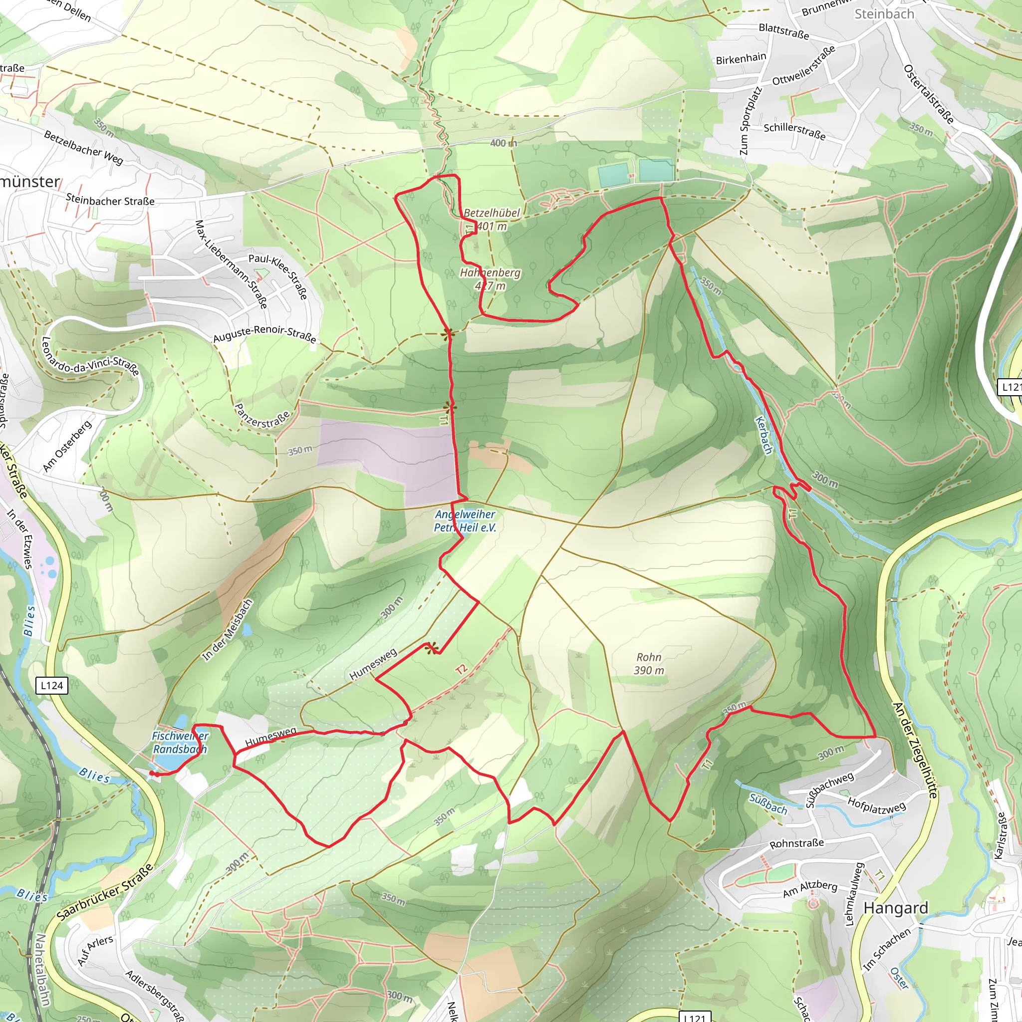
Fischweiher Randsbach Around the 3 km (1.9 miles) mark, you'll encounter the serene Fischweiher Randsbach. This picturesque pond is a great spot for a short break, offering opportunities for bird-watching and photography. The area is rich in local flora and fauna, so keep an eye out for various species of birds and small mammals that inhabit the region.
Angelweiher Petri Heil Continuing along the trail, you'll reach the Angelweiher Petri Heil at approximately 5 km (3.1 miles). This larger pond is popular among local anglers and is surrounded by lush greenery. The trail around the pond is relatively flat, making it an ideal place to relax and enjoy the natural surroundings. There are several benches and picnic spots where you can rest and have a snack.
Historical Significance The region around Neunkirchen has a rich history, with several historical landmarks and remnants of old settlements. As you hike, you'll come across informational plaques detailing the area's past, including its role in local industry and agriculture. The Schauinslandweg Hangard itself has historical significance, having been used for centuries by locals for various purposes, including trade and travel.
Final Stretch and Descent The final part of the trail involves a descent back towards the starting point. This section is about 4 km (2.5 miles) long and drops approximately 200 meters (656 feet) in elevation. The path winds through dense forest, offering a cool and shaded environment, which is particularly refreshing during the warmer months. Be cautious of the occasional rocky or uneven sections, especially after rain, as they can become slippery.
Navigation and Safety For navigation, it's highly recommended to use the HiiKER app, which provides detailed maps and real-time updates. The trail is well-marked, but having a reliable navigation tool can enhance your hiking experience and ensure you stay on track. Always carry sufficient water, snacks, and a basic first-aid kit. Weather in this region can be unpredictable, so check the forecast and dress in layers to accommodate changing conditions.
This trail offers a balanced mix of physical challenge, natural beauty, and historical interest, making it a rewarding experience for medium-level hikers.
What to expect?
Activity types
Comments and Reviews
User comments, reviews and discussions about the Fischweiher Randsbach and Angelweiher Petri Heil via Schauinslandweg Hangard, Germany.
4.25
average rating out of 5
4 rating(s)
