Download
Preview
Add to list
More
8.1 km
~1 hrs 48 min
107 m
Loop
“Explore the scenic Stadt Illertissen Loop, an 8 km trail blending nature and history near Neu-Ulm.”
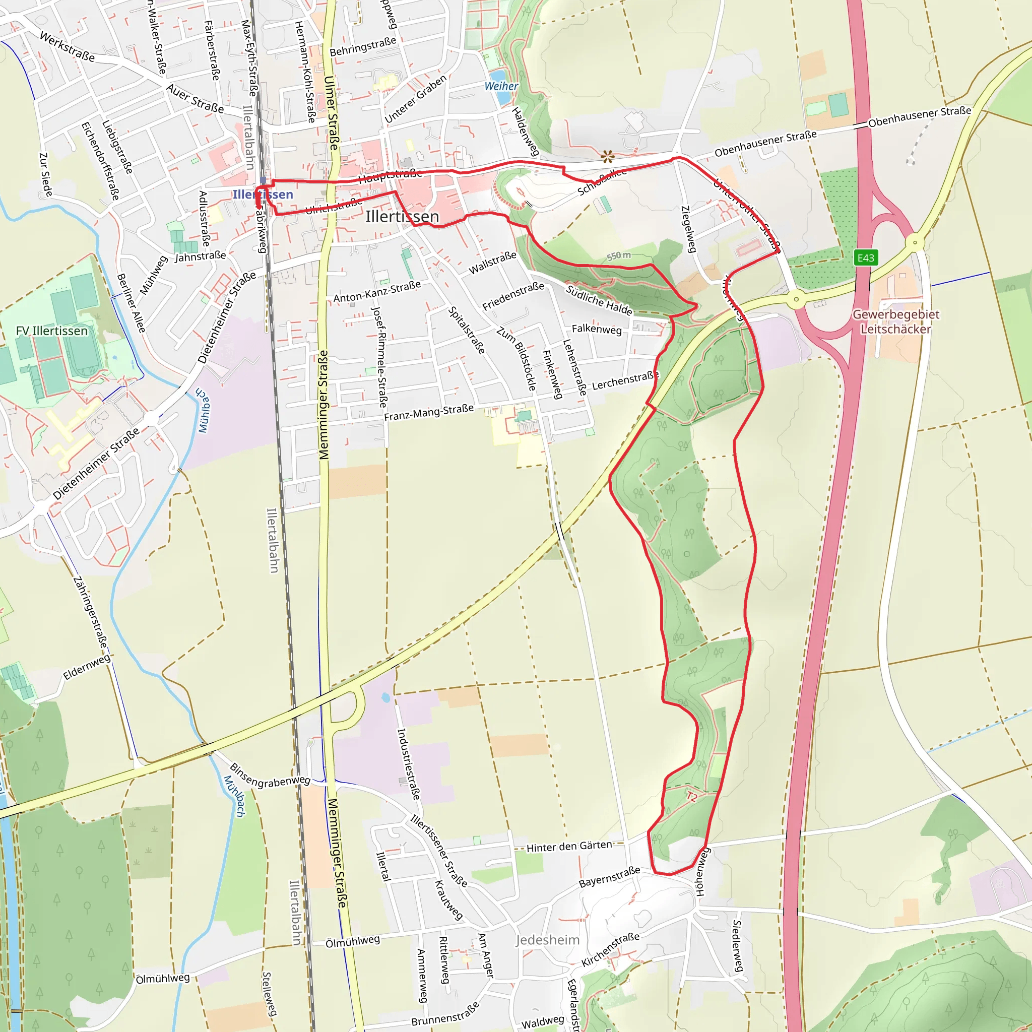
Starting near Neu-Ulm, Germany, the Stadt Illertissen Loop is an 8 km (approximately 5 miles) trail with an elevation gain of around 100 meters (328 feet). This loop trail is rated as medium difficulty, making it suitable for moderately experienced hikers.
Getting There
To reach the trailhead, you can either drive or use public transport. If driving, head towards Neu-Ulm and follow signs to Illertissen. There is ample parking available near the start of the trail. For those using public transport, take a train to Illertissen station, which is well-connected from major cities like Ulm and Munich. From the station, it's a short walk to the trailhead.
Trail Overview
The trail begins near the picturesque town of Illertissen, known for its charming streets and historical buildings. As you start your hike, you'll be greeted by a mix of urban and natural landscapes. The first section of the trail takes you through the town, where you can admire the traditional Bavarian architecture.
Nature and Wildlife
Once you leave the town, the trail meanders through lush forests and open meadows. Keep an eye out for local wildlife such as deer, foxes, and a variety of bird species. The forested areas are particularly beautiful in the autumn when the leaves change color, creating a vibrant tapestry of reds, oranges, and yellows.
Significant Landmarks
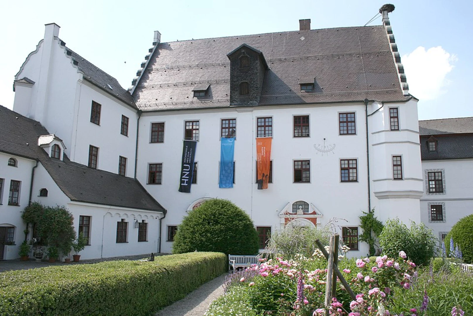
Around the 3 km (1.86 miles) mark, you'll come across the Vöhlin Castle, a historical landmark that dates back to the 12th century. The castle is perched on a hill, offering panoramic views of the surrounding countryside. It's worth taking a short detour to explore the castle grounds and learn about its history.
Continuing on, the trail takes you along the banks of the Iller River. This section is relatively flat and offers a peaceful setting with the gentle sound of flowing water. There are several spots along the river where you can take a break and enjoy a picnic.
Elevation and Terrain
The trail features a gradual elevation gain of 100 meters (328 feet), with the most significant ascent occurring around the 5 km (3.1 miles) mark. This section can be a bit challenging, but the well-maintained path and the rewarding views at the top make it worthwhile. The terrain is a mix of dirt paths, gravel, and some paved sections, so sturdy hiking shoes are recommended.
Navigation
For navigation, it's advisable to use the HiiKER app, which provides detailed maps and real-time updates. The trail is well-marked, but having a reliable navigation tool can enhance your hiking experience and ensure you stay on the right path.
Final Stretch
As you approach the final stretch of the loop, the trail brings you back into the town of Illertissen. This is a great opportunity to explore more of the town's attractions, such as the local museums and cafes. The trail ends where it began, completing a satisfying loop that offers a blend of natural beauty and historical intrigue.
What to expect?
Activity types
Comments and Reviews
User comments, reviews and discussions about the Stadt Illertissen Loop, Germany.
average rating out of 5
0 rating(s)

