Download
Preview
Add to list
More
8.9 km
~2 hrs 13 min
267 m
Loop
“Embark on a 9 km scenic loop with waterfalls, river views, and historical landmarks near Neckar-Odenwald-Kreis.”
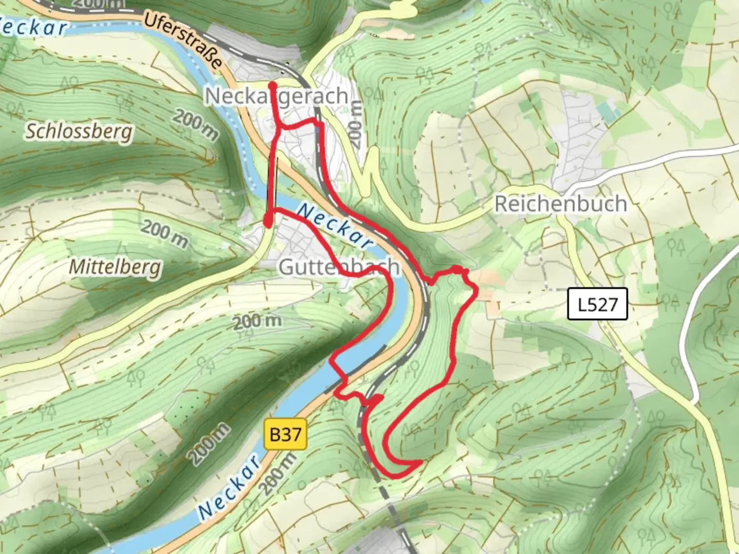
Starting your adventure near Neckar-Odenwald-Kreis, Germany, the Neckar via Margarethenschlucht Weg is a captivating loop trail that spans approximately 9 km (5.6 miles) with an elevation gain of around 200 meters (656 feet). This medium-difficulty trail offers a blend of natural beauty, historical intrigue, and moderate physical challenge, making it a rewarding experience for hikers of various skill levels.### Getting There To reach the trailhead, you can either drive or use public transport. If you're driving, set your GPS to Neckar-Odenwald-Kreis, and look for parking options near the trail's starting point. For those using public transport, the nearest significant landmark is the town of Mosbach. From Mosbach, you can take a local bus or taxi to the trailhead.### Trail Highlights#### Margarethenschlucht Gorge One of the most striking features of this trail is the Margarethenschlucht Gorge. Located approximately 2 km (1.2 miles) from the starting point, this gorge is a natural wonder with cascading waterfalls and steep, rocky walls. The trail through the gorge can be slippery, especially after rain, so sturdy hiking boots are recommended. The elevation gain here is about 100 meters (328 feet), making it one of the more challenging sections of the hike.#### Neckar River Views As you continue along the trail, you'll be treated to stunning views of the Neckar River. Around the 5 km (3.1 miles) mark, the trail runs parallel to the river, offering picturesque vistas and serene spots perfect for a short break or a picnic. The gentle sound of the flowing water adds a calming backdrop to your hike.### Historical Significance The Neckar-Odenwald region is steeped in history, dating back to Roman times. Along the trail, you'll encounter remnants of ancient settlements and medieval structures. One notable landmark is the ruins of a Roman watchtower, located about 6 km (3.7 miles) into the hike. This site offers a glimpse into the area's strategic importance in ancient times.### Flora and Fauna The trail is rich in biodiversity. You'll traverse through dense forests, open meadows, and along riverbanks, each offering a unique ecosystem. Keep an eye out for local wildlife such as deer, foxes, and a variety of bird species. The flora is equally diverse, with wildflowers, ferns, and towering trees providing a lush, green canopy.### Navigation and Safety For navigation, it's highly recommended to use the HiiKER app, which provides detailed maps and real-time updates. The trail is well-marked, but having a reliable navigation tool ensures you stay on track, especially in the more remote sections.### Final Stretch The last 2 km (1.2 miles) of the trail loop back towards the starting point, gradually descending through a mixed forest. This section is less strenuous, allowing you to cool down and reflect on the diverse landscapes and historical sites you've encountered.Whether you're a seasoned hiker or a nature enthusiast, the Neckar via Margarethenschlucht Weg offers a memorable journey through one of Germany's most scenic and historically rich regions.

Comments and Reviews
User comments, reviews and discussions about the Neckar via Margarethenschlucht Weg, Germany.
4.5
average rating out of 5
6 rating(s)