Download
Preview
Add to list
More
13.1 km
~3 hrs 52 min
753 m
Loop
“Explore the Bavarian Alps' beauty and history on this captivating 13 km loop from Spitzingsee.”
Starting your hike near Miesbach, Germany, the Spitzingsee via Brecherspitz and Bockerlbahn Weg trail offers a captivating 13 km (8 miles) loop with an elevation gain of approximately 700 meters (2,300 feet). This medium-difficulty trail is perfect for those looking to experience the Bavarian Alps' natural beauty and historical significance.
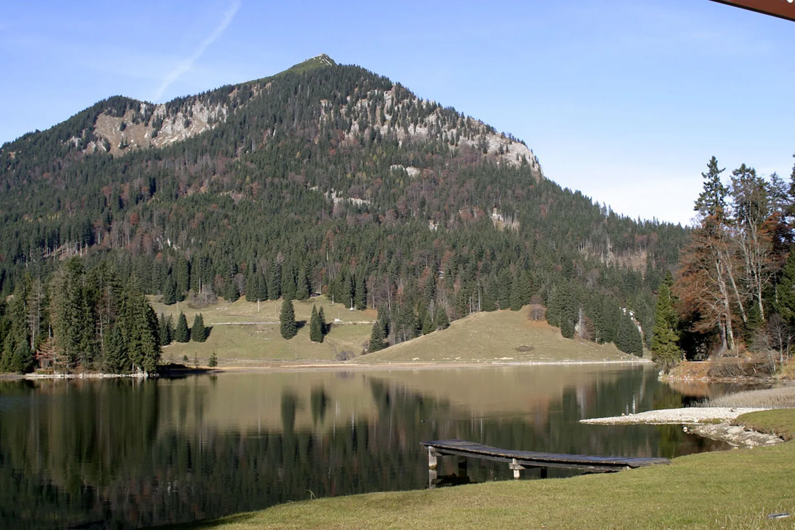
Getting There To reach the trailhead, you can drive to the parking area near Spitzingsee, which is well-signposted from Miesbach. If you prefer public transport, take a train to Miesbach and then a bus to Spitzingsee. The nearest significant landmark is the Spitzingsee Lake, a popular destination for both locals and tourists.
Trail Overview The trail begins with a gentle ascent through lush forests, offering a serene start to your adventure. As you progress, the path becomes steeper, leading you to the Brecherspitz summit. This section covers approximately 5 km (3.1 miles) with an elevation gain of about 500 meters (1,640 feet). The climb can be challenging, but the panoramic views of the surrounding mountains and valleys are well worth the effort.
Brecherspitz Summit At the Brecherspitz summit, you'll be rewarded with breathtaking vistas of the Bavarian Alps. This is an excellent spot for a break and some photography. The summit stands at 1,683 meters (5,522 feet) above sea level, offering a 360-degree view that includes the Tegernsee and Schliersee lakes.
Descent and Bockerlbahn Weg The descent from Brecherspitz is initially steep but soon levels out as you approach the Bockerlbahn Weg. This section of the trail is historically significant, as it follows the route of an old logging railway used in the early 20th century. The path is well-marked and relatively flat, making for a pleasant walk through dense forests and past picturesque meadows.
Wildlife and Flora Keep an eye out for local wildlife, including deer, foxes, and a variety of bird species. The area is also rich in flora, with vibrant wildflowers in the spring and summer months. The trail is particularly beautiful in autumn when the foliage turns a stunning array of colors.
Navigation and Safety For navigation, it's highly recommended to use the HiiKER app, which provides detailed maps and real-time updates. The trail is well-marked, but having a reliable navigation tool ensures you stay on track. Make sure to wear sturdy hiking boots, carry enough water, and pack a light snack or lunch.
Return to Trailhead The final stretch of the trail loops back towards Spitzingsee, covering the remaining 3 km (1.9 miles) with a gentle descent. You'll pass by the scenic Spitzingsee Lake, a perfect spot to relax and reflect on your hike before heading back to your starting point.
This trail offers a perfect blend of natural beauty, historical significance, and moderate physical challenge, making it a must-visit for any hiking enthusiast exploring the Bavarian Alps.

What to expect?
Activity types
Comments and Reviews
User comments, reviews and discussions about the Spitzingsee via Breacherspitz and Bockerlbahn Weg, Germany.
4.0
average rating out of 5
4 rating(s)