Download
Preview
Add to list
More
14.1 km
~4 hrs 0 min
713 m
Point-to-Point
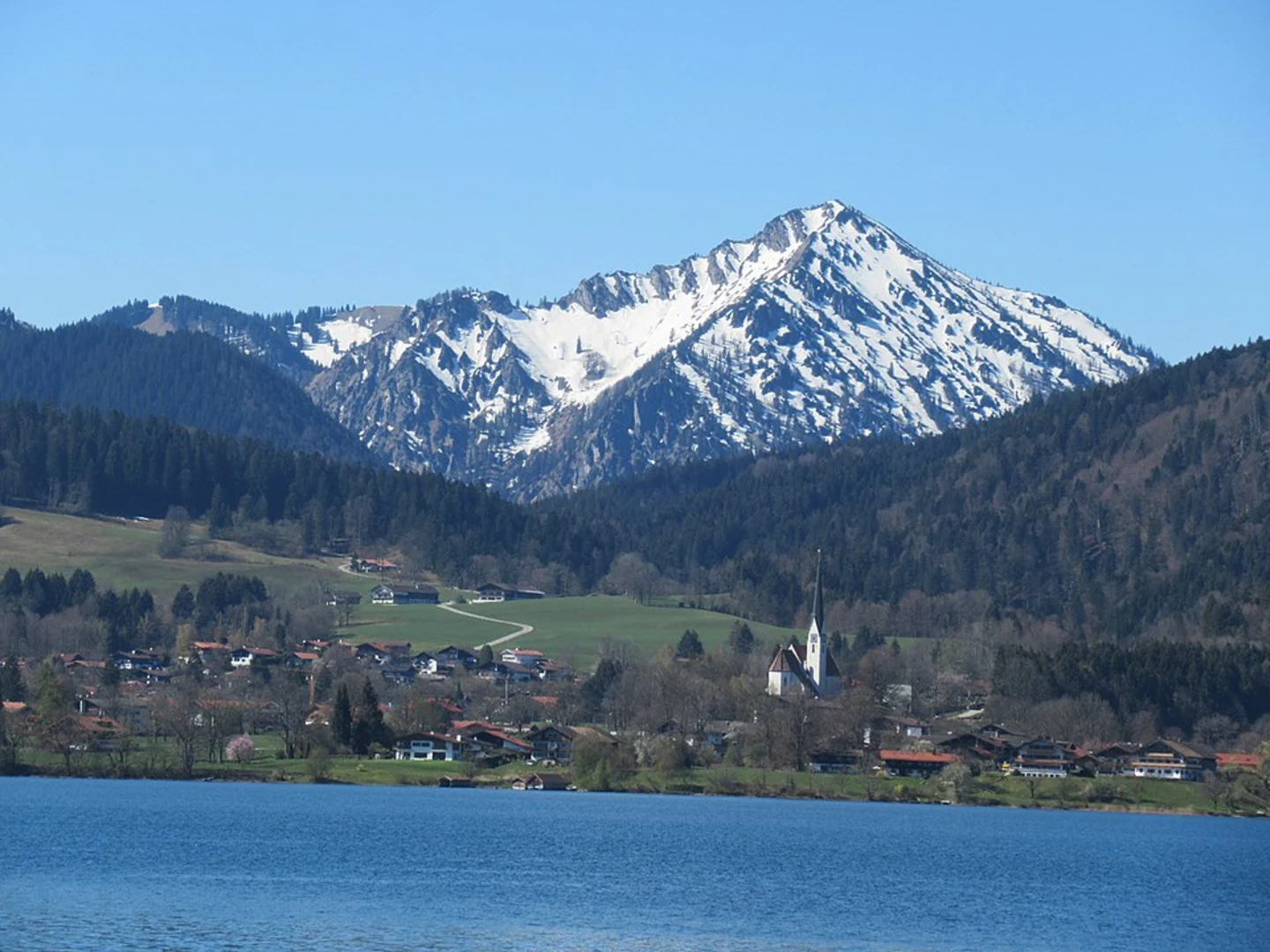
“Embark on the picturesque Schliersee to Tegernsee hike for Bavarian beauty, history, and culture.”
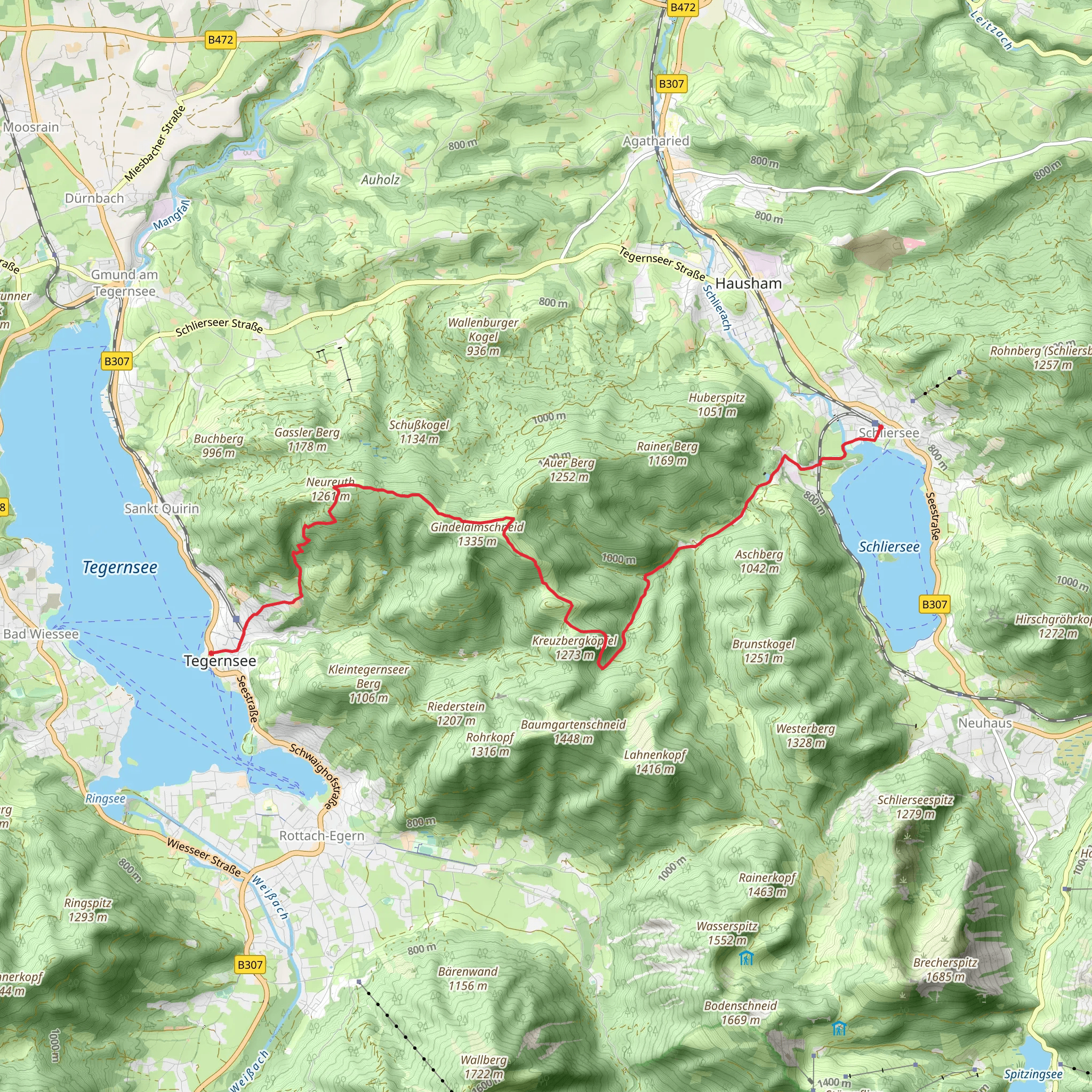
Starting near the charming town of Miesbach, Germany, the Schliersee to Tegernsee Walk via Hennererstraße is a picturesque point-to-point trail that stretches approximately 14 km (8.7 miles) with an elevation gain of around 700 meters (2,297 feet). This medium-difficulty hike offers a blend of natural beauty, historical significance, and a touch of Bavarian culture.
Getting There
To reach the trailhead, you can take a train to Miesbach from Munich, which is about an hour's journey. From Miesbach, local buses or a short taxi ride will bring you to the starting point near Hennererstraße. If you prefer to drive, there are parking facilities available in Miesbach.
Trail Overview
The trail begins with a gentle ascent through lush forests and meadows, offering a serene start to your hike. As you make your way up, you'll encounter a variety of flora and fauna native to the Bavarian Alps. Keep an eye out for deer, foxes, and a plethora of bird species that inhabit the area.
Key Landmarks and Sections
#### Hennererstraße to Schliersee
The first significant landmark is the Hennererstraße, a quaint rural road that leads you towards the town of Schliersee. This section is relatively easy, with a gradual incline that allows you to warm up for the more challenging parts ahead. Schliersee itself is a picturesque lake surrounded by mountains, and it's worth taking a short detour to enjoy the view.
#### Schliersee to Gindelalm
From Schliersee, the trail becomes steeper as you head towards Gindelalm, a traditional Bavarian mountain hut. This section is about 5 km (3.1 miles) and involves an elevation gain of approximately 300 meters (984 feet). The Gindelalm is a perfect spot to take a break, enjoy some local Bavarian cuisine, and soak in the panoramic views of the surrounding peaks.
#### Gindelalm to Neureuth
Continuing from Gindelalm, the trail leads you through dense forests and open meadows towards Neureuth. This section is around 4 km (2.5 miles) with an elevation gain of 200 meters (656 feet). Neureuth is another excellent resting point, offering stunning views of Tegernsee and the valley below.
#### Neureuth to Tegernsee
The final stretch from Neureuth to Tegernsee is a descent of about 5 km (3.1 miles). This part of the trail is less strenuous but requires careful footing, especially if the ground is wet. As you approach Tegernsee, the trail opens up to reveal breathtaking views of the lake and the town. Tegernsee is known for its historic monastery and brewery, making it a fitting end to your hike.
Historical Significance
The region around Schliersee and Tegernsee is steeped in history. Tegernsee Abbey, founded in the 8th century, played a crucial role in the region's development. The abbey's brewery, one of the oldest in Bavaria, is still operational and offers a taste of traditional Bavarian beer. The trail itself has been used for centuries by locals and travelers alike, adding a layer of historical depth to your hiking experience.
Navigation and Safety
For navigation, it's highly recommended to use HiiKER, which provides detailed maps and real-time updates. The trail is well-marked, but having a reliable navigation tool ensures you stay on track. Always check the weather forecast before you set out, as conditions can change rapidly in the mountains.
This hike offers a perfect blend of natural beauty, physical challenge, and cultural immersion, making it a must-do for any hiking enthusiast visiting Bavaria.
What to expect?
Activity types
Comments and Reviews
User comments, reviews and discussions about the Schliersee to Tegernsee Walk via Hennererstraße, Germany.
4.8
average rating out of 5
5 rating(s)

