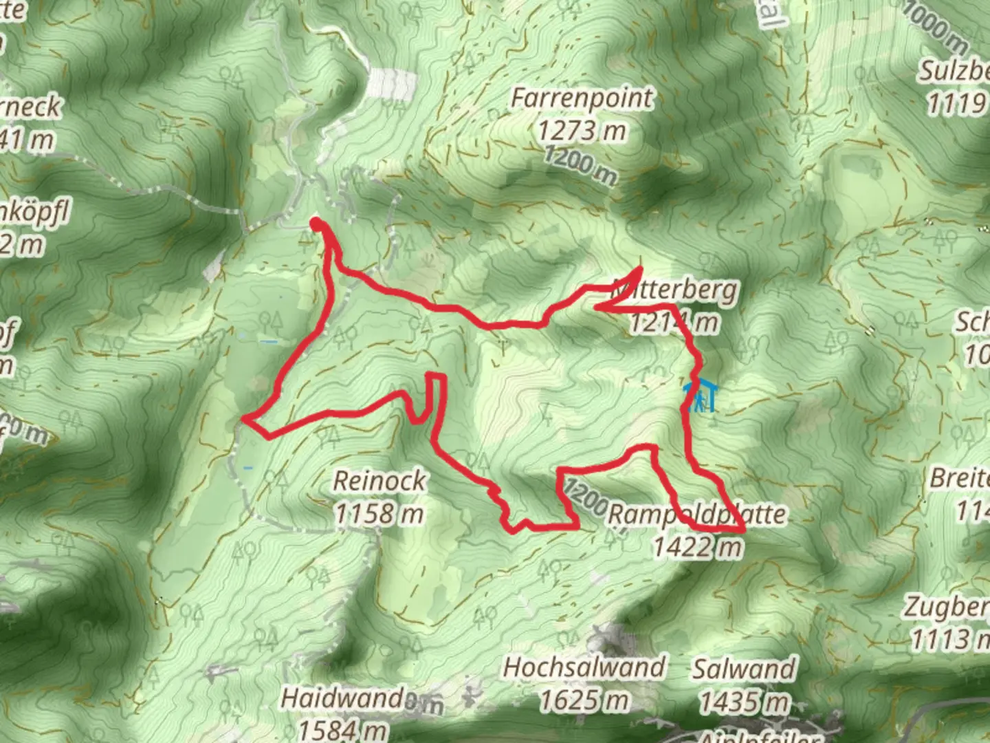
Rampoldplatte and Mitterberg via Ueber Stock und Stein and Bad Feilnbach
Download
Preview
Add to list
More
10.4 km
~3 hrs 21 min
763 m
Loop
“Experience the Bavarian Alps on a captivating 10 km loop with stunning views and historical landmarks.”
Starting your adventure near Miesbach, Germany, the Rampoldplatte and Mitterberg via Ueber Stock und Stein and Bad Feilnbach trail offers a captivating 10 km (6.2 miles) loop with an elevation gain of approximately 700 meters (2,297 feet). This medium-difficulty trail is perfect for those looking to experience the beauty of the Bavarian Alps.
Getting There To reach the trailhead, you can drive or use public transport. If driving, head towards Miesbach and follow signs to Bad Feilnbach. There is ample parking available near the trailhead. For those using public transport, take a train to Miesbach station. From there, you can catch a bus to Bad Feilnbach, which is the nearest significant landmark to the trailhead.
Trail Overview The trail begins with a gentle ascent through lush forests, offering a serene start to your hike. As you progress, the path becomes steeper, leading you through a mix of dense woodland and open meadows. The first significant landmark you'll encounter is the Ueber Stock und Stein, a rocky outcrop that provides stunning views of the surrounding landscape.
Wildlife and Flora Keep an eye out for local wildlife, including deer, foxes, and a variety of bird species. The area is also rich in flora, with wildflowers blooming in the spring and summer months. The diverse plant life adds a splash of color to the trail, making it a photographer's paradise.
Historical Significance The region around Miesbach and Bad Feilnbach has a rich history dating back to medieval times. The trail itself passes near several historical sites, including old farmhouses and remnants of ancient trade routes. These landmarks offer a glimpse into the area's past and add an educational element to your hike.
Key Sections - **Ueber Stock und Stein to Rampoldplatte**: This section is approximately 4 km (2.5 miles) and involves a steady climb. The elevation gain here is around 400 meters (1,312 feet). The path is well-marked, but it's advisable to use HiiKER for navigation to ensure you stay on track. - **Rampoldplatte Summit**: Reaching the summit of Rampoldplatte, you'll be rewarded with panoramic views of the Bavarian Alps. This is a great spot to take a break and enjoy the scenery. - **Rampoldplatte to Mitterberg**: The descent from Rampoldplatte to Mitterberg is about 3 km (1.9 miles) and involves a mix of downhill and flat sections. The trail here is less steep but can be rocky, so watch your footing. - **Mitterberg to Bad Feilnbach**: The final stretch back to Bad Feilnbach is around 3 km (1.9 miles) and relatively flat. This section takes you through picturesque meadows and past small streams, offering a peaceful end to your hike.
Tips for Hikers - **Footwear**: Sturdy hiking boots are recommended due to the rocky and uneven terrain. - **Weather**: Check the weather forecast before you go, as conditions can change rapidly in the mountains. - **Supplies**: Bring enough water and snacks, as there are no facilities along the trail. - **Navigation**: Use HiiKER to keep track of your progress and ensure you stay on the correct path.
This trail offers a perfect blend of natural beauty, historical significance, and moderate physical challenge, making it a must-visit for any hiking enthusiast.
What to expect?
Activity types
Comments and Reviews
User comments, reviews and discussions about the Rampoldplatte and Mitterberg via Ueber Stock und Stein and Bad Feilnbach, Germany.
4.25
average rating out of 5
4 rating(s)
