Download
Preview
Add to list
More
6.8 km
~2 hrs 3 min
420 m
Out and Back
“Embark on a scenic, moderately challenging hike from Miesbach to Farrenpoint Peak, rich in natural beauty and history.”
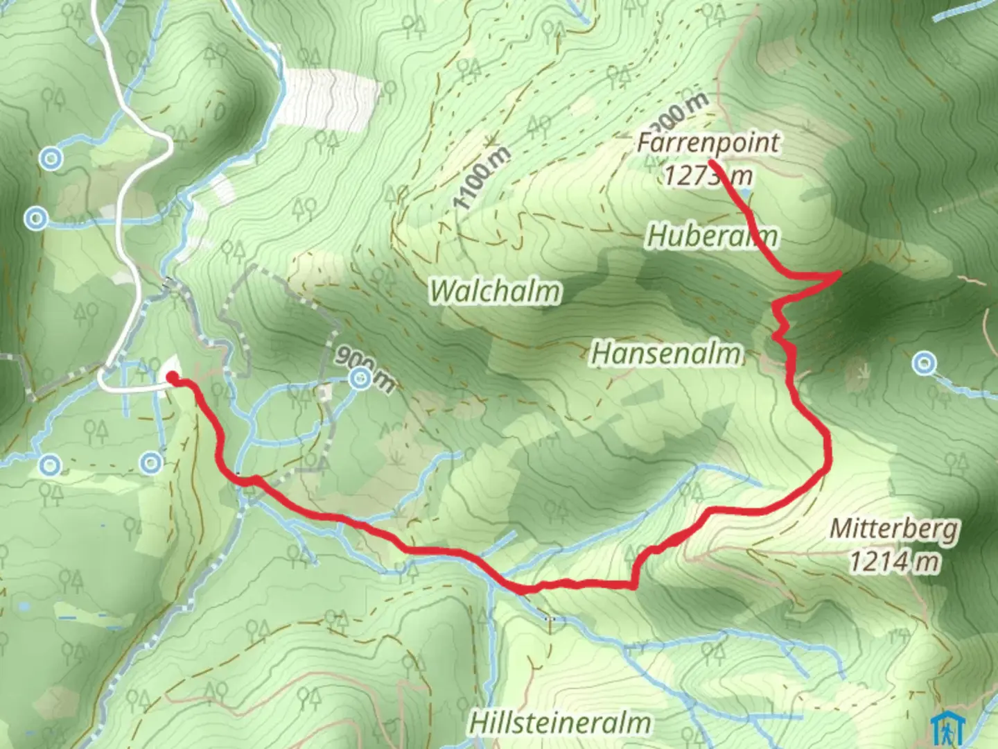
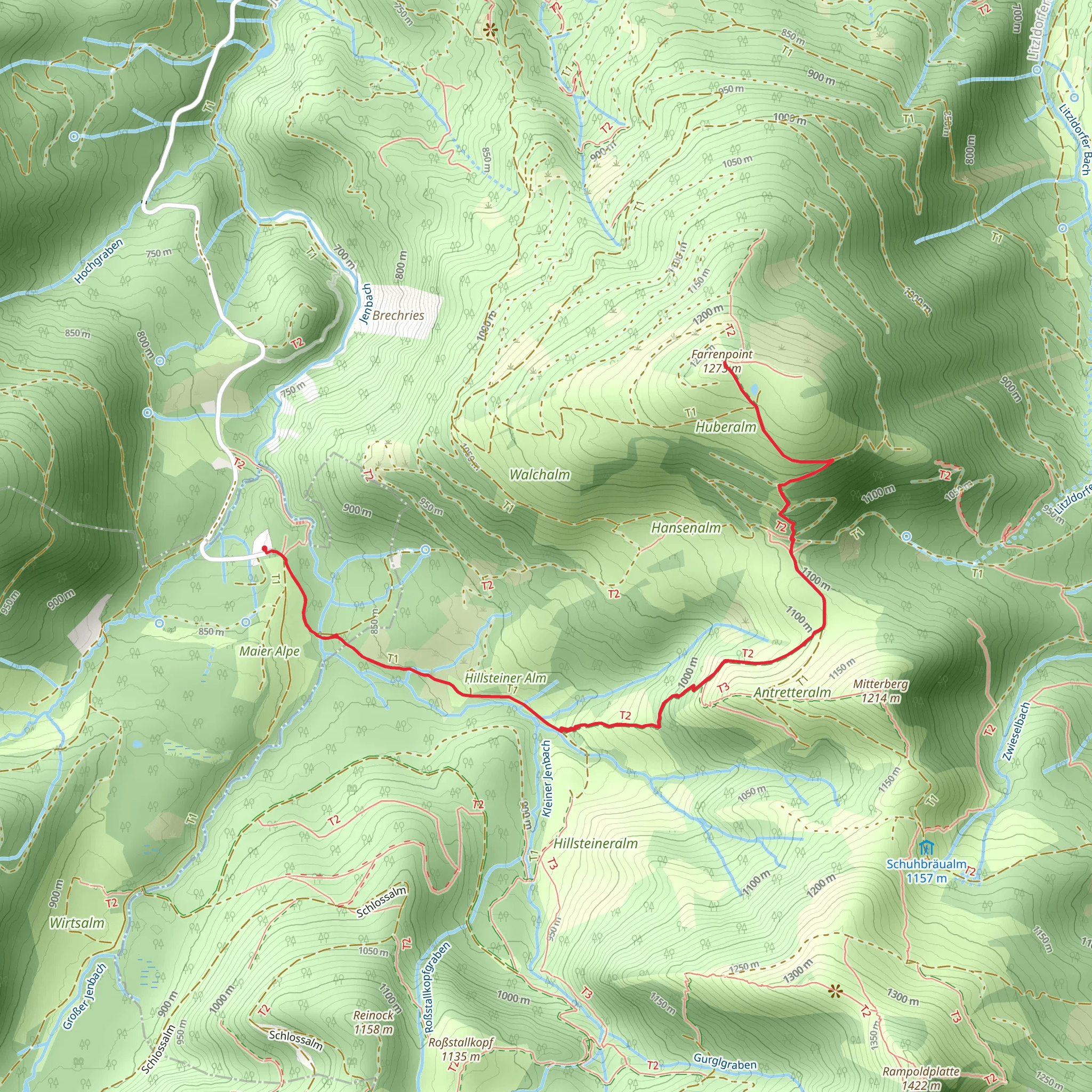
Starting your hike near the charming town of Miesbach, Germany, the Farrenpoint Peak Walk via BF6-Über Stock and Stein offers a delightful blend of natural beauty and moderate challenge. This out-and-back trail spans approximately 7 km (4.3 miles) with an elevation gain of around 400 meters (1,312 feet), making it a rewarding yet accessible adventure for hikers of medium skill level.
Getting There To reach the trailhead, you can either drive or use public transportation. If driving, head towards Miesbach and look for parking options near the town center. For those using public transport, take a train to Miesbach Station, which is well-connected to major cities like Munich. From the station, it's a short walk to the trailhead.
Trail Overview The trail begins near Miesbach and quickly immerses you in the serene Bavarian landscape. As you start your ascent, you'll traverse through lush forests and open meadows, offering a variety of flora and fauna. Keep an eye out for local wildlife such as deer and various bird species that inhabit the area.
Key Landmarks and Sections - **First Kilometer (0.6 miles):** The initial stretch is relatively gentle, allowing you to warm up as you walk through dense forest. The path is well-marked, but it's always a good idea to have the HiiKER app for navigation. - **Second Kilometer (1.2 miles):** As you progress, the trail begins to climb more steeply. Here, you'll encounter the first significant elevation gain of about 100 meters (328 feet). The forest starts to thin out, offering glimpses of the surrounding valleys. - **Midpoint (3.5 km / 2.2 miles):** At around the halfway mark, you'll reach a scenic viewpoint. This is an excellent spot to take a break and enjoy panoramic views of the Bavarian Alps. On clear days, you can see as far as the Tegernsee Valley. - **Final Ascent:** The last stretch to Farrenpoint Peak is the most challenging, with a steeper incline and rocky terrain. The elevation gain in this section is around 200 meters (656 feet). Use caution and ensure you have sturdy footwear.
Historical Significance The region around Miesbach has a rich history dating back to medieval times. The town itself was first mentioned in historical records in the 11th century. As you hike, you'll be walking through areas that have been traversed for centuries, adding a layer of historical depth to your journey.
Flora and Fauna The trail is a haven for nature enthusiasts. In spring and summer, the meadows are adorned with wildflowers, including species like the Alpine Aster and Edelweiss. The forested sections are home to a variety of trees, including spruce, fir, and beech. Birdwatchers will appreciate the diversity of avian life, from common songbirds to the occasional sighting of a golden eagle.
Final Stretch and Return Upon reaching Farrenpoint Peak, take a moment to savor the breathtaking views. The peak offers a 360-degree panorama of the surrounding mountains and valleys. After soaking in the scenery, retrace your steps back to the trailhead, enjoying the downhill sections that provide a different perspective of the landscape.
Tips for Hikers - **Weather:** Check the weather forecast before you go. The trail can be slippery after rain, and visibility can be reduced in foggy conditions. - **Gear:** Wear sturdy hiking boots and bring trekking poles if you have them. A rain jacket and layers are advisable, as mountain weather can be unpredictable. - **Navigation:** Use the HiiKER app to stay on track, especially in the forested sections where the path can be less obvious.
This hike offers a perfect blend of natural beauty, moderate challenge, and historical intrigue, making it a must-do for anyone visiting the Miesbach region.
What to expect?
Activity types
Comments and Reviews
User comments, reviews and discussions about the Farrenpoint Peak Walk via BF6-Über Stock and Stein, Germany.
4.4
average rating out of 5
5 rating(s)
