Download
Preview
Add to list
More
12.6 km
~3 hrs 44 min
734 m
Loop
“Experience stunning vistas, historical landmarks, and rich biodiversity on the 13 km Damianskopf loop trail.”
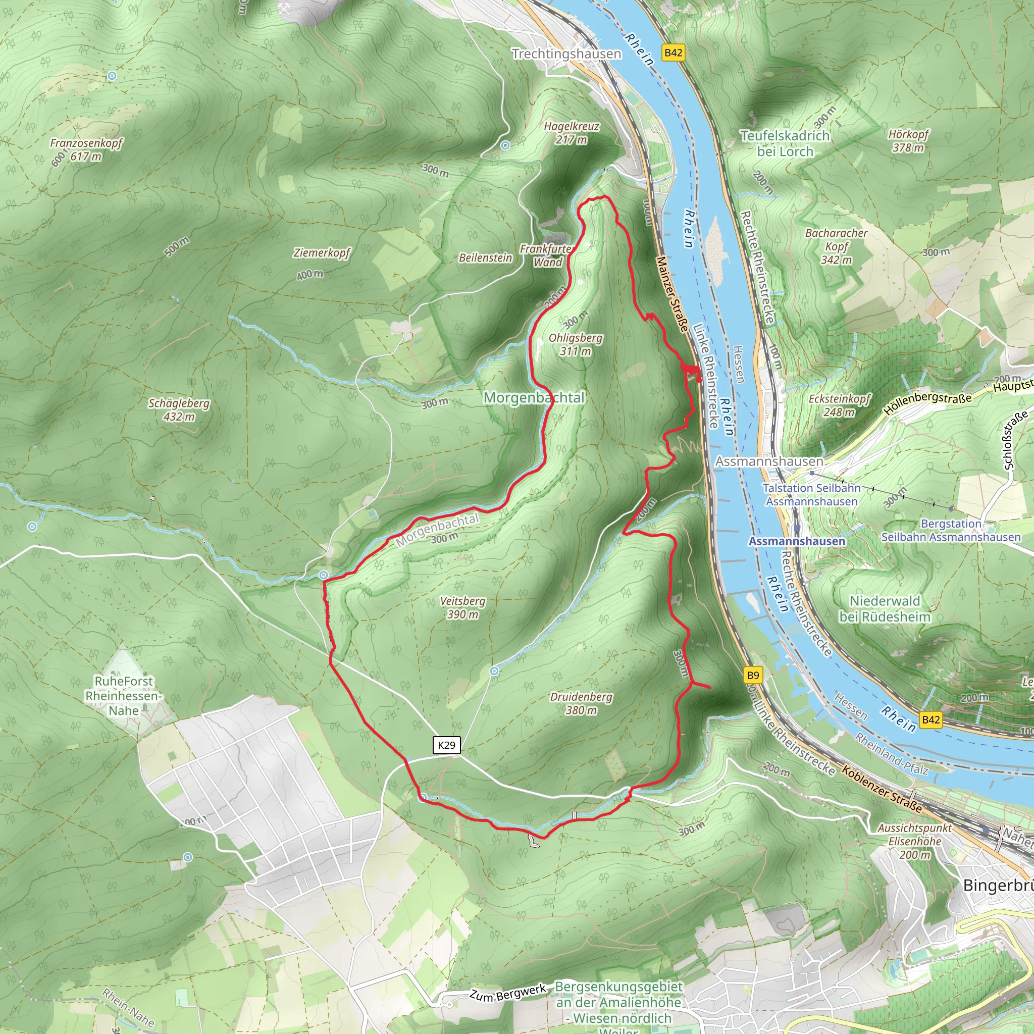
Starting near Mainz-Bingen, Germany, the Damianskopf via Kreuzbach and Nahehoehenweg trail offers a captivating 13 km (8 miles) loop with an elevation gain of approximately 700 meters (2,300 feet). This medium-difficulty hike is perfect for those looking to experience the natural beauty and historical richness of the region.
Getting There To reach the trailhead, you can drive or use public transport. If driving, set your GPS to the nearest known address: Bingen am Rhein, a charming town that serves as a gateway to the trail. For those using public transport, take a train to Bingen (Rhein) Hauptbahnhof. From there, local buses or a short taxi ride will get you to the trailhead.
Trail Overview The trail begins with a gentle ascent through lush forests, offering a serene start to your hike. As you progress, you'll encounter the Kreuzbach stream, a picturesque waterway that adds a soothing soundtrack to your journey. The first significant climb brings you to an elevation of around 300 meters (984 feet) within the first 3 km (1.8 miles).
Key Landmarks and Sections #### Kreuzbach Around the 4 km (2.5 miles) mark, you'll reach the Kreuzbach area, known for its tranquil ambiance and the sound of flowing water. This is a great spot to take a short break and enjoy the natural surroundings.
#### Nahehoehenweg Continuing along the Nahehoehenweg, the trail offers panoramic views of the Nahe Valley. This section is particularly scenic, with rolling hills and expansive vistas that stretch as far as the eye can see. The elevation here reaches approximately 500 meters (1,640 feet), making it one of the more challenging parts of the hike.
#### Damianskopf Summit The trail's highlight is the Damianskopf summit, which you will reach after about 8 km (5 miles). Standing at an elevation of 700 meters (2,300 feet), the summit offers breathtaking views of the surrounding landscape. On a clear day, you can see the Rhine River and the distant hills of the Hunsrück region.
Flora and Fauna The trail is rich in biodiversity. Keep an eye out for native wildlife such as deer, foxes, and various bird species. The flora is equally impressive, with a mix of deciduous and coniferous trees, wildflowers, and ferns that create a vibrant tapestry of colors, especially in spring and autumn.
Historical Significance The region around Mainz-Bingen is steeped in history. The Nahe Valley has been inhabited since Roman times, and remnants of ancient settlements can still be found. The trail itself passes near several historical landmarks, including old stone walls and ruins that hint at the area's storied past.
Navigation and Safety Given the trail's moderate difficulty, it's advisable to use a reliable navigation tool like HiiKER to stay on track. The trail is well-marked, but having a digital map can provide additional peace of mind. Wear sturdy hiking boots, bring plenty of water, and be prepared for varying weather conditions.
Return to Trailhead The descent back to the trailhead is gradual, allowing you to enjoy the final stretch without too much strain. The loop nature of the trail ensures that you return to your starting point, making logistics straightforward.
This hike offers a perfect blend of natural beauty, physical challenge, and historical intrigue, making it a must-do for any hiking enthusiast visiting the Mainz-Bingen area.
What to expect?
Activity types
Comments and Reviews
User comments, reviews and discussions about the Damianskopf via Kreuzbach and Nahehoehenweg, Germany.
4.38
average rating out of 5
8 rating(s)

