Download
Preview
Add to list
More
11.0 km
~3 hrs 3 min
519 m
Loop
“Experience the 11 km Hesenberg via Taunusklub trail: a blend of nature, history, and wildlife.”
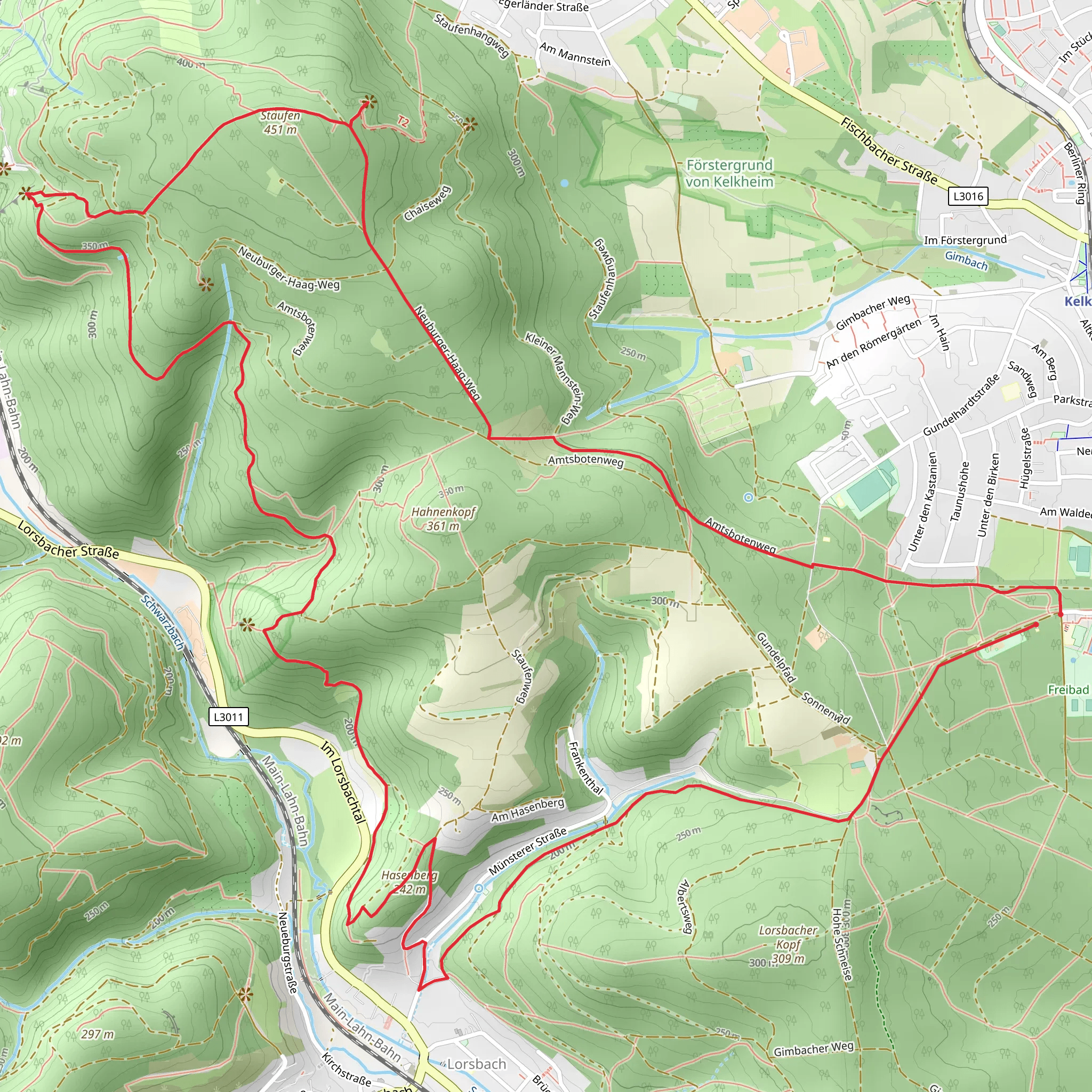
Starting near Main-Taunus-Kreis, Germany, the Hesenberg via Taunusklub Route is a captivating loop trail that spans approximately 11 kilometers (around 6.8 miles) with an elevation gain of about 500 meters (1,640 feet). This medium-difficulty hike offers a blend of natural beauty, historical landmarks, and diverse wildlife, making it a rewarding experience for outdoor enthusiasts.
Getting There
To reach the trailhead, you can either drive or use public transport. If driving, set your GPS to Main-Taunus-Kreis, and look for parking options near the trailhead. For those using public transport, take a train to Hofheim am Taunus station. From there, local buses can take you closer to the starting point, or you can opt for a short taxi ride.
Trail Navigation
For navigation, it is highly recommended to use the HiiKER app, which provides detailed maps and real-time updates to ensure you stay on track throughout your hike.
Trail Highlights
#### Initial Ascent
The trail begins with a gentle ascent through dense forests, where you'll be surrounded by towering trees and the soothing sounds of nature. This initial section is relatively easy, allowing you to warm up before the more challenging parts of the hike.
#### Midway Point: Hesenberg Summit
Approximately 5 kilometers (3.1 miles) into the hike, you'll reach the Hesenberg summit. At an elevation of around 500 meters (1,640 feet), this point offers panoramic views of the surrounding Taunus region. It's an ideal spot for a short break and some photography.
#### Historical Significance
The Taunus region is steeped in history, with remnants of ancient Roman settlements scattered throughout. As you hike, keep an eye out for historical markers and information boards that provide insights into the area's rich past. The trail itself is maintained by the Taunusklub, an organization dedicated to preserving the region's natural and historical heritage.
Flora and Fauna
The trail is home to a diverse range of flora and fauna. In the spring and summer months, you'll encounter a variety of wildflowers, including orchids and lilies. The forested areas are inhabited by deer, foxes, and a plethora of bird species, making it a haven for wildlife enthusiasts.
Final Descent
The descent begins around the 8-kilometer (5-mile) mark, leading you back through lush forests and open meadows. This section is less strenuous but requires careful footing, especially if the ground is wet. The trail eventually loops back to the starting point, completing your 11-kilometer journey.
Practical Tips
- Footwear: Sturdy hiking boots are recommended due to the varied terrain. - Weather: Check the weather forecast before you go, as conditions can change rapidly. - Supplies: Carry enough water and snacks, as there are no facilities along the trail. - Safety: Always inform someone of your hiking plans and estimated return time.
By following these guidelines and using the HiiKER app for navigation, you'll be well-prepared to enjoy the Hesenberg via Taunusklub Route.
What to expect?
Activity types
Comments and Reviews
User comments, reviews and discussions about the Hesenberg via Taunusklub Route, Germany.
4.2
average rating out of 5
5 rating(s)

