Download
Preview
Add to list
More
7.9 km
~2 hrs 13 min
387 m
Loop
“Discover the Vorderer via Hohenstein Weg: an 8 km trail blending lush forests, castle ruins, and stunning vistas.”
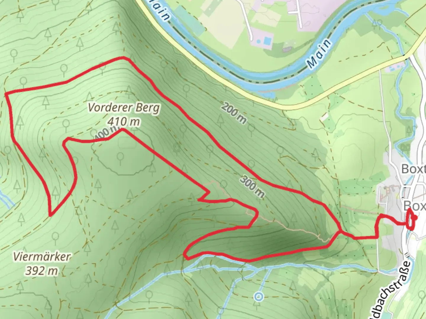
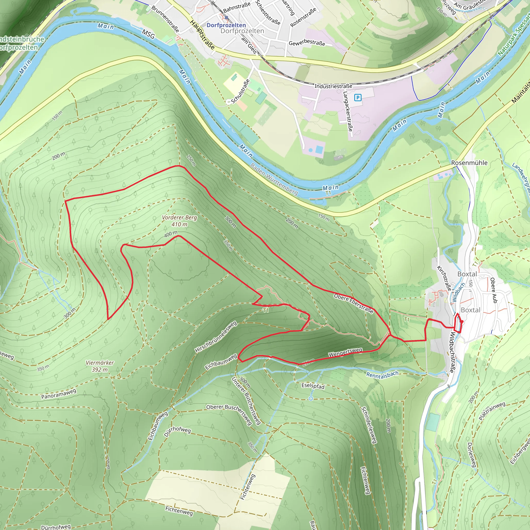
Starting near Main-Tauber-Kreis, Germany, the Vorderer via Hohenstein Weg is an 8 km (approximately 5 miles) loop trail with an elevation gain of around 300 meters (984 feet). This medium-difficulty trail offers a blend of natural beauty and historical significance, making it a rewarding experience for hikers.
Getting There To reach the trailhead, you can drive or use public transportation. If driving, set your GPS to Main-Tauber-Kreis, Germany, and look for parking options near the trailhead. For those using public transport, take a train to the nearest station in Tauberbischofsheim and then a local bus to the vicinity of the trailhead. Check local schedules for the most accurate and up-to-date information.
Trail Navigation For navigation, it's highly recommended to use the HiiKER app, which provides detailed maps and real-time updates to ensure you stay on track.
Trail Highlights As you embark on the Vorderer via Hohenstein Weg, you'll first encounter a gentle ascent through lush forests. The initial 2 km (1.2 miles) of the trail are relatively easy, with a gradual elevation gain of about 100 meters (328 feet). This section is perfect for warming up and getting accustomed to the terrain.
Historical Significance Around the 3 km (1.8 miles) mark, you'll come across the ruins of Hohenstein Castle. This medieval fortress dates back to the 12th century and offers a glimpse into the region's rich history. Take some time to explore the ruins and imagine the lives of those who once inhabited this stronghold.
Flora and Fauna Continuing on, the trail meanders through a diverse landscape of deciduous and coniferous trees. Keep an eye out for local wildlife, including deer, foxes, and a variety of bird species. The flora is equally captivating, with seasonal wildflowers adding splashes of color to the verdant surroundings.
Scenic Views At approximately 5 km (3.1 miles), you'll reach a viewpoint that offers panoramic vistas of the Main-Tauber-Kreis region. This is an ideal spot for a break and some photography. The elevation gain to this point is around 200 meters (656 feet), making it a moderate climb but well worth the effort for the stunning views.
Final Stretch The last 3 km (1.9 miles) of the trail involve a descent back to the trailhead. This section can be a bit steep in places, so watch your footing, especially if the ground is wet. The total elevation gain for the entire loop is around 300 meters (984 feet), making it a manageable yet invigorating hike.
Practical Tips - Wear sturdy hiking boots for uneven terrain. - Bring plenty of water and snacks, especially if you plan to explore the castle ruins. - Check the weather forecast before heading out, as conditions can change rapidly. - Use the HiiKER app for real-time navigation and updates.
This trail offers a perfect blend of natural beauty, historical intrigue, and moderate physical challenge, making it a must-visit for any hiking enthusiast.
What to expect?
Activity types
Comments and Reviews
User comments, reviews and discussions about the Vorderer via Hohenstein Weg, Germany.
4.25
average rating out of 5
4 rating(s)
